
Hide
Belstone
hide
Hide
hide
- Almanacs◬
- Archives & Libraries◬
- Bibliography◬
- Biography◬
- Business & Commerce Records◬
- Cemeteries
- Census◬
- Chronology◬
- Church History◬
- Church Records
- Churches
- Civil Registration◬
- Correctional Institutions◬
- Court Records◬
- Description & Travel
- Directories
- Emigration & Immigration◬
- Encyclopaedias & Dictionaries◬
- Folklore◬
- Gazetteers
- Genealogy
- Handwriting◬
- Heraldry◬
- Historical Geography◬
Hide
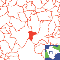
Click on map to view parish boundaries in detail.
Hide
Hide
hide
- History
- Jewish History◬
- Land & Property
- Language & Languages◬
- Manors◬
- Maps
- Medical Records◬
- Merchant Marine◬
- Military History◬
- Names, Geographical◬
- Names, Personal◬
- Newspapers◬
- Occupations◬
- Periodicals◬
- Politics & Government◬
- Poor Houses, Poor Law◬
- Population◬
- Probate Records◬
- Schools◬
- Social Life & Customs◬
- Societies◬
- Taxation◬
- Voting Registers◬
Hide
"BELSTON, or Belstone, is a small village, picturesquely seated, 2 miles S.E. of Okehampton, at the northern extremity of Dartmoor Forest, between and near the sources of the rivers Taw and East Okement, where there are many rocky tors and highly interesting druidical remains. Its parish contains 208 inhabitants, and 1756 acres of land, including 784 acres of open commons and wastes, and the hamlet of Prestacott. . . . The manor of Belston belonged to an ancient family of its own name till the reign of Henry III., when their three co-heiresses married into the families of Specot, Chamberlayne, and Fulford. . . . The Church (Virgin Mary,) is a small but interesting specimen of Anglo-Saxon architecture, with a tower and five bells. The interior was newly seated with deal a few years ago, but still retains some of the ancient oak seats, with carved ends, and a finely carved oak screen. The chancel has two windows, a sedilla, and a few panes of painted glass. The fabric is built of granite, and an ancient cross, formerly belonging to it, is now placed in the wall of an ancient stable. There is a small chapel in the parish, used by Baptists and Wesleyans." [From White's Devonshire Directory (1850)]
A parish in Black Torrington Hundred, the Archdeaconry of Totnes and the Diocese of Exeter. Regarded as part of the Dartmoor area. Sticklepath, formerly a chapel of ease (St Mary's) in Sampford Courtenay, is now in Belstone.
Hide
Brown, Mike. Belstone (Mini Survey). In Dartmoor Region Monumental Inscriptions Indexes, Vol. 23. Dartmoor Press, PO Box 132, Plymouth PL4 7YL.
| St Mary, Belstone, Church of England |
Parish Registers going back to 1552 are held in the Devon Record Office. The pre-1837 registers contain a large number of entries relating to Sticklepath.
Transcripts of the Parish Registers going back to 1552, and of the Bishops' Transcripts going back to 1609, are held in a special collection in the Westcountry Studies Library.
The Devon FHS publishes indexes covering (as of June 2004): Marriages 1754-1837 - for details see their Devon Parish List.
Entered into the IGI (as of Jan 1993): Parish Church Christenings 1553-1565, 1578-1837 Marriages 1553-1766, 1785-1835. (These entries are based in part on Bishops' transcripts.)
The Deanery of Okehampton: An index of baptisms, marriages and burials in the parishes of Ashbury, Beaworthy, Belstone, Bratton Clovelly, Broadwoodkelly, Exbourne, Germansweek, Hatherleigh, Highampton, Honeychurch, Inwardleigh, Jacobstowe,Monkokehampton, Northlew, Okehampton and Sampford Courtenay. Photographs of the churches and extracts from White's Devonshire Directory 1850. CD-ROM, Exeter, Devon FHS (2011). [Ashbury Mar: 1755-1810; Beaworthy Bapt: 1813-1840, Mar: 1758-1837, Bur: 1760-1837; Belstone Bapt: 1813-1840, Mar: 1755-1835, Bur: 1813-1837; Bratton Clovelly Bapt: 1813-1840, Mar: 1754-1837, Bur: 1813-1837; Broadwoodkelly Bapt: 1813-1839, Mar: 1754-1839, Bur: 1813-1838; Exbourne Bapt: 1813-1839, Mar: 1755-1837, Bur: 1813-1837; Germansweek Bapt: 1813-1840, Mar: 1756-1837, Bur: 1813-1840; Hatherleigh Bapt: 1813-1840, Mar: 1754-1837, Bur: 1813-1837; Highampton Bapt: 1813-1840, Mar: 1747-1837, Bur: 1813-1839; Honeychurch Bapt: 1813-1842, Mar: 1757-1837, Bur: 1813-1842; Inwardleigh Bapt: 1813-1840, Mar: 1754-1838, Bur: 1790-1837; Jacobstowe Bapt: 1813-1852, Mar: 1755-1837, Bur: 1813-1851; Monkokehampton Bapt: 1813-1840, Mar: 1755-1838, Bur: 1813-1837; Northlew Bapt: 1813-1839, Mar: 1754-1837, Bur: 1813-1837; Okehampton Bapt: 1813-1840, Mar: 1754-1837, Bur: 1813-1837; Okehampton Independent Chapel Bur: 1829-1837; Sampford Courtenay Bapt: 1813-1839, Mar: 1754-1837, Bur: 1813-1837.]
Section on Belstone from Samuel Lewis: A Topographical Dictionary of England (1831), provided by Mel Lockie
Brown, Mike. Trade Directory for Belstone, Drewsteignton, South Tawton, Throwleigh 1850, 1870, 1878, Dartmoor Press (2001).
The transcription of the section for this parish from the National Gazetteer (1868), provided by Colin Hinson.
- Ask for a calculation of the distance from Belstone to another place.
The Online Parish Clerk for this parish is Denise Hunt. (Resources: land tax 1782, misc. parish register entries. Requests "missing entries of PRs 1730-1770" and any other data.).
Dartmoor Press Online Magazine's page for this parish (archived copy), with articles, transcriptions, publication details, etc. - highly recommended.
James, Dorothea. Belstone: Some account of the parish past and present. Winchester: Warren & Son (1930) 58p,[5] lves pls.
Shields, Helen. Walking Sticklepath through the Centuries: Part 1, Devon Family Historian, vol. 170, (2019) pp.20-25.
Williams, H. Fulford. Notes on the Parish of Belstone, Devon. Typescript (1962) 8 leaves. [Westcountry Studies Library]
Brown, Mike. Belstone. In "Dartmoor Tithe Apportionments, Vol. 7". The Dartmoor Press (c1997) 16p.
View a map of the boundaries of this town/parish.
You can see maps centred on OS grid reference SX619935 (Lat/Lon: 50.724664, -3.957915), Belstone which are provided by:
- OpenStreetMap
- Google Maps
- StreetMap (Current Ordnance Survey maps)
- Bing (was Multimap)
- Old Maps Online
- National Library of Scotland (Old Ordnance Survey maps)
- Vision of Britain (Click "Historical units & statistics" for administrative areas.)
- English Jurisdictions in 1851 (Unfortunately the LDS have removed the facility to enable us to specify a starting location, you will need to search yourself on their map.)
- Magic (Geographic information) (Click + on map if it doesn't show)
- GeoHack (Links to on-line maps and location specific services.)
- All places within the same township/parish shown on an Openstreetmap map.
- Nearby townships/parishes shown on an Openstreetmap map.
- Nearby places shown on an Openstreetmap map.