
Hide
Elton
hide
Hide
hide
Hide
hide
Hide
Hide
ELTON, a township, a chapelry, and a sub-district, in Bury district, Lancashire. The township is in Bury parish; lies adjacent to the Bury and Bolton and Bury and Haslingden railways, 1¾ mile WSW of Bury; and contains Starling and Summerseat. Post town, Bury, Lancashire. Acres, 2,521. Real property, £36,105; of which £1,680 are in mines, £50 in quarries, and £1,702 in gas-works. Pop., 8,172. Houses, 1,494. The cotton, the paper, and the iron trades are carried on; and an increase of population in the decade ending in 1861 arose from the prosperity of these trades, and from the advantages of railway and canal communication. The chapelry is less extensive than the township, and was constituted in 1843. Pop., 7,716. Houses, 1,394. The living is a vicarage in the dio. of Manchester. Value, £300.* Patron, the Rector of Bury. The church is an edifice in the Norman style. The sub-district excludes the part of the township not in the chapelry, and includes part of another Bury township, and parts of two other parishes. Acres, 3,817. Pop., 9,584. Houses, 1,745.
John Marius Wilson, Imperial Gazetteer of England and Wales (1870-72)
Hide
Local studies information is held at Bury library.
| All Saints, Elton, Church of England |
Details about the census records, and indexes for Elton.
The Register Office covering the Elton area is Bury.
The National Gazetteer of Great Britain and Ireland - 1868
"ELTON, a township in the parish of Bury, hundred of Salford, county palatine of Lancaster, 1 mile from Bury, of which it may be considered a suburb. It is situated close to the Yorkshire and Lancashire railway, and the two places, Starling and Summerseat, are included in the township. Here are chemical works, and cotton is largely manufactured. Bleaching and dyeing are also carried on. The living is a perpetual curacy in the diocese of Manchester, value £230, in the patronage of the rector. The church is a fine stone edifice of Norman architecture, dedicated to All Saints. There is a National school for both sexes, and a large Sunday-school."
- Ask for a calculation of the distance from Elton to another place.
In 1835 Elton was a township in the parish of Bury.
Information about boundaries and administrative areas is available from A Vision of Britain through time.
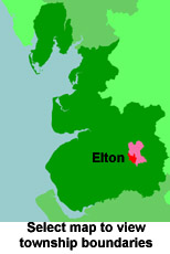
View a map of the boundaries of this town/parish.
You can see maps centred on OS grid reference SD780122 (Lat/Lon: 53.606198, -2.334498), Elton which are provided by:
- OpenStreetMap
- Google Maps
- StreetMap (Current Ordnance Survey maps)
- Bing (was Multimap)
- Old Maps Online
- National Library of Scotland (Old Ordnance Survey maps)
- Vision of Britain (Click "Historical units & statistics" for administrative areas.)
- English Jurisdictions in 1851 (Unfortunately the LDS have removed the facility to enable us to specify a starting location, you will need to search yourself on their map.)
- Magic (Geographic information) (Click + on map if it doesn't show)
- GeoHack (Links to on-line maps and location specific services.)
- All places within the same township/parish shown on an Openstreetmap map.
- Nearby townships/parishes shown on an Openstreetmap map.
- Nearby places shown on an Openstreetmap map.
For probate purposes prior to 1858, Elton was in the Archdeaconry of Chester, in the Diocese of Chester. The original Lancashire wills for the Archdeaconry of Chester are held at the Lancashire Record Office.
You can also see Family History Societies covering the nearby area, plotted on a map. This facility is being developed, and is awaiting societies to enter information about the places they cover.