
Hide
Heap
hide
Hide
hide
Hide
hide
Hide
Hide
HEAP, a village, a township, and a parochial chapelry in Bury parish, Lancashire. The village stands near the river Roche and the Bury and Rochdale railway, 2 miles E of Bury. The township includes also the town of Heywood, with its post office and r. station; and is nearly divided into the chapelries of Heap and Heywood. Acres, 2,934. Real property, £56,545; of which £200 are in mines, £80 in quarries, and £1,200 in gas works. Pop. in 1851, 16,048; in 1861, 17,353. Houses, 3,535. Pop., exclusive of Heywood town, in 1861, 4,529. Houses, 1,905. There are large paper mills, cotton mills, and wool mills, manufactories of power looms and boilers, works of iron and brass founding, two churches, eight dissenting chapels, a mechanics' institution, and four national schools, mostly in Heywood. The chapelry was constituted in 1840. Pop. in 1861, 7,633. Houses, 1,605. The living is a p. curacy in the diocese of Manchester. Value, £300. Patron, the Bishop of Manchester. The church is modern.
John Marius Wilson, Imperial Gazetteer of England and Wales (1870-72)
Hide
Details about the census records, and indexes for Heap.
| Heap Brow Free Methodist, Heap |
The Register Office covering the Heap area is Rochdale.
The National Gazetteer of Great Britain and Ireland - 1868
"HEAP, (or Heywood), a township in the parish of Bury, county Lancaster, 3 miles E. of Bury. It is situated near the river Roche, in the centre of a large manufacturing district. The inhabitants are chiefly engaged in the cotton mills. The living is a perpetual curacy in the diocese of Chester, value £150, in the patronage of the bishop. The church, which is a modern structure, is dedicated to St. James. There are places of worship for Independents and Wesleyans, also National and other schools.
- Ask for a calculation of the distance from Heap to another place.
In 1835 Heap was a township in the parish of Bury.
Information about boundaries and administrative areas is available from A Vision of Britain through time.
View maps of Heap and places within its boundaries.
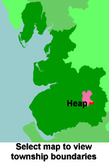
View a map of the boundaries of this town/parish.
You can see maps centred on OS grid reference SD839106 (Lat/Lon: 53.591398, -2.245224), Heap which are provided by:
- OpenStreetMap
- Google Maps
- StreetMap (Current Ordnance Survey maps)
- Bing (was Multimap)
- Old Maps Online
- National Library of Scotland (Old Ordnance Survey maps)
- Vision of Britain (Click "Historical units & statistics" for administrative areas.)
- English Jurisdictions in 1851 (Unfortunately the LDS have removed the facility to enable us to specify a starting location, you will need to search yourself on their map.)
- Magic (Geographic information) (Click + on map if it doesn't show)
- GeoHack (Links to on-line maps and location specific services.)
- All places within the same township/parish shown on an Openstreetmap map.
- Nearby townships/parishes shown on an Openstreetmap map.
- Nearby places shown on an Openstreetmap map.
For probate purposes prior to 1858, Heap was in the Archdeaconry of Chester, in the Diocese of Chester. The original Lancashire wills for the Archdeaconry of Chester are held at the Lancashire Record Office.
You can also see Family History Societies covering the nearby area, plotted on a map. This facility is being developed, and is awaiting societies to enter information about the places they cover.