
Hide
Garthorpe
hide
Hide
hide
Hide
hide
Hide
Hide
Hide
Note: Garthorpe is NOT an ancient parish of Lincolnshire. Prior to 1900 it was a township in Luddington parish. There is also a Garthorpe in Leicester.
Hide
- The parish was in the Swinefleet sub-district of the Goole Registration District.
- Check our Census Resource page for county-wide resources.
- The table below gives census piece numbers, where known:
| Census Year | Piece No. |
|---|---|
| 1841 | H.O. 107 / 639 |
| 1881 | R.G. 11 / 4700 |
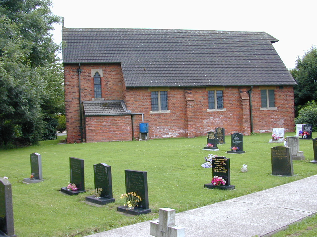
- The Anglican parish church is dedicated to Saint Mary.
- The church was built in 1913.
- The church seats 120.
- Here is a photo of Saint Mary's Church, taken by Ron COLE (who retains the copyrights).
- The Anglican parish church registers exist from 1561. Many entries are in Luddington parish register.
- The Lincolnshire Family History Society has provided a marriage index for the Isle of Axholme Deanery to make your search easier.
- The Wesleyan Methodist chapel was rebuilt in 1883.
- The Primitive Methodist chapel was built in 1838 and rebuilt in 1890.
- For information and assistance in researching these chapels, see our non-conformist religions page.
- Check our Church Records page for county-wide resources.
- The parish was in the Swinefleet sub-district of the Goole Registration District.
- Check our Civil Registration page for sources and background on Civil Registration which began in July, 1837.
Garthorpe is NOT one of the eight original parishes in the Isle of Axholme, but for centuries it was a township in that far north-west corner of Lincolnshire. See the histories and descriptions provided by the Isle of Axholme FHS.
Garthorpe was once part of a river island, having the Meredyke on the south, the River Trent on the east and the Old River Don on the north and west
- Ask for a calculation of the distance from Garthorpe to another place.
Histories and descriptions of Garthorpe are provided by the Isle of Axholme FHS.
See our Maps page for additional resources.
You can see maps centred on OS grid reference SE847190 (Lat/Lon: 53.660357, -0.719433), Garthorpe which are provided by:
- OpenStreetMap
- Google Maps
- StreetMap (Current Ordnance Survey maps)
- Bing (was Multimap)
- Old Maps Online
- National Library of Scotland (Old Ordnance Survey maps)
- Vision of Britain (Click "Historical units & statistics" for administrative areas.)
- English Jurisdictions in 1851 (Unfortunately the LDS have removed the facility to enable us to specify a starting location, you will need to search yourself on their map.)
- Magic (Geographic information) (Click + on map if it doesn't show)
- GeoHack (Links to on-line maps and location specific services.)
- All places within the same township/parish shown on an Openstreetmap map.
- Nearby townships/parishes shown on an Openstreetmap map.
- Nearby places shown on an Openstreetmap map.
In the 1086 Domesday Book, the village name is rendered as Gerulftorp, from the Old Scandinavian "hamlet of (a man named) Geirulfr".
[A. D. Mills, "A Dictionary of English Place-Names," Oxford University Press, 1991]
- Prior to 1900 this parish was a township and village in Luddington parish.
- The parish was in the West division of the ancient Manley Wapentake in the West Lindsey district in the parts of Lindsey.
- In the 1972 government redistricting, Garthorpe became part of the Boothferry District, which is now in the County of Humberside (formerly Lindsey, Lincolnshire).
- You can contact the local Garthorpe Parish Council regarding civic or political issues. They are NOT staffed to assist you with family history questions.
- For today's district governance, see the North Lincolnshire Council website.
- Bastardy cases would be heard in the Epworth petty session hearings.
- As a result of the 1834 Poor Law Amendment Act, the parish became part of the Goole Poor Law Union.
- A Public Elementary School was built here in 1852.
- See our Schools page for more information on researching school records.
The local genealogical society is the Isle of Axholme FHS.