
Hide
Gautby
hide
Hide
hide
Hide
hide
Hide
Hide
hide
Hide
Hide
- The parish was in the Wragby sub-district of the Horncastle Registration District.
- Gautby appears to be missing from the Public Record Office census returns for the year 1861.
- Check our Census Resource page for county-wide resources.
- The table below gives census piece numbers, where known:
| Census Year | Piece No. |
|---|---|
| 1841 | H.O. 107 / 634 |
| 1851 | H.O. 107 / 2107 |
| 1861 | R.G. 9 / 2365 |
| 1871 | R.G. 10 / 3379 |
| 1891 | R.G. 12 / 2597 |
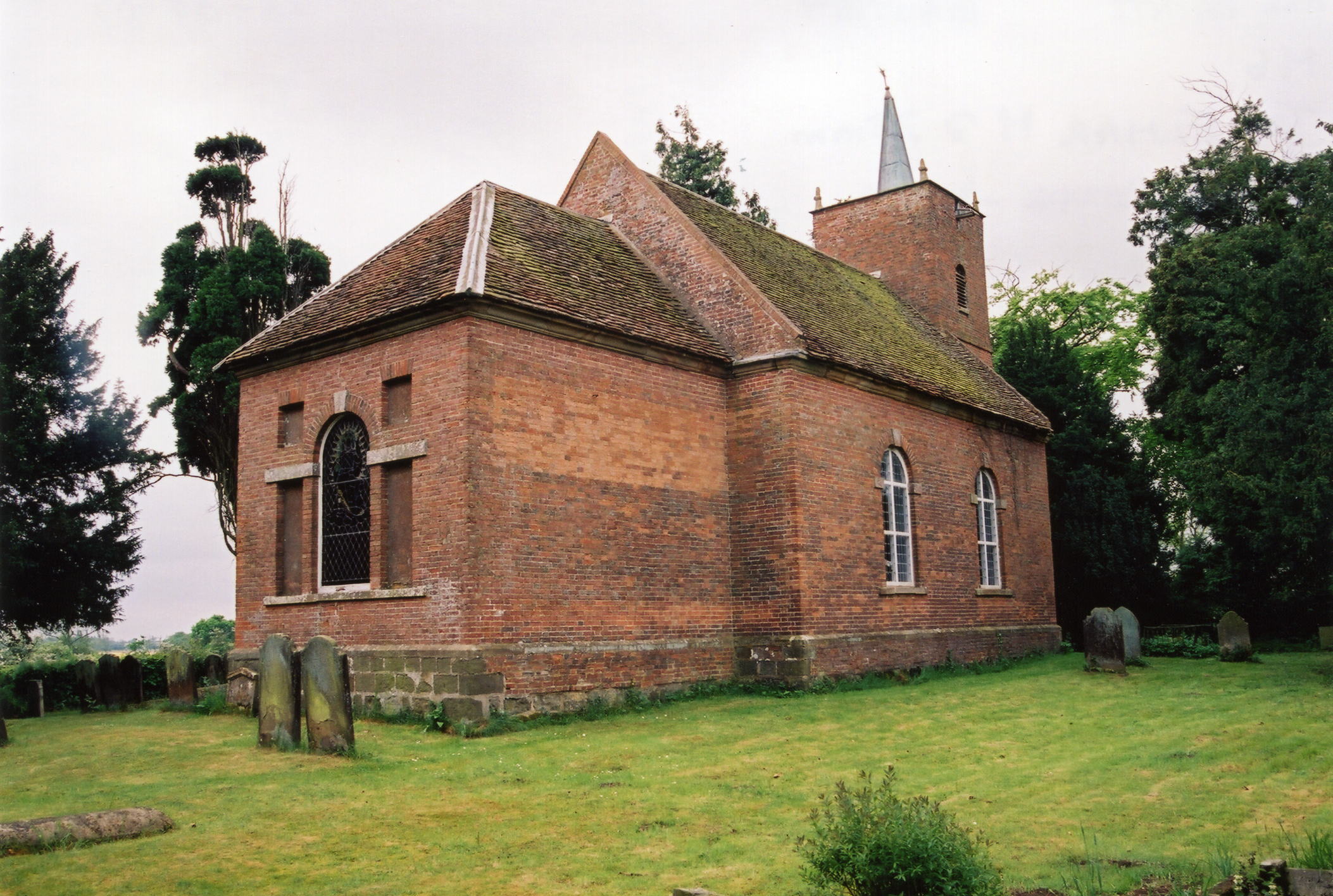
- The Anglican parish church is dedicated to All Saints.
- All Saints is a tiny brick church with a western tower and spire.
- The church was rebuilt around 1756.
- The church was thoroughly restored in 1908.
- The church seats 70.
- There is a photograph of All Saints' Church on the Wendy PARKINSON Church Photos web site.
- Richard CROFT has a photograph of All Saints' Church on Geo-graph, taken in June, 2006.
- Here is a photo of All Saints' Church, taken by Ron COLE (who retains the copyright):
- The parish register dates from 1571. Researchers should also check the registers at Baumber parish for the period of 1695 to 1799.
- The National Burial Index (NBI) lists 194 burials for the period 1814 through 1900.
- The LFHS has published several marriage indexes for the Horncastle Deanery to make your search easier.
- Check our Church Records page for county-wide resources.
- The parish was in the Wragby sub-district of the Horncastle Registration District.
- Check our Civil Registration page for sources and background on Civil Registration which began in July, 1837.
Gautby is a parish and a village about 7 miles north-west of Horncastle. Waddingworth parish lies to the south-east and Baumber parish to the east. The parish covers just under 1,500 acres.
The village of Gautby sits on a bold rise above a small rivulet known as the Great Drain. If you are planning a visit:
- Richard CROFT has a photograph of the Village Hall on Geo-graph, taken in December, 2007. Stop in and ask for a schedule of forth-coming events.
- Visit our touring page for more sources.
- Ask for a calculation of the distance from Gautby to another place.
- Moat House was occupied by Neville LUCAS-CALCRAFT in 1900, but was the property of Robert Charles De GREY VYNER.
- Sir Robert VYNER was Lord Mayor of London in 1675.
- See our Maps page for additional resources.
You can see maps centred on OS grid reference TF175724 (Lat/Lon: 53.235641, -0.240985), Gautby which are provided by:
- OpenStreetMap
- Google Maps
- StreetMap (Current Ordnance Survey maps)
- Bing (was Multimap)
- Old Maps Online
- National Library of Scotland (Old Ordnance Survey maps)
- Vision of Britain (Click "Historical units & statistics" for administrative areas.)
- English Jurisdictions in 1851 (Unfortunately the LDS have removed the facility to enable us to specify a starting location, you will need to search yourself on their map.)
- Magic (Geographic information) (Click + on map if it doesn't show)
- GeoHack (Links to on-line maps and location specific services.)
- All places within the same township/parish shown on an Openstreetmap map.
- Nearby townships/parishes shown on an Openstreetmap map.
- Nearby places shown on an Openstreetmap map.
Inside the church is a brass plaque and a framed document. To see them and the two names on them, see the Roll of Honour site.
David HITCHBORNE has a photograph of the World War II Memorial in the church on Geo-graph, taken in August, 2004 .
- The name Gautby is from the Old Scandanavian Gaute+by, or "village of a man named Gauti".
[A. D. Mills, "A Dictionary of English Place-Names," Oxford University Press, 1991].
- This place was an ancient parish in Lincolnshire and became a modern Civil Parish when those were established.
- The parish was in the southern division of the ancient Gartree Wapentake in the East Lindsey district in the parts of Lindsey.
- Gautby has a joint Parish Council with Minting. You may contact the Minting and Gautby Parish Council regarding civic or political issues. They are NOT staffed to assist you with family history questions.
- For today's district governance, see the East Lindsey District Council.
- Bastardy cases would be heard in the Horncastle petty session hearings.
- As a result of the 1834 Poor Law Amendment Act, the parish became part of the Horncastle Poor Law Union.
Year Inhabitants 1801 118 1811 122 1821 118 1831 109 1841 99 1851 99 1871 128 1881 100 1891 92 1901 88 1911 97 1971 81
- The parish joined with Minting Parish to form a School Board of 5 members on 4 Feb., 1876.
- The children of this parish attended school in Minting parish.
- For more on researching school records, see our Schools Research page.