
Hide
Northorpe
hide
Hide
hide
Hide
hide
Hide
Hide
hide
- Maps
- Memorial Inscriptions
- Migration, Internal◬
- Military History
- Military Records
- Names, Geographical
- Names, Personal
- Naturalisation & Citizenship◬
- Newspapers◬
- Occupations◬
- Politics & Government
- Poor Houses, Poor Law
- Population
- Postal & Shipping Guides◬
- Probate Records◬
- Public Records◬
- Schools
- Societies◬
- Voting Registers◬
Hide
Hide
The Gainsborough Library is an excellent resource with both a Local History section and a Family History section.
Alternatively, the Scunthorpe Library also has a Local History section.
Jonathan BILLINGER has a photograph of Saint John's Churchyard on Geo-graph, taken in October, 2009. Be cautious with headstones that may fall on you.
- The parish was in the Scotter sub-district of the Gainsborough Registration District.
- Check our Census Resource page for county-wide resources.
- The table below gives census piece numbers, where known:
| Census Year | Piece No. |
|---|---|
| 1841 | H.O. 107 / 641 |
| 1851 | H.O. 107 / 2119 |
| 1871 | R.G. 10 / 3441 |
| 1881 | R.G. 11 / 3293 |
| 1891 | R.G. 12 / 2632 |
There are three small brass figures in the church to members of the YERBURGH family.
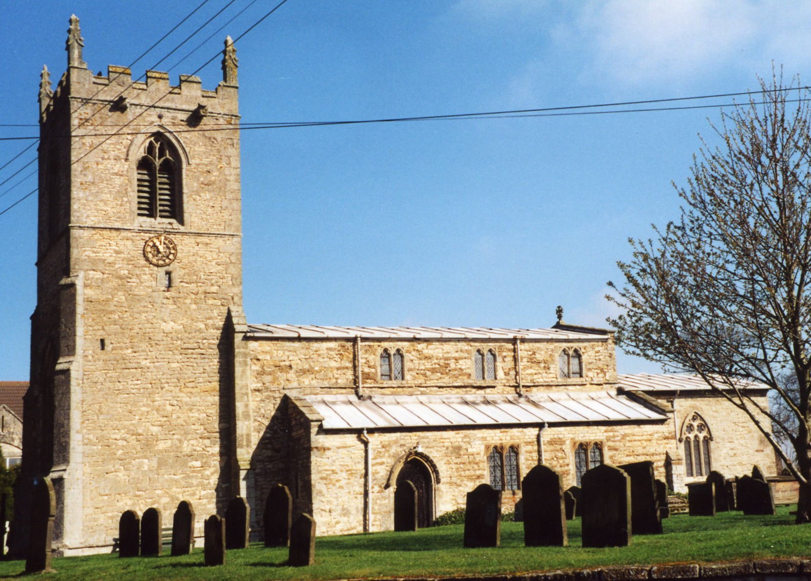
- The Anglican church is dedicated to Saint John the Baptist.
- Some of the lower portions of the church appear to be of Saxon origin. Most of the structure is Late Norman in style.
- The church seats 120.
- There is a photograph of St. John's Church on the Wendy PARKINSON Church Photos web site.
- Richard CROFT has a photograph of St. John's Church on Geo-graph, taken in 2005.
- Here is a photo of St. John's Church, taken by Ron COLE (who retains the copyright):
- The Anglican parish registers exist from 1593.
- We have a partial Parish Register Extract in a text file. Your additions are welcome.
- Check the Manlake Deanery to see what LFHS indexes exist.
- One should check Gordon WARRINGTON's contributions to FreeReg, which contains baptisms from 1791 - 1981.
- At the North Lincolnshire Library, copies of the parish register are on file covering baptisms, 1593 - 1985, burials, 1593 - 1985, and marriages, 1593 - 1983.
- The Primitive Methodists had a small chapel here, built in 1847 and enlarged in 1899. For information and assistance in researching Methodist chapels, see our non-conformist religions page.
- Check our Church Records page for county-wide resources.
- The parish was in the Scotter sub-district of the Gainsborough Registration District.
- Check our Civil Registration page for sources and background on Civil Registration which began in July, 1837.
Northorpe is a parish and village about eight miles north-east of Gainsborough, due south of Scunthorpe about 11 miles and about 150 miles north of London. Scotton parish lies to the north and Kirton in Lindsey parish to the northeast. The River Eau runs northward through the eastern portion of the parish on its way to the Trent. A small parish in area, it covers only about 1,800 acres. Southorpe parish was once an extra-parochial portion of Northorpe.
Researchers should be careful as there are at least two other hamlets called Northorpe in Lincolnshire (in Donington and Thurlby parishes) and the name occurs elsewhere in England.
If you are planning a visit:
- The village of Northorpe is perhaps best reached off of the A159 trunk road. Either come south through Scotter and Scotton or east at Blyton onto the B1205.
- Jo and Steve TURNER provide the photograph of a Auto Association Sign on Geo-graph, taken in May, 2016.
- Visit our touring page for more sources.
- Ask for a calculation of the distance from Northorpe to another place.
In the reign of Queen Elizabeth I the greater part of this parish belonged to the YERBURGH family, from wom it passed to the MONSON family.
- Northrope Hall is an Elizabethan manor, once the seat of the MONSON family.
- Norththorpe Hall was the residence of William EMBELTON-FOX in 1896.
- See our Maps page for additional resources.
You can see maps centred on OS grid reference SK895972 (Lat/Lon: 53.463883, -0.653429), Northorpe which are provided by:
- OpenStreetMap
- Google Maps
- StreetMap (Current Ordnance Survey maps)
- Bing (was Multimap)
- Old Maps Online
- National Library of Scotland (Old Ordnance Survey maps)
- Vision of Britain (Click "Historical units & statistics" for administrative areas.)
- English Jurisdictions in 1851 (Unfortunately the LDS have removed the facility to enable us to specify a starting location, you will need to search yourself on their map.)
- Magic (Geographic information) (Click + on map if it doesn't show)
- GeoHack (Links to on-line maps and location specific services.)
- All places within the same township/parish shown on an Openstreetmap map.
- Nearby townships/parishes shown on an Openstreetmap map.
- Nearby places shown on an Openstreetmap map.
Julian P. GUFFROGG provides a photograph of the Memorial Brass to Anthony MONSON (d.1648), 4th son of John MONSON.
- Richard CROFT has a photograph of the War Memorial in the churchyard on Geo-graph, taken in 2005.
For the list of names on the War Memorial, see the Roll of Honour site.
- The name derives from Old Scandinavian Nor+throp, for "northern farm".
["A Dictionary of English Place-Names," A. D. Mills, Oxford University Press, 1991]
- Surnames associated with this parish include YERBURGH, MONSON, DALTON and EMBERTON-FOX, all wealthy landowners. Other surnames include COOK, DUCKERING and SLEIGHTHOLME.
- This place was an ancient parish in Lincoln county and became a modern Civil Parish when those were established.
- The parish was in the ancient Corringham Wapentake in the West Lindsey district in the parts of Lindsey.
- Today's district governance is provided by the West Lindsey District Council.
- In April, 1936, Southorpe Civil Parish was abolished and merged back into this Civil Parish.
- Bastardy cases would be heard in the Gainsborough petty session hearings.
- After the Poor Law Amendment Act of 1834, this parish became part of the Gainsborough Poorlaw Union.
- A National School was built here in 1846 for as many as 50 children.
- The National School building is now the parish hall.
- Richard CROFT has a photograph of the old National School building on Geo-graph, taken in 2008.
- For more on researching school records, see our Schools Research page.