
Hide
St Edmund the King
hide
Hide
hide
Hide
Hide
Hide
"ST. EDMOND the KING, the church of, is situated on the north side of Lombard-street, between George-yard and Birchin-lane. This church derives its names from being dedicated to St. Edmund, king of the East Angles, who was murdered by the Danes in 870. The original church is supposed to have been built in the Saxon heptarchy, and the late church was destroyed in the great fire of 1606. The present church was built by Sir Christopher Wren, and finished in 1690. . . At the south end is a square tower, with a well-proportioned spire, and a dial projecting into the street. This church is a rectory in the patronage of the King and the Archbishop of Canter- bury alternately. The parish is united to that of St. Nicholas Acons, the church of which, before the fire of London, stood on the west side of St. Nicholas, and was a rectory in the gift of the crown, as that of St. Edmund was in the gift of the Archbishop of Canterbury; and hence the alternate patronage. These united parishes are in the ward of Langbourn, in the archdeaconry of London; and their present rector is the Rev. Richard Lendon, a prebendary of St. Paul's, who was instituted by the king 1n 1811." [James Elmes. A Topographical Dictionary of London and its Environs (1831) - transcribed by Brian Randell]
Hide
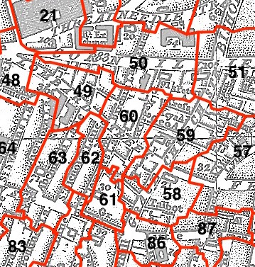
This parish - no. 60 in the above map - is located in Langbourn Ward.
The church was built by Wren 1670-9.
Hide
London Metropolitan Archive holdings for St Edmund the King.
Online Parish Register Images and Indexes for St Edmund the King parish are provided by, or at various subscription sites via, the LDS FamilySearch wiki.
No non-Church of England denominations have been identified for St Edmund the King with St Nicholas Acons [LDS FamilySearch Wiki].
Wikipedia page on St Edmund the King.
- Ask for a calculation of the distance from St Edmund the King to another place.
Summary history of St Edmund the King parish, from the Worshipful Company of Parish Clerks.
Plans of the Parish of St Edmund the King in 1788 and 1838 from COLLAGE, the London Picture Archive.
1901 map of St Edmund the King and Martyr - illustration of the location covered, and of archive(s) holding a copy, provided by the Catalogue of British Town Maps.
You can see maps centred on OS grid reference TQ329810 (Lat/Lon: 51.512216, -0.086206), St Edmund the King which are provided by:
- OpenStreetMap
- Google Maps
- StreetMap (Current Ordnance Survey maps)
- Bing (was Multimap)
- Old Maps Online
- National Library of Scotland (Old Ordnance Survey maps)
- Vision of Britain (Click "Historical units & statistics" for administrative areas.)
- English Jurisdictions in 1851 (Unfortunately the LDS have removed the facility to enable us to specify a starting location, you will need to search yourself on their map.)
- Magic (Geographic information) (Click + on map if it doesn't show)
- GeoHack (Links to on-line maps and location specific services.)
- All places within the same township/parish shown on an Openstreetmap map.
- Nearby townships/parishes shown on an Openstreetmap map.
- Nearby places shown on an Openstreetmap map.
Surnames from the 1881 census in the St Edmond King London district.
Clerical career summaries for the parish of (i) St Edmund the King and (ii) St Edmund The King With St Nicholas Acons, from the Clergy of the Church of England Database website.
Sources for listings of taxpayer names for St Edmund the King parish, listed on the LDS FamilySearch wiki.