
Hide
St Mary Woolchurch-Haw
hide
Hide
hide
Hide
Hide
Hide
"ST. MARY WOOLCHURCH HAW, so named, from a beam that stood anciently in the church-yard for the weighing of wool, stood on the eastern side of Stock's market, which is now occupied by the Lord Mayor's Mansion-house. It was destroyed by the fire of London, and being a small parish, was united by act of parliament to that of St. Mary Woolnoth." [James Elmes. A Topographical Dictionary of London and its Environs (1831) - transcribed by Brian Randell]
Hide
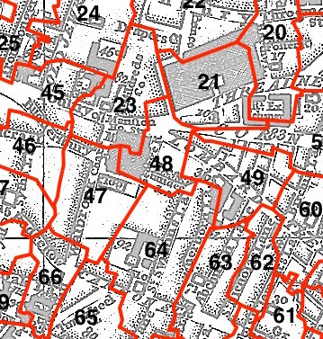
This parish - no. 48 in the above map - is located in Walbrook Ward.
The church was destroyed in 1666 and not rebuilt.
The parish was later united with St Mary Woolnoth 1670.
Hide
London Metropolitan Archive holdings for St Mary Woolchurch-Haw.
Cecil, Richard. Memoirs of the Rev. John Newton, late rector of the united parishes of St. Mary Woolnoth, and St. Mary Woolchurch Haw, Lombard street, with general remarks on his life, connexions, and character. London, Printed for J. Hatchard, Piccadilly. [S. Gosnell, printer] (1808) 322 pp. [Full text]
Online Parish Register Images and Indexes for St Mary Woolchurch-Haw parish are provided by, or at various subscription sites via, the LDS FamilySearch wiki.
No non-Church of England denominations have been identified for St Mary Woolnoth with St Mary Woolchurch Haw [LDS FamilySearch Wiki].
Brooke, J.M.S. and Hallen, A.W.C. The transcript of the registers of the united parishes of S. Mary Woolnoth and S. Mary Woolchurch Haw, in the city of London, from their commencement 1538 to 1760. To which is prefixed a short account of both parishes, list of rectors and churchwardens, chantries, &c. together with some interesting extracts from the churchwardens' accounts. London, Printed by Bowles & Sons, (1886) 522 pp. [Full text]
Wikipedia page on St Mary Woolchurch-Haw.
- Ask for a calculation of the distance from St Mary Woolchurch-Haw to another place.
Summary history of St Mary Woolchurch-Haw parish, from the Worshipful Company of Parish Clerks.
A section of the "woodcut" map of London of c.1561, showing St Mary Woollchurch Haw United with St Mary Woolnoth (1670), from Wikipedia (Vov 2016).
1900 map of St Mary Woolchurch Haw - illustration of the location covered, and of archive(s) holding a copy, provided by the Catalogue of British Town Maps.
You can see maps centred on OS grid reference TQ327811 (Lat/Lon: 51.513114, -0.089344), St Mary Woolchurch-Haw which are provided by:
- OpenStreetMap
- Google Maps
- StreetMap (Current Ordnance Survey maps)
- Bing (was Multimap)
- Old Maps Online
- National Library of Scotland (Old Ordnance Survey maps)
- Vision of Britain (Click "Historical units & statistics" for administrative areas.)
- English Jurisdictions in 1851 (Unfortunately the LDS have removed the facility to enable us to specify a starting location, you will need to search yourself on their map.)
- Magic (Geographic information) (Click + on map if it doesn't show)
- GeoHack (Links to on-line maps and location specific services.)
- All places within the same township/parish shown on an Openstreetmap map.
- Nearby townships/parishes shown on an Openstreetmap map.
- Nearby places shown on an Openstreetmap map.
Surnames from the 1881 census in the St Mary Woolchurch-Haw district.
Clerical career summaries for the parish of (i) St St Mary Woolchurch Haw, and (ii) St Mary Woolnoth With St Mary Woolchurch Haw, from the Clergy of the Church of England Database website.
Sources for listings of taxpayer names for St Mary Woolchurch-Haw parish, listed on the LDS FamilySearch wiki.