
Hide
St Michael Paternoster Royal
hide
Hide
hide
Hide
Hide
Hide
"ST. MICHAEL PATERNOSTER ROYAL, the church of, stands on the eastern side of College-hill, Upper Thames-street. It derives its name from its patron saint, and from its contiguity to the Tower Royal, that stood anciently at the upper or northern end of College-hill. . . The church of St. Michael Paternoster Royal, has been a rectory from very ancient date, and the patronage was in the Prior and Canons of Canterbury, as early as 1285. . . The old church was pulled down and rebuilt in 1410, when by license from Henry IV., it was made Collegiate of the Holy Spirit and St. Mary, by Sir Richard Whittington, four times mayor. . . The ancient church, college and alms houses, were all consumed by the great fire of 1666, and the present edifice erected in its stead, by Sir Christopher Wren in 1694. It was made parochial for this parish and for that of St. Martin Vintry, the church of which was also destroyed by the same fire. . . The present rector is the Rev. George F. L. Nicolay, M.A., one of the brethren of St. Katherine's Hospital in the Regent's-park, and vicar of Little Marlow, who was instituted in 1790." [James Elmes. A Topographical Dictionary of London and its Environs (1831) - transcribed by Brian Randell]
Hide
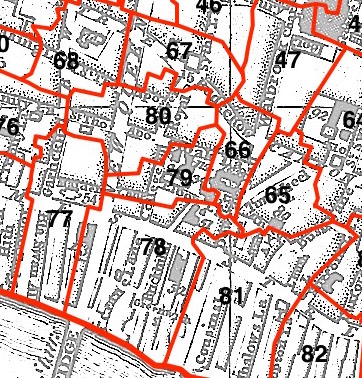
This parish - no. 79 in the above map - is located in Vintry Ward.
The church dates from before the Great Fire, and was rebuilt by Wren 1686-94.
Hide
London Metropolitan Archive holdings for St Michael Paternoster Royal.
Richard Whittington, a paper by Alan Seymour Lamboll, to the Guildhall Historical Association in 1975.
The Real Dick Whittington, from The Lord Mayor's Show website.
Online Parish Register Images and Indexes for St Michael Paternoster Royal parish are provided by, or at various subscription sites via, the LDS FamilySearch wiki.
Independent/Congregational is the only identified non-Church of England denomination in St Michael Royal with St Martin Vintry [LDS FamilySearch Wiki].
Wikipedia page on St Michael Paternoster Royal.
- Ask for a calculation of the distance from St Michael Paternoster Royal to another place.
Summary history of St Michael Paternoster Royal parish, from the Worshipful Company of Parish Clerks.
You can see maps centred on OS grid reference TQ325809 (Lat/Lon: 51.511408, -0.092177), St Michael Paternoster Royal which are provided by:
- OpenStreetMap
- Google Maps
- StreetMap (Current Ordnance Survey maps)
- Bing (was Multimap)
- Old Maps Online
- National Library of Scotland (Old Ordnance Survey maps)
- Vision of Britain (Click "Historical units & statistics" for administrative areas.)
- English Jurisdictions in 1851 (Unfortunately the LDS have removed the facility to enable us to specify a starting location, you will need to search yourself on their map.)
- Magic (Geographic information) (Click + on map if it doesn't show)
- GeoHack (Links to on-line maps and location specific services.)
- All places within the same township/parish shown on an Openstreetmap map.
- Nearby townships/parishes shown on an Openstreetmap map.
- Nearby places shown on an Openstreetmap map.
Surnames from the 1881 census in the St Michael Paternoster district.
Sources for listings of taxpayer names for St Michael Paternoster Royal parish, listed on the LDS FamilySearch wiki.