
Hide
City of London Parishes & Wards
hide
Hide
- The City of London: Parishes and Wards
- The County of London: Metropolitan Boroughs 1888-1965
- Greater London: London Boroughs 1965 to the present
For further information about the the historical development of the administrative units of London, see Local Government Changes in the United Kingdom.
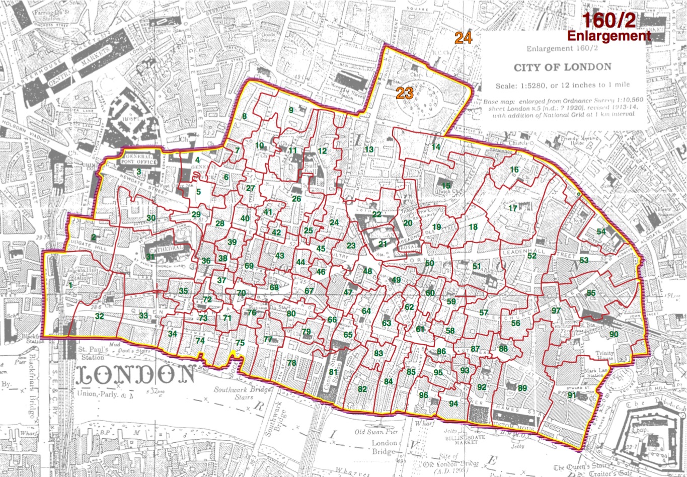
City of London Parishes and Wards
Since each parish within the City of London comprises at most a few streets, the parishes are known primarily by the name of the church, and not by the location. However, many of the dedications occur frequently in the City, in which case the full name of the parish contains some other identifying information, such as street name or location relative to some landmark.
If you are looking for a London parish known primarily by a place name, you can be sure it is not in the City of London, but in some other part of the metropolitan area. If it's north of the Thames, look in Middlesex. If it's south of the river, it is probably in Surrey, or else in Kent.
This listing of links provides means of reaching each of the separate pages that are provided here for the parishes and wards of the City of London. The set of one hundred and eighteen parishes (including nine extra-parochial places) is based on that given by The Phillimore Atlas and Index of Parish Registers. Thus it is a set of historic parishes, and differs from the list of ecclesiastical parishes used by the LDS FamilySearch Wiki, since parishes that had merged after the Great Fire of London (1666), or in the 18th-19th centuries, remain separated here.
Almost all these parish pages are provided with an initial location map, based on the 1818 John Cary Map of London that is included in the splendid John Snow website, courtesy of Professor Ralph R. Frerichs. The (redrawn) historic parish boundaries (i.e. of the parishes that are within the Walls) overlaid on these map fragments (see Key) are based on those shown in the City of London map in Historic Parishes of England and Wales, provided here courtesy of Professor R.J.P. Kain. This map is based on a 1920s Ordnance Survey map - much of the street layout has changed very considerably since 1818, so the parish boundaries shown here are approximate. However the pages for the few parishes that were outside the City walls, or the extra-parochial places, do not have such location maps here, but instead just ones from modern Google Maps. (A source of detailed ecclesiastical parish boundaries is that provided by LDS FamilySearch, which also uses a modern Google map background for its parish boundary maps.)
The City of London is divided into twenty-five wards. The set of pages provided here for these wards also just have small location maps from Google, but each page has a link to a detailed 18th century street map of the ward. These maps are either by Blome (1754) or Cole (1755). A listing of the parishes that make up each ward is provided here.
City of London Wards
City of London Parishes
The County of London
In 1889, the London County Council was created, consisting of the City of London and 28 Metropolitan Boroughs taking areas from Middlesex, Surrey and Kent.
| Metropolitan Borough | Original County |
|---|---|
| Battersea | Surrey |
| Bermondsey | Surrey |
| Bethnal Green | Middlesex |
| Camberwell | Surrey |
| Chelsea | Middlesex |
| Deptford | Kent |
| Finsbury | Middlesex |
| Fulham | Middlesex |
| Greenwich | Kent |
| Hackney | Middlesex |
| Hammersmith | Middlesex |
| Hampstead | Middlesex |
| Holborn | Middlesex |
| Islington | Middlesex |
| Kensington | Middlesex |
| Lambeth | Surrey |
| Lewisham | Kent |
| Paddington | Middlesex |
| Poplar | Middlesex |
| St Marylebone | Middlesex |
| St Pancras | Middlesex |
| Shoreditch | Middlesex |
| Southwark | Surrey |
| Stepney | Middlesex |
| Stoke Newington | Middlesex |
| Wandsworth | Surrey |
| Westminster | Middlesex |
| Woolwich | Kent |
Greater London
In 1965, the administrative unit of Greater London was created, though the name itself had previously been used in an informal sense. This comprised the old County of London, with the Metropolitan Boroughs merged into a smaller number of Boroughs, the remaining parts of Middlesex, and parts of Essex, Herts, Surrey and Kent. Middlesex ceased to exist as an administrative county, though the name is still used in postal addresses.
The table lists the present-day boroughs of Greater London together with the counties which originally contained their current area, and the Metropolitan Broroughs they replaced. Note that many places in Greater London are still frequently referred to as being in counties, because the counties are still used in postal addresses.
| Greater London Borough | Metropolitan Boroughs | Original County |
|---|---|---|
| Barking and Dagenham | Essex | |
| Barnet | Middlesex & Hertfordshire | |
| Bexley | Kent | |
| Brent | Middlesex | |
| Bromley | Kent | |
| Camden | Finsbury Hampstead Holborn St Pancras | Middlesex |
| City of London | - | - |
| Croydon | Surrey | |
| Ealing | Middlesex | |
| Enfield | Middlesex | |
| Greenwich | Deptford Greenwich Woolwich | Kent |
| Hackney | Hackney Shoreditch Stoke Newington | Middlesex |
| Hammersmith and Fulham | Fulham Hammersmith | Middlesex |
| Haringey | Middlesex | |
| Harrow | Middlesex | |
| Havering | Essex | |
| Hillingdon | Middlesex | |
| Hounslow | Middlesex | |
| Islington | Finsbury Islington | Middlesex |
| Kensington and Chelsea | Chelsea Kensington | Middlesex |
| Kingston upon Thames | Surrey | |
| Lambeth | Lambeth | Surrey |
| Lewisham | Deptford Lewisham | Surrey & Kent |
| Merton | Surrey | |
| Newham | Essex | |
| Redbridge | Essex | |
| Richmond upon Thames | Surrey & Middlesex | |
| Southwark | Bermondsey Camberwell Southwark | Surrey |
| Sutton | Surrey | |
| Tower Hamlets | Bethnal Green Poplar Stepney | Middlesex |
| Waltham Forest | Middlesex & Essex | |
| Wandsworth | Battersea Wandsworth | Surrey |
| Westminster | Paddington St Marylebone Westminster | Middlesex |
A clickable map of the boroughs is provided by the London Councils, and Oultwood Services also have a clickable map and list of London Borough Web sites. National Statistics Geography webpages have a map of London (pdf format).
Our page London Boroughs - Archives and Local Studies Libraries has links to web sites of each London borough, and to their archives or local studies libraries.