
Hide
Ingram
hide
Hide
hide
Hide
Hide
Hide
"INGRAM is a parish, comprising the three townships of Fawdon, Clinch, and Hartside; Ingram, Linop, and Greenshaw Hill; and Reavealey. It is bounded by the parishes of Alnham, Eglingham, Ilderton, and Whittingham, and comprises an area of 11,304 acres. The number of inhabitants in 1801 was l71; in 1811, 180; in 1821, 228; in 1831, 205; in 1841, 220; and in 1851, 198 souls. This district, which is very irregular, mountainous and picturesque is very thinly peopled, and is intersected by the river Breamish." [From History, Topography, and Directory of Northumberland, Whellan, 1855].
Hide
- Northumberland County Record Office holds copies of Census Returns 1841 - 1891 and provides a useful User Guide
- The 1851 Census Index (microfiche CN35) published by the https://www.ndfhs.org.uk/ may be of value to researchers interested in this parish.
- Ingram - Church Records - links and information.
- This area is within Northumberland North First Registration District.
- Certificates of birth, death and marriage can be ordered locally from Northumberland County Council.
- Photographs of Ingram Valley from Les Bell's Northumberland Cam website.
- The section of The National Gazetteer (1868) relating to this parish - transcribed by Colin Hinson.
- Ask for a calculation of the distance from Ingram to another place.
- A history of the village of Ingram from the Northumberland National Park website.
- The history of Ingram Parish is included in:- Northumberland County History Committee, History of Northumberland, Volume 14. Newcastle, A. Reid, 1935. (Available on fiche from Ancestral Indexes).
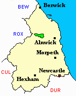
- Ingram - Maps - links and information.
You can see maps centred on OS grid reference NT976164 (Lat/Lon: 55.441832, -2.040024), Ingram which are provided by:
- OpenStreetMap
- Google Maps
- StreetMap (Current Ordnance Survey maps)
- Bing (was Multimap)
- Old Maps Online
- National Library of Scotland (Old Ordnance Survey maps)
- Vision of Britain (Click "Historical units & statistics" for administrative areas.)
- English Jurisdictions in 1851 (Unfortunately the LDS have removed the facility to enable us to specify a starting location, you will need to search yourself on their map.)
- Magic (Geographic information) (Click + on map if it doesn't show)
- GeoHack (Links to on-line maps and location specific services.)
- All places within the same township/parish shown on an Openstreetmap map.
- Nearby townships/parishes shown on an Openstreetmap map.
- Nearby places shown on an Openstreetmap map.
Lest We Forget
Ingram St Michael
14 Nov 1918 A. J. Turnbull, Private 84483 3rd Bn Northumberland Fusiliers [grave nr east boundary wall]
7 Dec 1940 Robert Holywell, Guardsman 2659496 Coldstream Guards, age 23 son of Robert and Jane Scott Holywell of Branton