
Hide
Lesbury
hide
Hide
hide
Hide
Hide
Hide
"LESBURY is a parish comprising the townships of Alnmouth, Bilton, and Lesbury, and is bounded on the north by Long Houghton, on the west by Alnwick, on the south by High Buston and Shilbottle, and on the east by the German Ocean. It contains 2,624 acres, and the number of its inhabitants in 1801, was 874; in 1811, 858; in 1821, 982; in 1831, 976; in 1841, 1,108; and in 1851, it had increased to 1,238 souls. A portion of this parish extends across the river Aln into Coquetdale Ward." [From History, Topography, and Directory of Northumberland, Whellan, 1855].
Hide
- Northumberland County Record Office holds copies of Census Returns 1841 - 1891 and provides a useful User Guide
- The 1851 Census Index (microfiche CN31) Warkworth, Felton, Shilbottle and Lesbury (PRO piece HO107/2419 folios-275) (Type B) (Book)
- 1891 Census Warkworth (Amble, Gloster Hill, Hauxley, Radcliffe, Morwick, Togstone, Acklington, Acklington Park, Lesbury, Bilton, Alnmouth, ships in port and Coquet Lighthouse) (PRO piece RG12/4262) (Type B) (Book) (Volume 72) BOTH published by the https://www.ndfhs.org.uk/ may be of value to researchers interested in this parish.
- The Ancestral Indexes website provides information about Alnmouth, St John.
- Lesbury - Church Records - links and information.
- This area is within Northumberland North Second Registration District.
- Certificates of birth, death and marriage can be ordered from Northumberland County Council.
- Photographs of Alnmouth and Alnmouth Bay from Les Bell's Northumberland Cam website.
- The Northumberland Communities website includes pages relating to Alnmouth and Lesbury. They provide "a range of learning resource material that reflects Northumberland's heritage, providing a base for studying the County's history. The website provides a starting point for understanding the development of communities in Northumberland. It also seeks to illustrate the range of sources for family and local history research that are available via Northumberland Archives Service."
- The section of The National Gazetteer (1868) relating to this parish - transcribed by Colin Hinson.
- Ask for a calculation of the distance from Lesbury to another place.
- The history of Lesbury Parish is included in:- Northumberland County History Committee, History of Northumberland, Volume 2. Newcastle, A. Reid, 1895.
- LNER Wartime Evacuation Documents N.EVAC 2 and N.EVAC 3 describing the arrangements for evacuating children from Newcastle and Gateshead to rural parts of Northumberland (including Alnmouth), Co Durham, Yorkshire, Cumberland and Westmorland. The second document includes lists of schools with details of their places and times of departure and their destinations.
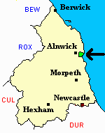
You can see maps centred on OS grid reference NU233114 (Lat/Lon: 55.396288, -1.633186), Lesbury which are provided by:
- OpenStreetMap
- Google Maps
- StreetMap (Current Ordnance Survey maps)
- Bing (was Multimap)
- Old Maps Online
- National Library of Scotland (Old Ordnance Survey maps)
- Vision of Britain (Click "Historical units & statistics" for administrative areas.)
- English Jurisdictions in 1851 (Unfortunately the LDS have removed the facility to enable us to specify a starting location, you will need to search yourself on their map.)
- Magic (Geographic information) (Click + on map if it doesn't show)
- GeoHack (Links to on-line maps and location specific services.)
- All places within the same township/parish shown on an Openstreetmap map.
- Nearby townships/parishes shown on an Openstreetmap map.
- Nearby places shown on an Openstreetmap map.
- A transcript of Alnmouth St John War Memorial provided by Ancestral Indexes.