
Hide
Whittonstall
hide
Hide
hide
Hide
Hide
Hide
"WHITTONSTALL is a chapelry, township and village, the property of the Commissioners of Greenwich Hospital, to whom the manorial rights belong. It was separated from Bywell St. Peter's parish, and became a distinct chapelry for ecclesiastical purposes, in 1774, when it received an augmentation from Queen Anne's bounty. It comprises the townships of Whittonstall and Newlands, the former of which contains 1,968 acres, and its rateable value is £1,673 10s. Population in 1821 was 146; in 1831, 175; in 1841, 184; and in 1851, 198 souls. Here is a drain-tile manufactory, which is carried on by Mr. William Dinning. THE VILLAGE of Whittonstall is situated about three and a half miles south by east of Bywell. THE CHAPEL is a plain stone building, containing about 305 sittings, and was erected in 1832, from the materials of the former chapel, on whose site it partly stands. The living is a perpetual curacy in the gift of the Dean and Chapter of Durham, and incumbency of the Rev. Richard Marshall. The register of this chapelry commences in 1754. WHITTONSTALL SCHOOL was erected by subscription in 1846; it is self supporting, and under government inspection" [From History, Topography, and Directory of Northumberland, Whellan, 1855].
'WHITTONSTALL, a chapelry in the parish of BYWELL-ST-PETER, eastern division of TINDALE ward, county of NORTHUMBERLAND ..." [Samuel Lewis Topographical Dictionary of England 1831 © Mel Lockie]
Hide
- Northumberland County Record Office holds copies of Census Returns 1841 - 1891 and provides a useful User Guide
- The 1851 Census Index (microfiche CN15) Bywell, Ovingham, Shotley, Blanchland and Whittonstall (PRO piece HO107/2414 folios 1-268) (Type A) (Book) published by the Northumberland and Durham Family History Society may be of value to researchers interested in this parish.
- The 1891 Census Northumberland – Bywell (Broomley, Healey, High Fotherley, Espershields, Whittonstall, Newlands, Bywell, Styford, Newton, Stelling, Ovington, Newton Hall, Welton, Broomhaugh, Riding, Newbiggin, Blanchland, Shotley Low Quarter, Nafferton, Ovingham, Wylam, Hedley, Dukershagg and part of Prudhoe) (PRO piece RG12/4244) (Type B) (Book) (Volume 54) https://www.ndfhs.org.uk/ may be of value to researchers interested in this parish.
- Whittonstall - Church Records - links and information.
- Bishops Transcripts Baptisms 1774 to 1812 can be accessed here https://Northumberlandparishregistertranscriptslocalhistory.wordpress.com please scroll down the page to the parish you require
- This area is within Northumberland West Registration District.
- Certificates of birth, death and marriage can be ordered from Northumberland County Council.
- The section of The National Gazetteer (1868) relating to this parish - transcribed by Colin Hinson.
- Ask for a calculation of the distance from Whittonstall to another place.
- Maps of locations in this parish provided by Streetmap.
Newlands, Whittonstall.
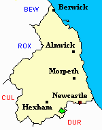
You can see maps centred on OS grid reference NZ071571 (Lat/Lon: 54.908565, -1.890792), Whittonstall which are provided by:
- OpenStreetMap
- Google Maps
- StreetMap (Current Ordnance Survey maps)
- Bing (was Multimap)
- Old Maps Online
- National Library of Scotland (Old Ordnance Survey maps)
- Vision of Britain (Click "Historical units & statistics" for administrative areas.)
- English Jurisdictions in 1851 (Unfortunately the LDS have removed the facility to enable us to specify a starting location, you will need to search yourself on their map.)
- Magic (Geographic information) (Click + on map if it doesn't show)
- GeoHack (Links to on-line maps and location specific services.)
- All places within the same township/parish shown on an Openstreetmap map.
- Nearby townships/parishes shown on an Openstreetmap map.
- Nearby places shown on an Openstreetmap map.