
Hide
Kingoldrum
hide
Hide
"The parish, which is situated in the braes of Angus, covers about 20 square miles. It is bounded on the north and east by Kirriemuir and Cortachy, on the south by Airlie and on the west by Lintrathen. The people, generally speaking, are obliging, hospitable and affable. Poaching in the salmon fisheries formerly prevailed; but this has been completely checked. The parish may be said to be completely agricultural. The sheep are principally of the black-faced breed. The Angus-shire black cattle are the most common. They are generally sold to dealers for the London, Edinburgh and Glasgow markets. The nearest market town is Kirriemuir. The only village is in the neighbourhood of the church. The roads are in a bad state of repair. The bridges are not so numerous as they require to be, and several are insecure. The fences are partly of thorn and partly of dry stone. The parish is divided into large farms; the parctice of keeping bothies is almost universal. This may be advantageous to the farmer, but is certainly most adverse to the morals of the labouring population."
Edited from The New Statistical Account of Scotland, Angus, 1842.
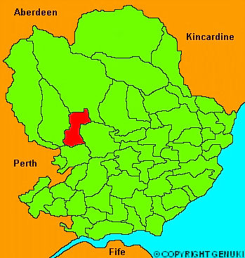
Click on the map to access more maps of Kingoldrum.
Hide
| Kingoldrum Parish Church, Kingoldrum, Church of Scotland |
| Kingoldrum Parish Church, Kingoldrum, Church of Scotland |
- The transcription of the section for Kingoldrum from the National Gazetteer (1868) provided by Colin Hinson.
- Ask for a calculation of the distance from Kingoldrum to another place.
You can see maps centred on OS grid reference NO337571 (Lat/Lon: 56.700998, -3.085115), Kingoldrum which are provided by:
- OpenStreetMap
- Google Maps
- StreetMap (Current Ordnance Survey maps)
- Bing (was Multimap)
- Old Maps Online
- National Library of Scotland (Old Ordnance Survey maps)
- Vision of Britain (Click "Historical units & statistics" for administrative areas.)
- Magic (Geographic information) (Click + on map if it doesn't show)
- GeoHack (Links to on-line maps and location specific services.)
- All places within the same township/parish shown on an Openstreetmap map.
- Nearby townships/parishes shown on an Openstreetmap map.
- Nearby places shown on an Openstreetmap map.