
Hide
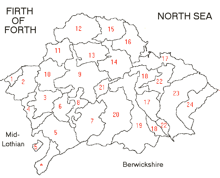
East Lothian Parish Map
hide
Hide
Here is a map of the parishes in East Lothian showing their relative positions and approximate sizes. The parishes are indicated using numbers and an alphabetical list of the parishes appears after the map. Adjacent counties are also indicated to help give you some geographical context.
|
|
| 1 | Prestonpans | 10 | Gladsmuir | 19 | Whittinghame |
| 2 | Tranent | 11 | Aberlady | 20 | Garvald |
| 3 | Pencaitland | 12 | Dirleton | 21 | Morham |
| 4 | Ormiston | 13 | Athelstaneford | 22 | Spott |
| 5 | Humbie | 14 | Prestonkirk | 23 | Innerwick |
| 6 | Saltoun | 15 | North Berwick | 24 | Oldhamstocks |
| 7 | Gifford | 16 | Tynninghame | ||
| 8 | Bolton | 17 | Dunbar | * | Soutra (part of Midlothian since 1891) |
| 9 | Haddington | 18 | Stenton |
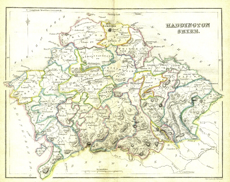
Two copies of this 19th Century map of Haddingtonshire are available:
Click here for a small copy of the map (350kb), or here for a detailed copy (~1Mb).