
Hide
Kirk Brae, Liberton, Church of Scotland
hide
Hide
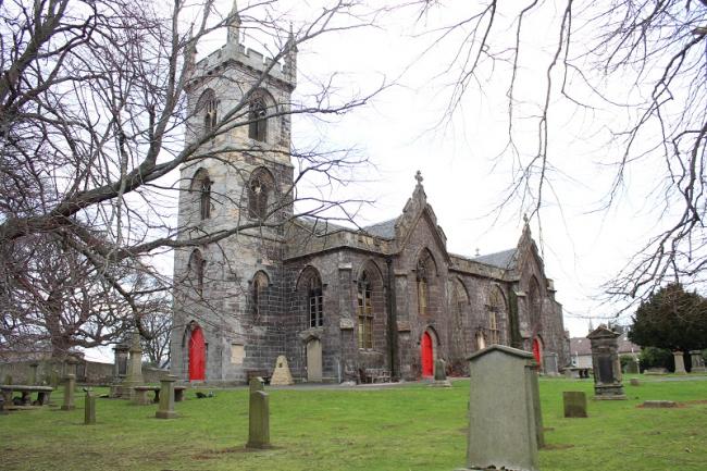
Dave Howie ©2019 Liberton Kirk
Hide
Church of Scotland,
Kirk Brae,
Liberton
Hide
It was founded in 1143, the current building dates from 1814, although has been modified since then.
The church website contains a history section.
OPRs (Old Parish Registers) are available from 1624 (Births), 1631 (Marriages) and 1647 (Deaths).
Details of the available records, gaps, etc, can be found on the NRS website.
It is located at NT2750869527 (Lat/Lon 55.913355, -3.161305). You can see this on maps provided by:
- OpenStreetMap
- Google Maps
- StreetMap (Current Ordnance Survey maps)
- Bing (was Multimap)
- Old Maps Online
- National Library of Scotland (Old Ordnance Survey maps)
- Vision of Britain (Click "Historical units & statistics" for administrative areas.)
- Magic (Geographic information) (Click + on map if it doesn't show)
- GeoHack (Links to on-line maps and location specific services.)
The First World War Memorial in the church grounds has been photographed, and copies are available from the IWM database. Although the names are not listed, the photos are sufficiently detailed to allow the names to be viewed.