
Hide
St Mungo's, Penicuik, Church of Scotland
hide
Hide
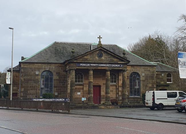
St Mungo's, Penicuik
© Dave Howie 2023
Hide
St Mungo's,
High Street,
Penicuik
Hide
The foundation stone of the church was laid on 15th August, 1770. The church was a replacement for the adjacent St Kentigerns, which had become too small for the growing population of the parish.
Some details of the history of the church can be found on the parish website.
The Canmore database includes several photos of the church.
OPRs (Old Parish Registers) are available from 1654 (Births and Marriages), 1658 (Deaths).
Details of the gaps, irregular entries, etc, can be found on the NRS website.
It is located at NT2367959968 (Lat/Lon 55.826893, -3.219853). You can see this on maps provided by:
- OpenStreetMap
- Google Maps
- StreetMap (Current Ordnance Survey maps)
- Bing (was Multimap)
- Old Maps Online
- National Library of Scotland (Old Ordnance Survey maps)
- Vision of Britain (Click "Historical units & statistics" for administrative areas.)
- Magic (Geographic information) (Click + on map if it doesn't show)
- GeoHack (Links to on-line maps and location specific services.)
Details (including names of the fallen) of the war memorial in the church are available from the IWM database.