
Hide
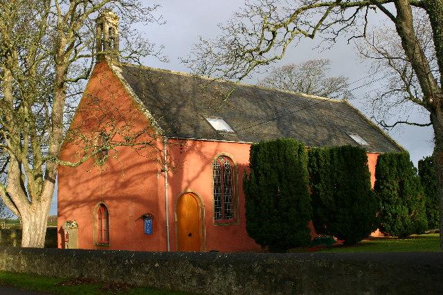
Speymouth, Church of Scotland
hide
Hide
© Copyright Iain Macaulay and licensed for reuse under this Creative Commons Licence.
Hide
Church of Scotland,
Speymouth
Fochabers
IV32
Hide
This church, the so-called Red Kirk, was built in the 1730s in order to serve the community of the new parish of Speymouth, which was created by the union of Essil and Dipple parishes in 1731. The church is located close to a small, rural road, a short distance north of Mosstodloch village and close to the west bank of the River Spey. There is no graveyard at the church, but there are landscaped grounds around the building and a car parking area to the south and east.
It is located at NJ3365760760 (Lat/Lon 57.631881, -3.112666). You can see this on maps provided by:
- OpenStreetMap
- Google Maps
- StreetMap (Current Ordnance Survey maps)
- Bing (was Multimap)
- Old Maps Online
- National Library of Scotland (Old Ordnance Survey maps)
- Vision of Britain (Click "Historical units & statistics" for administrative areas.)
- Magic (Geographic information) (Click + on map if it doesn't show)
- GeoHack (Links to on-line maps and location specific services.)