
Hide
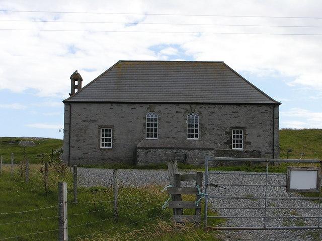
Nesting, Church of Scotland
hide
Hide
Hide
Church of Scotland,
Nesting
Hide
Nesting includes the ancient parish of Lunnasting in the North and the island parish of Whalsay to the east, which were added to Nesting in 1891. Before that, the ancient parishes of North Nesting and South Nesting were merged. The parish church, St Ola's Kirk, stands some 10 miles north of Lerwick near the war memorial at Brettabister.
It is located near HU487579 (Lat/Lon 60.301993, -1.119993). You can see this on maps provided by:
- OpenStreetMap
- Google Maps
- StreetMap (Current Ordnance Survey maps)
- Bing (was Multimap)
- Old Maps Online
- National Library of Scotland (Old Ordnance Survey maps)
- Vision of Britain (Click "Historical units & statistics" for administrative areas.)
- Magic (Geographic information) (Click + on map if it doesn't show)
- GeoHack (Links to on-line maps and location specific services.)