
Hide
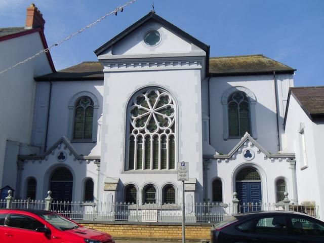
Tabernacle Chapel, Cardigan (Welsh Calvinistic Methodist)
hide
Hide
Hide
Tabernacle Chapel,
Pendre,
Cardigan
Cardiganshire
Hide
- The entry for this church on the National Monuments Record of Wales (NMRW) website (Coflein).
- See also the Chapels database
-
From Tivy-side Advertiser 11/2021 "CARDIGAN town councillors have expressed their sadness at the news that an iconic town centre chapel has been put up for sale. Tabernacl, a towering Calvinistic Methodist chapel which has dominated Pendre since 1832, has played a key role in the life of the town for almost two centuries.........."
It was located at SN1779946250 (Lat/Lon 52.084535, -4.660616). You can see this on maps provided by:
- OpenStreetMap
- Google Maps
- StreetMap (Current Ordnance Survey maps)
- OpenStreetMap Cymru (Welsh counties only)
- Bing (was Multimap)
- Old Maps Online
- National Library of Scotland (Old Ordnance Survey maps)
- Vision of Britain (Click "Historical units & statistics" for administrative areas.)
- Magic (Geographic information) (Click + on map if it doesn't show)
- GeoHack (Links to on-line maps and location specific services.)