
Hide
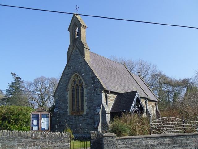
St Tydfil, Llechryd (Church in Wales)
hide
Hide
Hide
St Tydfil,
A484,
Llechryd
Cardiganshire SA43 2NL
Hide
- The entry for this church on the National Monuments Record of Wales (NMRW) website (Coflein).
- Although the parish registers have burial records the modern parish church appears not to have its own cemetery, services would have been held here but actual burials would have been in Llechryd Cemetery
- There are gravestones visible at the Holy Cross site
Whilst every effort has been made to record exact details of record office and library holdings
you are recommended to check with them before visiting to ensure that they do hold the records and years you
wish to examine. Similarly check with transcript publishers to ensure they cover the records and years
you require before making a purchase.
Copies of Original Registers
Baptisms
- 1810-1996 held by Ceredigion Archives
- 1810-1996 held by Ceredigion Archives
Banns
- 1824-1996 held by Ceredigion Archives
- 1824-1996 held by Ceredigion Archives
Marriages
- 1805-1970 held by Ceredigion Archives
- 1805-1970 held by Ceredigion Archives
Burials
- 1810-1969 held by Ceredigion Archives
- 1810-1969 held by Ceredigion Archives
Indexes
It is located at SN2166343897 (Lat/Lon 52.064661, -4.603062). You can see this on maps provided by:
- OpenStreetMap
- Google Maps
- StreetMap (Current Ordnance Survey maps)
- OpenStreetMap Cymru (Welsh counties only)
- Bing (was Multimap)
- Old Maps Online
- National Library of Scotland (Old Ordnance Survey maps)
- Vision of Britain (Click "Historical units & statistics" for administrative areas.)
- Magic (Geographic information) (Click + on map if it doesn't show)
- GeoHack (Links to on-line maps and location specific services.)