
Hide
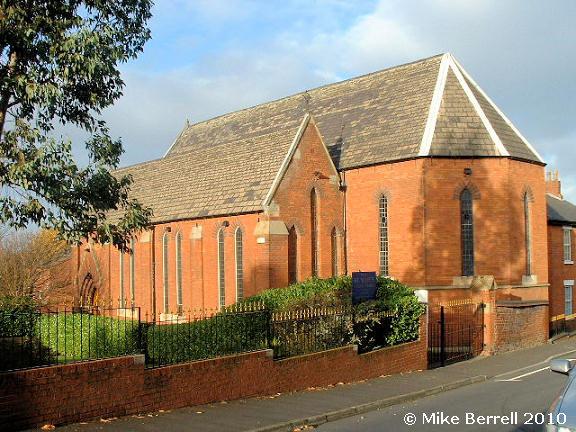
St Mary, Dukinfield, Roman Catholic
hide
Hide
Hide
St Mary,
Zetland Street,
Dukinfield
Hide
It was founded in 1854.
Zetland Street
Church History
The first church was built in 1825 at the corner of Palmer St and Ashley St (Dog Lane), but became unsafe due to coal mine workings underneath. A replacement church was built in Zetland Street in 1872.
Church Records
C = Christenings (Baptisms) ; M = Marriages ; B = Burials ; Conf = Confirmations
| Original Registers | Church (?) |
| Copies and Indexes | M 1981-1999 — Cheshire BMD (TA:AP68) |
It is located at SJ9414498048 (Lat/Lon 53.479123, -2.089712). You can see this on maps provided by:
- OpenStreetMap
- Google Maps
- StreetMap (Current Ordnance Survey maps)
- Bing (was Multimap)
- Old Maps Online
- National Library of Scotland (Old Ordnance Survey maps)
- Vision of Britain (Click "Historical units & statistics" for administrative areas.)
- English Jurisdictions in 1851 (Unfortunately the LDS have removed the facility to enable us to specify a starting location, you will need to search yourself on their map.)
- Magic (Geographic information) (Click + on map if it doesn't show)
- GeoHack (Links to on-line maps and location specific services.)