
Hide
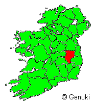
County Kildare
hide
Hide
hide
Hide
"KILDARE, a county of Ireland, province of Leinster, 37 m. long and 20 broad; bounded E by Dublin and Wicklow, W by King's county and Queen's county, N be E. Meath, and S by Catherlough, and containing 593 English acres, divided into 100 parishes. It sends 2 members to parliament. Principal rivers, the Liffey, Barrow, and Boyne. It is a very fertile county. Kildare is the capital, but the asssizes are held alternately at Athy and Naas. Pop 107,715."
[From The New London Gazetteer (1826)]
"COUNTY KILDARE, an inland county in the province of Leinster, Ireland. It lies between 52° 50' and 63° 25' N. lat., and between 6° 27' and 7° 10' W. long. It is 40 miles in length from N. to S., and 27 in breadth from E. to W. Its boundaries are county Meath on the N., counties Dublin and Wicklow on the E., county Carlow on the S., and Queen's County, King's County, and Westmeath on the W. It covers an area of 653 square miles, or 418,436 acres, of which 356,787 are arable lands, 51,854 are not cultivated, 8,288 are in plantation, 1,017 are under water, and 490 are occupied by the sites of towns. The general character of the surface is flat. The principal rising grounds are the Rathcoole hills, which form the western skirts of the Dublin mountains. At the S. end of the Bog of Allen are the Red Hill, Dunmurry Hill, Grange Hill, and the hill of Allen. S. of this point the surface maintains an unbroken level till it reaches the spurs of the Wicklow mountains on the S.E., which divide the southern part of the county into two parts, on the E. declining to the river Liffey, and on the W. to the Barrow. N. of the Dunmurry range a portion of the great Bog of Allen extends over some 36,000 acres....More"
[Description from The National Gazetteer of Great Britain and Ireland (1868) Transcribed by Colin Hinson ©2018]
"KILDARE, a county, of the province of Leinster, bounded on the east by the counties of Dublin and Wicklow, on the north by Meath, on the west by the King's and Queen's counties, and on the south by Carlow. It extends from 52° 51' to 53° 26' (N. Lat.)} and from 6° 30' to 7° 12' (W. Lon.); and comprises an area, according to the Ordnance survey, of 392,435 acres, of which 325,988 are cultivated ground, and 66,447 are unprofitable mountain and bog. The population, in 1821, amounted to 99,065, and in 1831, to 108,424....More"
[Transcription from A Topographical Dictionary of Ireland - Samuel Lewis - 1837 Mel Lockie ©2013]
Hide
Kavanagh's Historical Bibliography of County Kildare - at Kildare County Council Library & Arts Service; Local Studies Dept
Primary Sources of Historical Information (original /reprint) - at Kildare County Council Library & Arts Service; Local Studies Dept
- Griffith’s Valuation, Tithe Applotment Books (copies), Lewis’s Topographical Dictionary, Trade Directories etc.
- Maps – Original 1837 OS Maps (and some later editions), Town Plans, Valuation Maps, Petty 1685 (facsimile), Noble and Keenan 1752 Map of Co. Kildare, Alex. Taylor’s 1783 Map of Co. Kildare etc.
- Red Book of the Earls of Kildare.
- The Civil Survey 1654 – 1656, Vol. VIII Co. Kildare.
- Drogheda Rentals 1875 and Jan. 1879-Jan. 1888 (Monasterevin).
- 1901 and 1911 Census on Microfilm.
- Ordnance Survey Letters for County Kildare.
- Local Folklore collection relating to South Kildare on audio tape and transcribed.
- Shackleton/Leadbeater collection – transcripts of original letters; also poems and books relating to these families and the Quaker village of Ballitore, mostly late 18 th - early 19 th century.
- Teresa Brayton Collection: poems, short stories, letters, photographs and memorabilia relating to Teresa Brayton, author of The Old Bog Road, 1868-1943.
- Verschoyle Papers: Mostly rentals, few loose sheets relating to Verschoyle estate in Co. Dublin and Co. Kildare mostly for the years 1841 – 1877 and 1897.
- Thomas Rawson’s ‘Statistical Survey of the County of Kildare…,’ 1807.
- Comerford’s, Collections of the Dioceses of Kildare and Leighlin,
- Brenan’s, Schools of Kildare and Leighlin, 1775 – 1835.
- 8 th Report of the commission of Irish Education, Maynooth Inquiry, 1827
- Maynooth Commission Report, 1855
- Quaker Relief, 2 vols.
- Correspondence of the Society of Friends Relief of Distress Papers for County Kildare.
- The Famine in Co. Kildare, 5 vols.
- (Vols. I – III, papers of the Relief Commission and the Chief Secretary’s Registered Papers, Convict Reference Files and Outrage Reports.
- Vols. IV – V, articles and adverts from the Leinster Express (1839 – 1849) relating to the famine and the administration of the Poor Law in County Kildare.)
- County Kildare, A Geographical Background for Planning, 1970, 2 vols.
- Bradley, Halpin and King, O.P.W. Urban Archaeological Survey, 1982/83(?)
Kildare Cemetery Records - on IGP
County Kildare Cemetery Records - on interment.net
Kildare Church Records - on IGP
Kildare Roman Catholic records - on Irish Ancestors
County Kildare; Roman Catholic Records, list - on fianna
Kildare Vital Records (BMD) - on IGP
"The Royal canal passes along the N. border of the county, and sometimes enters the county of Meath. The Grand canal crosses the entire county, sending off branches to Naas, Milltown, and Athy, where it joins the Barrow river. This river enters on the W. side of Kildare, and takes a southerly course, passing Monastereven, to the S.W. boundary of the county. The Feagile, Blackwood, Finnery, Griese, and Leer are tributaries to the Barrow. The river Liffey enters Kildare on the eastern border, and first takes a westerly course, and afterwards flows N.N.E. to Leixlip. The Morrel, Rye, and several small rivulets are tributaries to this river within the county. The river Boyne has its source in Kildare, near the western boundary, and passes out into the county of Meath.
"The principal communications of the county, besides the canals already alluded to, are the Great Southern and Western railway, which crosses it; and the roads from Kildare to Newbridge, Naas, Clane, Celbridge, Leixlip, Maynooth, Ballymore Eustace, and Blessington; from Kildare to Kilrush, Athy, Ballytore, Timolin, Castle-Dermot, and on to Carlow."
[Descriptions from The National Gazetteer of Great Britain and Ireland (1868) Transcribed by Colin Hinson ©2018]
Kildare Photos (places) - on IGP
County Kildare - on wikipedia
Directories, list - on fianna
Kildare County Council Library Local Studies Dept holds:
- 1846 Slaters Directory.
- 1848 & 1854 Thom's Trade Directory
- 1881 Claters Trade Directory for County Kildare
"Any genealogical list is an asset to researchers but the information provided in the Thom's Directories also gives us an insight into the workings of 'local government' in the County of Kildare at the end of the Famine period."
The transcription for this county from the National Gazetteer (1868), provided by Colin Hinson.
The transcription for this county from the 1837 Lewis's Topographical Dictionary of Ireland [Mel Lockie ©2013]
The Ireland Genealogy Project's County Kildare page, and its listing of the Project's available Kildare Records.
The Irish Ancestors website (subscription) has the following types of records: State Registration of Births, Marriages & Deaths, Census returns, Land records, Church records, Genealogical Office records, Gravestone inscriptions, Directories, Newspapers, Wills, Deeds, and Occupations.
Irish Ancestors' extensive County Kildare website.
The LDS FamilySearch Wiki's Ireland Online Genealogy Records.
The Fianna website's pages for County Kildare provide important addresses and extensive information about online and other genealogy resources.
Roots Ireland (subscription) "offers access to a unique database of more than 20 million Irish records". Its Kildare coverage includes Baptismal/Birth Records, Marriage Records, Burial/Death Records, Census Records, Gravestone Inscriptions, Griffith's Valuation (Free Access), and Census Substitutes.
"This county is divided into 14 baronies, viz:-Carbury, Clane, Connell, Ikeathy and Oughterany, Kilcullen, Kilkea, Moone, North and South Naas, Narragh, East and West Reban, East and West Offaly, and North and South Salt, which comprise 116 parishes The principal towns are Athy and Naas, where the assizes and sessions are held, Maynooth, Kildare, Kilcock, Monastereven, Timoline, Rathangan, Leixlip, Kilcullen-Bridge, and Newbridge. " [Description from The National Gazetteer of Great Britain and Ireland (1868) Transcribed by Colin Hinson ©2018]
See the county Kildare page on logainm.ie which has links to its civil parish pages
"The Placenames Database of Ireland was created by Fiontar & Scoil na Gaeilge in collaboration with The Placenames Branch (Department of Culture, Heritage and the Gaeltacht). This is a comprehensive management system for data, archival records and placenames research conducted by the State. It is a public resource for Irish people at home and abroad, and for all those who appreciate the rich heritage of Irish placenames."
Kildare civil parishes - on Irish Ancestors
Index of Townlands of County Kildare - at Kildare County Council Library & Arts Service; Local Studies Dept
Oaths of Allegiance 1775 - on IGP
List of United Irishmen of Naas, Etc.; KILDARE - EMMET'S REBELLION; Extracted from 'THE UNITED IRISHMEN - APPENDIX VI' - on IGP
A Brief History of Co. Kildare - on kildare.ie
The 1798 Rebellion in County Kildare - at Kildare County Council Library & Arts Service; Local Studies Dept
The Great Famine in Co. Kildare - at Kildare County Council Library & Arts Service; Local Studies Dept
- "This information has been taken from two volumes containing articles and advertisements from the Leinster Express newspaper from the period 1839 to 1849 relating to the famine and the administration of the poor law in Co. Kildare. The Leinster Express is available on microfilm in the National Library of Ireland, Kildare Street, Dublin. The bound volumes are available throughout the Kildare Co. Library service."
Co. Kildare and The First World War - at Kildare County Council Library & Arts Service; Local Studies Dept
Co. Kildare Online Electronic History Journal - part of Kildare County Council Library & Arts Service
Historic Sites of County Kildare - on kildare ie
- "County Kildare has a rich heritage of monuments and architectural structures stretching across the county. The history of the county can be traced through these monuments which range from the prehistoric to the modern era, and from the humble vernacular streetscapes and farmsteads to the magnificent Palladian mansions such as Castletown House in Celbridge. Kildre.ie has put together some of the highlights of our county's historical sites, some well known, some less well known, in the hope that highlighting these sites furthers the appreciation of the rich and diverse structural heritage produced over the millennia by the people who have lived in what is now County Kildare."
List of Landowners in 1870's - on IGP
Griffiths Valuation 1847/64 on the Ask about Ireland site. Use the search box to bring up entries showing Barony/Parish/Townlands and lists of Occupants
Tithe Applotment Books for county Kildare and its parishes are available online on the National Archives of Ireland website (free).
- The Tithe Applotment Books were compiled between 1823 and 1838 as a survey of land in each civil parish to determine the payment of tithes (a religious tax). Unlike Griffith's Valuation they do not cover cities or towns.
Deputy Keeper - Proclamations (Kildare) 1661-1827 - on IGP
Kildare Military Records (Irish Constabulary with native county of Kildare 1840+) - on IGP
Kildare Headstone Photos - on IGP
Surnames found in Ireland 1100 thru 1600 - on IGP
Newspaprs - on IGP
- 4 Dec 1739, Fugitives for debt - Kildare Session
- Freemans Journal, 7 Nov 1840, Loyal National Repeal Assoc. Celbridge
- Freemans Journal, 21 Jan 1841, Loyal National Repeal Association
Newspapers available on Microfilm in Kildare County Library - Newspapers are available on microfilm and in hardcopy.
"The system of agriculture is rapidly improving, though in many places it is still very imperfectly carried out. Up to the commencement of the present century the exhausting plan was everywhere adhered to. The principal crops raised are oats, wheat, potatoes, turnips, barley, rye, clover, &c. The soil is a rich stiff loam in the more fertile districts, but bog and rock in others. The fences are chiefly constructed of stone and turf. The farms range in size from 15 to 300 acres. The breeds of cattle and sheep are from introductions of the first class."
"The greater part of the inhabitants are agriculturists, but some few are occupied in the paper, cotton, and woollen-mills. The corn trade is very extensive, and numerous mills are in full operation."
[Descriptions from The National Gazetteer of Great Britain and Ireland (1868) Transcribed by Colin Hinson ©2018]
Periodicals available at Kildare County Council Library & Arts Service; Local Studies Dept
From Fianna:
Kildare Archaeological Society Journal (annual), (Index - at Kildare County Council Library & Arts Service; Local Studies Dept)
Mrs. Grehan, Oakfield, Naas
"The population of the county in 1851 was 95,724, and in 1861, 90,946. It returns two members to parliament (ten before the Union), and had a constituency in 1859 of 3,143." [Description from The National Gazetteer of Great Britain and Ireland (1868) Transcribed by Colin Hinson ©2018]
Kildare Wills - on IGP
Voters Register 1835 - 1839 Qualifying Freeholders and Leaseholders - at Kildare County Council Library & Arts Service; Local Studies Dept