
Hide
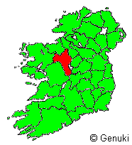
County Roscommon
hide
Hide
hide
Hide
Hide
Hide
"Roscommon, a county of Ireland, province of Connaught, bounded E by Longford and Westmeath, S by Galway, W by Mayo, N by Sligo, and NE by Leitrim, 50 English m. long, and 37 broad. It is a flat open coutry, in some places sprinkled with rocks, in many interrupted by extensive bogs, and but little diversified by hills. The Shannon divides it from Longford and Westmeath, and the Suck from Galway. It has excellent pastures. Pop. 207,777." [From The New London Gazetteer (1826)]
"ROSCOMMON, an inland county of the province of Connaught, Ireland. It lies between 53° 16' to 54° 7' N. lat., and from 7° 50' to 8° 46' W. long. It is bounded on the E. by the river Shannon, on the S. and S.W. by county Galway, on the W. by counties Galway and Mayo, on the N. by Sligo, and on the N.E. by Leitrim. It is 60 miles long, and its greatest breadth is 37 miles, comprising an area of 607,691 acres, of which 440,522 are in cultivation, 132,299 uncultivated, 768 occupied by the sites of towns, villages, and roads, 29,370 under water, and 6,732 in plantations. The general character of the surface is undulating or flat, except towards the N., where it becomes mountainous. The Curlew Mountains in the N.W., the Slievebawn range in the W., the Braulieve or Braughlieve on the Leitrim border, and some hills which skirt Lough Allen in the N., are the principal elevations, some of the summits attaining a height of 1,000 to 1,200 feet above the sea level. The principal rivers are the Suck and Shannon; the former traverses the N. boundary, and the latter drains it on the E. The lakes are numerous, and constitute a leading feature in this part of the island; Loughs Key, Garra, Skean, Meelagh, Aelagh, Erritt, and Glynn are the principal waters.............More" [Description from The National Gazetteer of Great Britain and Ireland (1868) Transcribed by Colin Hinson ©2018]
"ROSCOMMON, a county, of the province of CONNAUGHT, bounded on the north by the county of Leitrim, on the north-west by those of Mayo and Sligo, on the south-west and south by that of Galway, and on the east by the counties of Leitrim, Longford, Westmeath, and King's. It extends from 53° 16' to 54° 7' (N. Lat.), and from 7° 50' to 8° 46' (W. Lon.); comprising an area, according to the Ordnance survey, of 609,405 statute acres, of which 453,555 are cultivated land, 131,063 are uncultivated mountain and bog, and 24,787 are under water. The population, in 1821, was 208,729; and in 1831, 249,613.....More" [Transcription from A Topographical Dictionary of Ireland - Samuel Lewis - 1837 Mel Lockie ©2013]
Hide
Local Studies & Archives- at Roscommon Library
Roscommon Cemetery Records - on IGP
Roscommon Headstone Photos - on IGP
County Roscommon, Ireland Cemetery Records - on interment.net
National Censuses/Substitutes , list - on fianna
1911 Census - Co Roscommon FHLC numbers - on fianna
LEITRIM-ROSCOMMON; 1901 Census Home Page "A searchable data base containing data transcribed from the 1901 census of Ireland for Leitrim, Roscommon, Mayo & Sligo (and other cos.)."
Roscommon Church Records - on IGP
Roscommon Roman Catholic records - on Irish Ancestors
County Roscommon; Roman Catholic Records, dates, FHLC - on fianna
County Roscommon; Church of Ireland Records, dates, status - on fianna
County Roscommon; Roman Catholic Records, dates, locations - on fianna
Roscommon Vital Records - on IGP
County Roscommon - on wikipedia
"This county comprises nine baronies-Athlone, North and South Ballintober, Ballymoe, Boyle, Castlereagh, Frenchpark, Moycarn, and Roscommon, which together include 58 parishes. The population in 1851 was 173,798, and in 1861 100,000. The principal towns are Roscommon, Boyle, and Elphin." [Description from The National Gazetteer of Great Britain and Ireland (1868) Transcribed by Colin Hinson ©2018]
Directories, list - on fianna
County Roscommon Emigrant/Immigration Records - on IGP
The transcription for this county from the National Gazetteer (1868), provided by Colin Hinson.
The transcription for this county from the 1837 Lewis's Topographical Dictionary of Ireland [Mel Lockie ©2013]
The Ireland Genealogy Project's County Roscommon page, and its listing of the Project's available Roscommon Records.
The Irish Ancestors website (subscription) has the following types of records: State Registration of Births, Marriages & Deaths, Census returns, Land records, Church records, Genealogical Office records, Gravestone inscriptions, Directories, Newspapers, Wills, Deeds, and Occupations.
Irish Ancestors' extensive County Roscommon website.
The LDS FamilySearch Wiki's Ireland Online Genealogy Records.
The Fianna website's pages for County Roscommon provide important addresses and extensive information about online and other genealogy resources.
Roots Ireland (subscription) "offers access to a unique database of more than 20 million Irish records". Its Roscommon coverage includes Baptismal/Birth Records, Marriage Records, Burial/Death Records and Griffith's Valuation (Free Access).
The Leitrim-Roscommon Home Page
WorldGenWeb - Roscommon Queries
The Leitrim-Roscommon Surnames List
The Leitrim-Roscommon Townland search engine - an extensive and very useful database
Farrell, Noel. Roscommon Town. (In the "Exploring Family Origins" Series.). Noel Farrell, Park Road, Longford, Ireland (1998).
Roscommon civil parishes - on Irish Ancestors
The ROSCOMMON Transferred Townlands Page
See the county Roscommon page on logainm.ie which has links to its civil parish pages
- "The Placenames Database of Ireland was created by Fiontar & Scoil na Gaeilge in collaboration with The Placenames Branch (Department of Culture, Heritage and the Gaeltacht). This is a comprehensive management system for data, archival records and placenames research conducted by the State. It is a public resource for Irish people at home and abroad, and for all those who appreciate the rich heritage of Irish placenames."
- Searchable database of Griffiths Valuation for Leitrim and Roscommon
- General Valuation - Cancelled Valuations - Electoral Dist. Kilteevan ca 1911-1920's - on IGP
- Roscommon Land Records - on IGP
- Griffiths Valuation 1847/64 on the Ask about Ireland site. Use the search box to bring up entries showing Barony/Parish/Townlands and lists of Occupants
- Tithe Applotment Books for county Roscommon and its parishes are available online on the National Archives of Ireland website (free). The Tithe Applotment Books were compiled between 1823 and 1838 as a survey of land in each civil parish to determine the payment of tithes (a religious tax). Unlike Griffith's Valuation they do not cover cities or towns.
The Leitrim-Roscommon Home Page provides the following maps:
- Locations of catholic parishes
- Locations of civil parishes
- Locations of poor law unions
- Locations of baronies
- Townlands in the Catholic Parish of Ballintubber
- Townlands in the Catholic Parish of Fairymount
- Townlands in the Catholic Parish of Frenchpark
- Townlands in the Catholic Parish of Loughglynn
- Townlands in the Catholic Parish of Tulsk
- Townlands in the Civil Parish of Moore
Roscommon Military & Constabulary (Irish Constabulary with native county of Roscommon 1840+) - on IGP
Surnames found County Roscommon in 1100 thru 1600 - on IGP
"The ancient inhabitants of Roscommon are said to have been the Auterii; subsequently the county was divided among the O'Connors in the midland, the MacDermots in the northern, and the O'Kellies in the southern districts. " [Description from The National Gazetteer of Great Britain and Ireland (1868) Transcribed by Colin Hinson ©2018]
Freeman's Journal Aug/Sept 1840, Repeal Association (names) - on IGP
Newspaper collection - at Roscommon LIbrary
Roscommon Obituaries - on IGP
".....and in the northern part of the county they include a considerable coal field with three beds of coal, and resting on beds of the millstone-grit series, known as the Arigna district. Iron ore is worked here, and extensive smelting and casting operations are carried on, also potters' fire and pipe clays are obtained indifferent parts." [Description from The National Gazetteer of Great Britain and Ireland (1868) Transcribed by Colin Hinson ©2018]
"Agriculture is in a backward state, and the poorer classes of the inhabitants are extremely wretched. There are few dairies, though the pastures are luxuriant. The principal crops are oats, wheat, and potatoes. The breeds of cattle and sheep are good; the former long horned, and the latter long woolled...................... The linen manufacture was at one time extensively diffused over the county, but it is now nearly extinct." [Description from The National Gazetteer of Great Britain and Ireland (1868) Transcribed by Colin Hinson ©2018]
A Population Summary for Kilglass Civil Parish County Roscommon "Terry McCormick has put together a tabulated listing of the population for all the townlands in the Civil Parish of Kilglass in County Roscommon between 1749 and 1881"
Roscommon Wills - on IGP
Schools Folklore collection - at Roscommon Library