
Hide
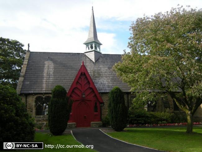
St Mark, Dunham Massey, Church of England
hide
Hide
Hide
St Mark,
School Lane/Back Lane,
Dunham Massey
Hide
It was founded in 1864.
Back Lane/School Lane.
Church History
Built in 1864 as a chapel to Bowdon: St. Mary. In 1873 it became a district church for part of the township of Dunham Massey (previously served by Bowdon: St. Mary). The boundaries of "The Disrtict Chapelry of Saint Mark, Dunham Massey" were described in the London Gazette on 17 January 1873:
"All that part of the parish of Bowdon (comprising a portion of the township of Dunham Massey), in the county of Chester, and in the diocese of Chester, wherein the present Incumbent of such parish now possesses the exclusive cure of souls, which is bounded on the east by the new parish of Saint Margaret, Dunham Massey, in the said county and diocese, on the north by the township and chapelry of Carrington, in the parish of Bowdon aforesaid, on the west by the parish of Warburton, in the county and diocese aforesaid, on the south, partly by the parish of Lymm, in the said county and diocese, partly by the consolidated chapelry of the Holy Trinity, Bollington, in the same county and diocese, and partly by an imaginary line, commencing upon the boundary which divides the said consolidated chapelry of the Holy Trinity, Bollington, from the parish of Bowdon aforesaid along an imaginary line from a point in the middle of the Duke of Bridgewater's Canal; and extending thence, north-eastward, for a distance of a quarter of a mile or thereabouts, along the middle of the said canal, to a point in the middle of the bridge which carries the same canal over the road leading from Woodhouses to Dunham town; and extending thence, south-eastward, for a distance of ten chains or thereabouts, to and along the middle of the said road to a point on the southern side of the same road, in the fence forming the northern boundary of the enclosure called or known as Dunham Old Park, and numbered 749 upon the tithe commutation map of the township of Dunham Massey, in the parish of Bowdon aforesaid, and upon the map hereunto annexed, such point being at or near to the western entrance to the said park; and extending thence, for a distance of nearly one mile, first north-eastward and then south-eastward, along the said park fence (thereby following in part the southern side of the road leading from Woodhouses to Dunham town as aforesaid, and in part the southern side of the road leading from Dunham town aforesaid to Bowdon), to the north-eastern entrance to the same park; and extending thence, northward, and in a direct line across the last-described road to a point on the northern side of the same road, in the fence forming the western and northern boundary of the enclosure called or known as Dunham New Park, and numbered 761 upon the said maps; and extending thence, for a distance of nearly one mile, alternately northward and eastward, along the last-described park fence, to the boundary which divides the said parish of Bowdon from the new parish of Saint Margaret, Dunham Massey aforesaid."
Church Records
C = Christenings (Baptisms) ; M = Marriages ; B = Burials ; BTs = Bishop's Transcripts
| Original Registers | C 1866-1915 ; M 1867-1983 ; B 1921-1953 — Cheshire Archives (P 255) C from 1915 ; M from 1983 ; B from 1953 — Church |
| Microfilm Copies | C 1866-1915 ; M 1867-1971 — Cheshire Archives ; Family History Society of Cheshire |
| Bishop's Transcripts | 1873-93, 1896-1913 (microfilmed) — Cheshire Archives |
| Copies and Indexes | M 1867-1960 — Cheshire BMD (TR:CE11) |
It is located at SJ7399087976 (Lat/Lon 53.387977, -2.392538). You can see this on maps provided by:
- OpenStreetMap
- Google Maps
- StreetMap (Current Ordnance Survey maps)
- Bing (was Multimap)
- Old Maps Online
- National Library of Scotland (Old Ordnance Survey maps)
- Vision of Britain (Click "Historical units & statistics" for administrative areas.)
- English Jurisdictions in 1851 (Unfortunately the LDS have removed the facility to enable us to specify a starting location, you will need to search yourself on their map.)
- Magic (Geographic information) (Click + on map if it doesn't show)
- GeoHack (Links to on-line maps and location specific services.)