
Hide
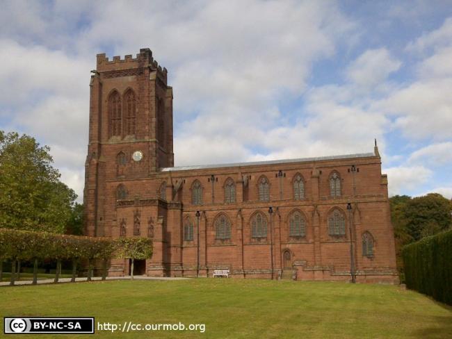
St Mary the Virgin, Eccleston, Church of England
hide
Hide
Hide
St Mary the Virgin,
Church Road,
Eccleston
Hide
It was founded in 1300.
Church History
An ancient parish church, serving the townships of Eaton by Chester and Eccleston.
The district was affected by the following boundary changes:
- 1973 March 8 — amalgamated with the district of Pulford: St. Mary to form the combined district of "Eccleston and Pulford".
Church Records
C = Christenings (Baptisms) ; M = Marriages ; B = Burials ; BTs = Bishop's Transcripts
| Original Registers | C 1593-1892 ; M 1595-1833 ; B 1593-1885 — Cheshire Archives (P 87) C from 1892 ; M from 1837 ; B from 1885 — Church |
| Microfilm Copies | C 1593-1892 ; M 1595-1833 ; B 1593-1885 — Cheshire Archives ; Manchester Archives & Local Studies |
| Bishop's Transcripts | 1599, 1603-04, 1610, 1614, 1617, 1623, 1631-34, 1638-39, 1663, 1666-71, 1675-79, 1681-84, 1704-32, 1734-59, 1761-79, 1782, 1784-89, 1791-96,1798-1805, 1807-1905, 1912 (microfilmed) — Cheshire Archives |
| Copies and Indexes | C 1593-1892 ; M 1593-1833 ; B 1593-1885 (transcript/index by H. Fearnall) — Cheshire Archives M 1595-1837 (incomplete) — Bertram Merrell Marriage Index of Cheshire (1750-1836) M 1837-1958 — Cheshire BMD (CW:CE21) |
| Monumental Inscriptions | Transcript by H. Fearnall, 1970 — Cheshire Archives |
It is located at SJ4124862569 (Lat/Lon 53.156998, -2.880079). You can see this on maps provided by:
- OpenStreetMap
- Google Maps
- StreetMap (Current Ordnance Survey maps)
- Bing (was Multimap)
- Old Maps Online
- National Library of Scotland (Old Ordnance Survey maps)
- Vision of Britain (Click "Historical units & statistics" for administrative areas.)
- English Jurisdictions in 1851 (Unfortunately the LDS have removed the facility to enable us to specify a starting location, you will need to search yourself on their map.)
- Magic (Geographic information) (Click + on map if it doesn't show)
- GeoHack (Links to on-line maps and location specific services.)