
Hide
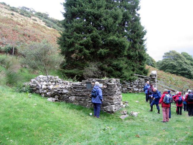
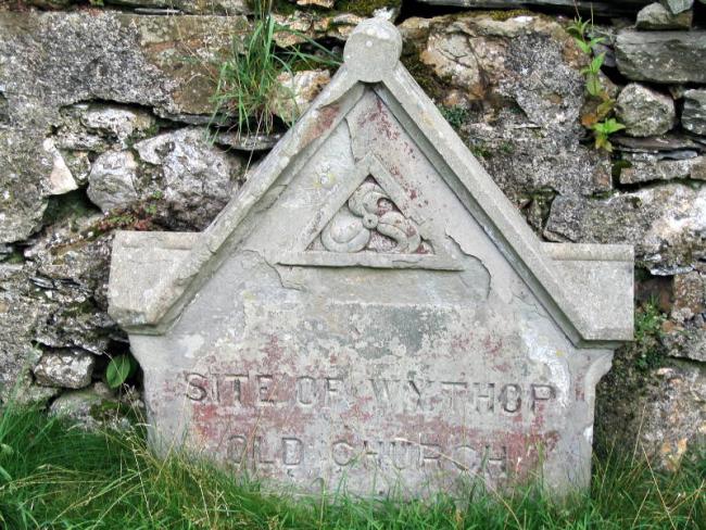
Chapel (ruins), Wythop, Church of England
hide
Hide
© Phil Stringer 2004
© Phil Stringer 2004
Hide
Chapel (ruins),
1.2km SE of St Margaret's, by Kelsick Farm,
Wythop
Hide
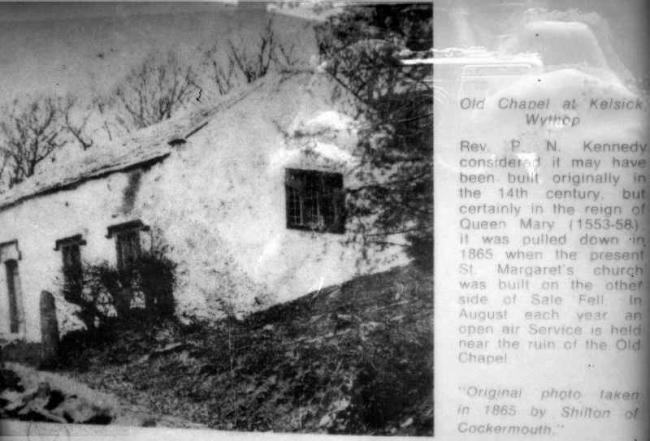
It may have been built originally in the 14th century, but certainly in the reign of Queen Mary (1553-58) . It closed and was pulled down in 1865. In August each year an open air service is held near the ruins of the old chapel.
Faculty for demolition, 1865 when the new St Margaret's was being built. Cumbria Archive Service appears to have no burial register coverage before this. Wythop was formerly in Lorton Parish, and this was a chapel of ease.
Cumbria Archive Service YPR 28. To see the list of items, click the link in the Ref box. To find more detail for an item click the item.
It was located at NY1940929077 (Lat/Lon 54.650329, -3.250522). You can see this on maps provided by:
- OpenStreetMap
- Google Maps
- StreetMap (Current Ordnance Survey maps)
- Bing (was Multimap)
- Old Maps Online
- National Library of Scotland (Old Ordnance Survey maps)
- Vision of Britain (Click "Historical units & statistics" for administrative areas.)
- English Jurisdictions in 1851 (Unfortunately the LDS have removed the facility to enable us to specify a starting location, you will need to search yourself on their map.)
- Magic (Geographic information) (Click + on map if it doesn't show)
- GeoHack (Links to on-line maps and location specific services.)