Hide
Buckland Tout Saints
hide
Hide
hide
- Almanacs◬
- Archives & Libraries◬
- Bibliography◬
- Biography◬
- Business & Commerce Records◬
- Cemeteries◬
- Census
- Chronology◬
- Church History◬
- Church Records
- Churches
- Civil Registration◬
- Correctional Institutions◬
- Court Records◬
- Description & Travel
- Directories
- Emigration & Immigration◬
- Encyclopaedias & Dictionaries◬
- Folklore◬
- Gazetteers
- Genealogy
- Handwriting◬
- Heraldry◬
- Historical Geography◬
Hide
hide
- History
- Jewish History◬
- Land & Property◬
- Language & Languages◬
- Manors◬
- Maps
- Medical Records◬
- Merchant Marine◬
- Military History◬
- Names, Geographical◬
- Names, Personal◬
- Newspapers◬
- Occupations◬
- Periodicals◬
- Politics & Government◬
- Poor Houses, Poor Law◬
- Population◬
- Probate Records◬
- Schools◬
- Social Life & Customs◬
- Societies◬
- Taxation
- Voting Registers◬
Hide
"BUCKLAND-TOUTSAINTS, or Buckland All Saints, is a small parochial chapelry, appended ecclesiastically to Loddiswell parish, though it is in Coleridge Hundred, and maintains its poor and roads as a distinct township. It is about two miles N.E. of Kingsbridge, and contains only 56 inhabitants, and about 500 acres of fertile land, belonging to Wm. John Clark, Esq., of Buckland House, and Edward Torr, Esq., of Bearscombe, or Woodmaston. The first named mansion is a large and handsome building, with tasteful grounds, on an eminence commanding fine views. Mr. Torr, sen., is in his 97th year, and in the enjoyment of all his faculties. The only tenant farmer is Mr. Josias Whyat, of the Quarry Farm. The manor belonged to the Toutsaint family in the reign of Richard I., and afterwards passed to the Hills and Southcotes, the latter of whom, after having been seated here for several generations, sold the manor in 1793 to the late Wm. Clark, Esq., of Plymouth. The Chapel (St. Peter.) was very ancient, but was mostly rebuilt in 1779, by John Henry Southcote, Esq. . . ." [From White's Devonshire Directory (1850)]
A parish in Coleridge Hundred, the Archdeaconry of Totnes and the Diocese of Exeter. Regarded as part of the South Hams area.
Hide
Parish Registers going back to 1815 are held in the Devon Record Office.
The Devon FHS publishes indexes covering (as of June 2004): Baptisms 1813-1839, Marriages 1813-1837, Burials 1813-1988 - for details see their Devon Parish List.
Nothing entered into the IGI (as of Jan 1993).
Buckland Tout Saints Baptism Registers, 1813-1839. Devon Family Historian 92 (Oct 1999).
Deanery of Woodleigh Baptisms 1813-1839, Marriages 1754-1837 and Burials 1813-1988 - CD-ROM, Exeter, Devon FHS (2006). [Index of Aveton Gifford: Baptisms (1813-1839), Marriages (1754-1837), Burials (1813-1837), Bigbury: Baptisms (1813-1839), Marriages (1754-1837, Burials 1813-1837), Buckland-Tout-Saints: Baptisms (1813-1839), Marriages (1818-1822), Burials (1813-1988), Charleton: Baptisms (1813-1839), Marriages (1754-1837), Burials (1780-1812), Chivelstone: Baptisms (1813-1839), Marriages (1754-1837), Burials (1800-1837), Churchstow: Baptisms (1813-1839), Marriages (1754-1837), Burials (1813-1848), Dodbrooke: Baptisms (1813-1839), Marriages (1754-1837), Burials (1813-1837), East Allington: Baptisms (1813-1839), Marriages (1754-1837), Burials (1813-1837), East Portlemouth: Baptisms (1813-1839), Marriages (1754-1837), Burials (1813-1837), Kingsbridge: Baptisms (1813-1839), Marriages (1754-1837), Burials (1813-1837), Kingsbridge Ind.: Burials (1793-1897), Loddiswell: Baptisms (1813-1839), Marriages (1754-1837), Burials (1813-1837), Malborough: Baptisms (1813-1839), Marriages (1754-1837), Burials (1813-1837), Moreleigh: Baptisms (1813-1839), Marriages (1754-1837), Burials (1813-1837), Ringmore: Baptisms (1813-1839), Marriages (1754-1837), Burials (1764-1814), Salcombe: Baptisms (1813-1839), Sherford: Baptisms (1813-1839), Marriages (1754-1837), Burials (1800-1837), Slapton: Baptisms (1813-1839), Marriages (1754-1837), Burials (1813-1837), South Huish: Baptisms (1813-1839), Marriages (1754-1837), Burials (1813-1856), South Milton: Baptisms (1813-1839), Marriages (1754-1837), Burials (1813-1838), South Pool: Baptisms (1813-1839), Marriages (1754-1837), Burials (1813-1838), Stokenham: Baptisms (1813-1839), Marriages (1754-1837), Burials (1813-1837), Stokenham Ind.: Burials (1795-1836), Thurlstone: Baptisms (1813-1839), Marriages (1754-1837), Burials (1813-1838), West Alvington: Baptisms (1813-1839), Marriages (1754-1837), Burials (1813-1837), Woodleigh: Baptisms (1813-1839), Marriages (1754-1837), Burials (1813-1837)]
Section on Buckland Tout Saints from Samuel Lewis: A Topographical Dictionary of England (1831), provided by Mel Lockie.
Transcription of the entry in White's Devonshire Directory (1850) by Terry Partridge.
Transcription provided by Val Henderson of the entry (description and names) in Morris and Co's Commercial Directory and Gazetteer of Devonshire 1870.
The transcription of the section for this parish from the National Gazetteer (1868), provided by Colin Hinson.
- Ask for a calculation of the distance from Buckland Tout Saints to another place.
The South Hams Genealogical Information Resource website offers lookups in their records concerning this parish.
Cove, Patricia. Buckland Tout Saints: a parish history. Buckland Tout Saints: P.Cove (1984) 159p: ill.
Lidstone, Ann. Buckland Tout Saints - the Parish, Its People and Their Homes, Buckland Tout Saints Millenium Committee (2000). [Available from Alan Crook, Country Life, Ledstone, Kingsbridge TQ7 2HQ]
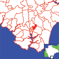
View a map of the boundaries of this town/parish.
You can see maps centred on OS grid reference SX757460 (Lat/Lon: 50.300817, -3.746672), Buckland Tout Saints which are provided by:
- OpenStreetMap
- Google Maps
- StreetMap (Current Ordnance Survey maps)
- Bing (was Multimap)
- Old Maps Online
- National Library of Scotland (Old Ordnance Survey maps)
- Vision of Britain (Click "Historical units & statistics" for administrative areas.)
- English Jurisdictions in 1851 (Unfortunately the LDS have removed the facility to enable us to specify a starting location, you will need to search yourself on their map.)
- Magic (Geographic information) (Click + on map if it doesn't show)
- GeoHack (Links to on-line maps and location specific services.)
- All places within the same township/parish shown on an Openstreetmap map.
- Nearby townships/parishes shown on an Openstreetmap map.
- Nearby places shown on an Openstreetmap map.

