Hide
High Bickington
hide
Hide
hide
- Almanacs◬
- Archives & Libraries◬
- Bibliography◬
- Biography
- Business & Commerce Records◬
- Cemeteries
- Census
- Chronology◬
- Church History
- Church Records
- Churches
- Civil Registration◬
- Correctional Institutions◬
- Court Records◬
- Description & Travel
- Directories
- Emigration & Immigration◬
- Encyclopaedias & Dictionaries◬
- Folklore◬
- Gazetteers
- Genealogy
- Handwriting◬
- Heraldry◬
- Historical Geography◬
Hide
hide
- History
- Jewish History◬
- Land & Property◬
- Language & Languages◬
- Manors◬
- Maps
- Medical Records◬
- Merchant Marine◬
- Military History◬
- Names, Geographical◬
- Names, Personal
- Newspapers◬
- Occupations◬
- Periodicals◬
- Politics & Government◬
- Poor Houses, Poor Law◬
- Population◬
- Probate Records◬
- Schools◬
- Social Life & Customs◬
- Societies◬
- Taxation◬
- Voting Registers◬
Hide
"BICKINGTON, (HIGH) 8 miles E. by N. of Torrington, and N.W. of Chulmleigh, has in its parish 895 souls, and 3993 acres of land, including North and South Hele, Stowford, and other scattered farms. It had formerly a market every Wednesday, which was discontinued about 1725, and it still has a cattle fair on the Monday after May 14th. The parish is in several manors, and belongs to A. Bassett, Esq., Mrs. Pyncombe's Trustees, the Rev. W.P. Stowell, John Bremridge, Esq., the Rev. P. Johnson, and a few smaller owners. The Church is an ancient structure, with a tower and six bells, and the rectory, valued in K.B. at £39. 7s. 7d., and in 1831 at £532, is in the patronage and incumbency of the Rev. W.P. Stowell, who has a pleasant residence and 157A. 3R. 34P. of glebe. The Baptists have a chapel here, and the poor have the interest of £40 left by Joshua Tucker, in 1721. The parish school has £10 a year from Mrs. Pyncombe's Charity." [From White's Devonshire Directory (1850)]
A parish in North Tawton Hundred, the Archdeaconry of Barnstaple, and the Diocese of Exeter.
Hide
MIs for this parish are included in the NDA North Devon index - see under Cemeteries on the main Devon page.
Snetzler, M.F. North Devon Surname Index to the Census. Microfiche: M.F. Snetzler. [Covers 1841, 1861, 1871 and 1881 census records for this parish]
High Bickington - from J. Stabb. Some Old Devon Churches (London: 1908-16).
Bolt, Margaret R. High Bickington Methodist Church 1834-1984: a brief history. [High Bickington]: M.R.Bolt [1984] 20p. [Barnstaple Library - 726.5/HIG 1/BOL]
Parish Registers going back to 1707 are held in the Devon Record Office.
Transcripts of the Parish Registers going back to 1707, and of the Bishops' Transcripts going back to 1597, are held in a special collection in the Westcountry Studies Library.
The Devon FHS publishes indexes covering (as of June 2004): Baptisms 1813-1839, Marriages 1754-1837, Burials 1813-1837 - for details see their Devon Parish List.
Entered into the IGI (as of Jan 1993): Parish Church Christenings 1597-1812 and Marriages 1597-1598, 1610-1644, 1670-1837.
Hingeston-Randolph, F.C. The Rectors of High Bickington in the Deanery of Torrington. (!891) [Westcountry Studies Library]
Deanery of Barnstaple - Baptisms 1813-1839, Marriages 1754-1837 and Burials 1813-1837 - CD-ROM, Exeter, Devon FHS (2005). [Index of Atherington: Baptisms (1813-1839), Marriages (1754-1837), Burials (1800-1837), Barnstaple: Baptisms (1813-1839), Marriages (1754-1837), Burials (1813-1837), Bishops Tawton: Baptisms (1813-1839), Marriages (1754-1837), Burials (1813-1837), Chittlehampton: Baptisms (1813-1839), Marriages (1754-1837), Burials (1813-1837), Filleigh: Baptisms (1813-1839), Marriages (1754-1837), Burials (1813-1837), Fremington: Baptisms (1813-1839), Marriages (1754-1837), Burials (1813-1837), High Bickington: Baptisms (1813-1839), Marriages (1754-1837), Burials (1813-1837), Horwood: Baptisms (1813-1839), Marriages (1654-1837), Burials (1675-1837), Huntshaw: Baptisms (1813-1839), Marriages (1754-1837), Burials (1813-1837), Instow: Baptisms (1813-1839), Marriages (1754-1837), Burials (1813-1837), Landkey: Baptisms (1813-1839), Marriages (1754-1837), Burials (1813-1837), Newton Tracey: Baptisms (1813-1839), Marriages (1570-1837), Burials (1725-1837), Pilton: Baptisms (1813-1839), Marriages (1754-1837), Burials (1813-1837), Swimbridge: Baptisms (1813-1839), Marriages (1754-1837), Burials (1813-1837), Tawstock: Baptisms (1813-1839), Marriages (1754-1837), Burials (1813-1837), Westleigh: Baptisms (1813-1839), Marriages (1754-1837), Burials (1813-1838)
High Bickington - Parish Council website.
Section on High Bickington from Samuel Lewis: A Topographical Dictionary of England (1831), provided by Mel Lockie.
Transcription provided by Val Henderson of the entry (description and names) in Morris and Co's Commercial Directory and Gazetteer of Devonshire 1870.
The transcription of the section for this parish from the National Gazetteer (1868), provided by Colin Hinson.
- Ask for a calculation of the distance from High Bickington to another place.
The Online Parish Clerk for this parish is William Cooke. (Resources: Baptisms 1813-1839, Marriages 1813-1837 and Burials 1813-1837.)
Barnes Peter. The Story of Welcombe, High Bickington, The author, PeterBarnes1958[at]hotmail[dot]com (2017) 28 pp. [Devon FHS - Tree House Library]
Stone, Avril. The Book of High Bickington - A Devon Ridgeway Village, Tiverton, Halsgrove Community History Series (2000) 160 pp., over 300 photographs. [ISBN: 1-84114-061-9] [Index]
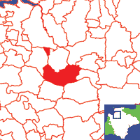
View a map of the boundaries of this town/parish.
You can see maps centred on OS grid reference SS599205 (Lat/Lon: 50.966835, -3.996567), High Bickington which are provided by:
- OpenStreetMap
- Google Maps
- StreetMap (Current Ordnance Survey maps)
- Bing (was Multimap)
- Old Maps Online
- National Library of Scotland (Old Ordnance Survey maps)
- Vision of Britain (Click "Historical units & statistics" for administrative areas.)
- English Jurisdictions in 1851 (Unfortunately the LDS have removed the facility to enable us to specify a starting location, you will need to search yourself on their map.)
- Magic (Geographic information) (Click + on map if it doesn't show)
- GeoHack (Links to on-line maps and location specific services.)
- All places within the same township/parish shown on an Openstreetmap map.
- Nearby townships/parishes shown on an Openstreetmap map.
- Nearby places shown on an Openstreetmap map.
Names from White's 1850 Directory.

