Hide
Loxbeare
hide
Hide
hide
- Almanacs◬
- Archives & Libraries◬
- Bibliography◬
- Biography◬
- Business & Commerce Records◬
- Cemeteries
- Census◬
- Chronology◬
- Church History
- Church Records
- Churches
- Civil Registration◬
- Correctional Institutions◬
- Court Records◬
- Description & Travel
- Directories◬
- Emigration & Immigration◬
- Encyclopaedias & Dictionaries◬
- Folklore◬
- Gazetteers
- Genealogy
- Handwriting◬
- Heraldry◬
- Historical Geography◬
Hide
hide
- History
- Jewish History◬
- Land & Property◬
- Language & Languages◬
- Manors◬
- Maps
- Medical Records◬
- Merchant Marine◬
- Military History◬
- Names, Geographical◬
- Names, Personal◬
- Newspapers◬
- Occupations◬
- Periodicals◬
- Politics & Government◬
- Poor Houses, Poor Law◬
- Population◬
- Probate Records◬
- Schools◬
- Social Life & Customs◬
- Societies◬
- Taxation◬
- Voting Registers◬
Hide
"LOXBEARE is a parish and small scattered village, near the road from Tiverton to South Molton, about 4 miles north-west from Tiverton . . . and 14 from South Molton, in the North Eastern division of the county, Cullompton petty sessional division, Tiverton hundred, union and county court district, rural deanery of West Tiverton and archdeaconry and diocese of Exeter. By Local Government Board Order 16,307, which came into operation March 25, 1885, Calverleigh parish has been annexed to Loxbeare for civil purposes. The church (dedication unknown), which stands 635 feet above the sea level, is a plain but ancient edifice of stone, chiefly in the Decorated style . . . The register of baptisms dates from the year 1570; marriages, 1563; burials, 1560. The living is a rectory, net yearly value £128, with residence and 84 acres of glebe, in the gift of Sir Charles T. Dyke Acland bart. and held since 1892 by the Rev. William Murray Fairbairn B.A. of Trinity College, Cambridge. . . . The manor was purchased in 1600 by D. Cudmore, whose last descendant in the male line (Daniel Cudmore esq.) died in 1703. Sir Charles Thomas Dyke Acland bart. of Killerton, is the present lord of the manor and sole landowner. . . . The chief crops are wheat and barley and some land is in pasture. The area is 1,353 acres; rateable value, £1,536; the population in 1901 was 169 in the civil and 105 in the ecclesiastical parish in 1891." [From: Kelly's Directory of Devonshire, 1902]
A parish in Tiverton Hundred, and the Archdeaconry and Diocese of Exeter.
Hide
Whitmore, J.B. Devonshire Monumental Inscriptions, MS at Society of Genealogists (1951). [Extracts]
Loxbeare - from J. Stabb. Some Old Devon Churches (London: 1908-16).
Parish Registers going back to 1560 are held in the Devon Record Office.
The Devon FHS publishes indexes covering (as of June 2004): Marriages 1754-1837, Burials 1813-1983 - for details see their Devon Parish List.
Nothing entered into the IGI (as of Jan 1993).
An index of baptisms, marriages and burials in the parishes of Bampton, Bickleigh, Burlescombe, Calverleigh, Clayhanger, Culmstock, Halberton, Hockworthy, Holcombe Rogus, Huntsham, Loxbeare, Morebath, Petton Chapelry, Sampford Peverell, Tiverton St. Peter, Tiverton Cove, Uffculme, Uplowman, Washfield and Willand. With photographs of the churches and extracts from White’s Directory (1850) and Kelly’s Directory of Devonshire (1902), CD-ROM 064, Exeter, Devon FHS (2016). [Bampton Bapt: 1813-1838 Mar: 1754-1837 Bur: 1814-1838; Bickleigh Bapt: 1813-1839 Mar: 1755-1836 Bur: 1800-1837; Burlescombe Bapt: 1813-1839 Mar: 1755-1838 Bur: 1813-1837; Calverleigh Bapt: 1813-1840 Mar: 1757-1837 Bur: 1813-1837; Clayhanger Bapt: 1813-1839 Mar: 1754-1833 Bur: 1750-1852; Culmstock Bapt: 1813-1840 Mar: 1754-1837 Bur: 1813-1837; Halberton Bapt: 1813-1840 Mar: 1754-1837 Bur: 1813-1837; Hockworthy Bapt: 1813-1840 Mar: 1759-1837 Bur: 1813-1838; Holcombe Rogus Bapt: 1813-1839 Mar: 1755-1844 Bur: 1813-1837; Huntsham Bapt: 1813-1840 Mar: 1755-1836 Bur: 1750-1838; Loxbeare Bapt: 1813-1841 Mar: 1755-1837 Bur: 1813-1983; Morebath Bapt: 1813-1840 Mar: 1754-1837 Bur: 1800-1837; Petton Chapelry Bampton Parish Bapt: 1813-1839 Bur: 1813-1861; Sampford Peverell Bapt: 1813-1840 Mar: 1754-1837 Bur: 1813-1837; Tiverton St Peter Bapt: 1813-1839 Mar: 1754-1837 Bur: 1813-1837; Tiverton Cove Bapt: 1813-1839 Mar: 1682-1837 Bur: 1815-1837; Uffculme Bapt: 1813-1839 Mar: 1783-1837 Bur: 1813-1837; Uplowman Bapt: 1813-1839 Mar: 1755-1837 Bur: 1813-1837; Washfield Bapt: 1813-1839 Mar: 1755-1837 Bur: 1800-1837; Willand Bapt: 1813-1839 Mar: 1754-1837 Bur: 1800-1837.]
Section on Loxbeare from Samuel Lewis: A Topographical Dictionary of England (1831), provided by Mel Lockie.
The transcription of the section for this parish from the National Gazetteer (1868), provided by Colin Hinson.
- Ask for a calculation of the distance from Loxbeare to another place.
Justice 1830s - the trial of Joanna Arter and her two daughters, by Len Arthur.
Horses and workers lives - Devon diaspora into the industrial age: two generations of the Arthur (Arter) family from Loxbeare Devon - by Len Arthur.
Arthur, Len. Horses’ and Workers’ Lives - From the blog of Len Arthur: Devon diaspora into the industrial age: two generations of the Arthur (Arter) family from Loxbeare Devon, Devon Family Historian, vol. 179 (2021) pp.35.
Sue Davey's Loxbeare pages provide historical information, and parish register extracts.
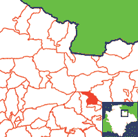
View a map of the boundaries of this town/parish.
You can see maps centred on OS grid reference SS911161 (Lat/Lon: 50.934033, -3.551123), Loxbeare which are provided by:
- OpenStreetMap
- Google Maps
- StreetMap (Current Ordnance Survey maps)
- Bing (was Multimap)
- Old Maps Online
- National Library of Scotland (Old Ordnance Survey maps)
- Vision of Britain (Click "Historical units & statistics" for administrative areas.)
- English Jurisdictions in 1851 (Unfortunately the LDS have removed the facility to enable us to specify a starting location, you will need to search yourself on their map.)
- Magic (Geographic information) (Click + on map if it doesn't show)
- GeoHack (Links to on-line maps and location specific services.)
- All places within the same township/parish shown on an Openstreetmap map.
- Nearby townships/parishes shown on an Openstreetmap map.
- Nearby places shown on an Openstreetmap map.

