Hide
Wembury
hide
Hide
hide
- Almanacs◬
- Archives & Libraries◬
- Bibliography◬
- Biography
- Business & Commerce Records◬
- Cemeteries◬
- Census◬
- Chronology◬
- Church History
- Church Records
- Churches
- Civil Registration◬
- Correctional Institutions◬
- Court Records◬
- Description & Travel
- Directories
- Emigration & Immigration◬
- Encyclopaedias & Dictionaries◬
- Folklore◬
- Gazetteers
- Genealogy
- Handwriting◬
- Heraldry◬
- Historical Geography◬
Hide
hide
- History
- Jewish History◬
- Land & Property◬
- Language & Languages◬
- Manors
- Maps
- Medical Records◬
- Merchant Marine◬
- Military History◬
- Names, Geographical◬
- Names, Personal◬
- Newspapers◬
- Occupations◬
- Periodicals◬
- Politics & Government◬
- Poor Houses, Poor Law◬
- Population◬
- Probate Records◬
- Schools◬
- Social Life & Customs◬
- Societies
- Taxation
- Voting Registers◬
Hide
"WEMBURY, a scattered village near the sea cliffs between Plymouth Sound and the mouth of the Yealm, 6 miles S.E. by S. of Plymouth, has in its parish 646 souls and 3670 acres of land, including the hamlets of Knighton and Down Thomas. . . . E.R.P. Bastard, Esq., is now lord of the manor and of the royalty of the river Plym, from Kitley to Plymouth Sound. C.B. Calmady, Esq., is lord of the manor of Langdon, and resides at Langdon Hall a neat Elizabethan mansion, which has been the seat of his family for several generations. T. Lockyer and several smaller owners have estates here, and Sir Edward Thornton, G.C.B., has a handsome seat in the parish. The Church (St. Werburg,) stands near the sea cliff, and is a small antique structure, with a tower and three bells. . . . The perpetual curacy, valued in 1831 at only £83, is in the patronage of the Dean and Canons of Windsor, and incumbency of the Rev. Rd. Lane, jun., of Brixton. The Wesleyans have a small chapel here, built in 1820.. . . ." [From White's Devonshire Directory (1850)]
A parish in Plympton Hundred, the Archdeaconry of Totnes, and the Diocese of Exeter. Regarded as part of the South Hams area.
Hide
Pengelly, W. Sir John Heale, Serjeant-at-Law. In: Devonshire gleanings from Manningham’s Diary. Transactions of the Devonshire Association, 1875, Vol VII, pp. 383-384. [Transcript]
St Werburgh's Church, Wembury, by Graham Naylor.
Ministers and Incumbents (1611-1967), provided by Michael Steer.
Section on Wembury from Samuel Lewis: A Topographical Dictionary of England (1831), provided by Mel Lockie.
Transcription of the entry in White's Devonshire Directory (1850) by Terry Partridge.
Transcription provided by Val Henderson of the entry (description and names) in Morris and Co's Commercial Directory and Gazetteer of Devonshire 1870.
The transcription of the section for this parish from the National Gazetteer (1868), provided by Colin Hinson.
- Ask for a calculation of the distance from Wembury to another place.
The Online Parish Clerk scheme's representative for this parish is Robert Rowland, who invites queries and lookup requests.
This parish is one of the growing number of places for which the Devon Heritage website provides census or parish register transcriptions, articles, and/or illustrations, etc.
Lang, Chris. Emma's Tale, Devon Family Historian, vol. 158, (2016) pp.14-16. [Emma Cobbledick (b. 1807)]
Avery, Wynsum G.D. The Averys of Wembury, (1997). [Devon FHS Library 929.2/AVE]
Rowland, Robert. The Rede family of Wembury, Devon Family Historian 1, 1977, pp. 18-20.
Willing, June A. Who Was Nathaniel Willing: Traditional research versus DNA testing, Devon Family Historian, vol. 160, (2016) pp.27-31. [Believed b. Wembury 1782-83.]
Sue Davey's Wembury pages provide historical information, and parish register extracts.
Broughton, P.W. The Wembury docks and railway proposal of 1909. Wembury Local History Society (1995) [iii], 16 leaves: ill, maps. [Westcountry Studies - px387.15/WEM/BRO]
Clamp, Arthur L. Recollections of Wembury. Plymouth: The Author (1995) 32p: chiefly ill. [Westcountry Studies - pxB/WEM 3/1900/CLA]
Evans, H. Montague. Wembury: its bay, church and parish - parts 1 and 2. Trans. Devon Assoc. 41-42 (1909-10). [Index]
Guthrig, Sylvia. Wembury: a scrapbook of cuttings and leaflets, 1959-1988. Manuscript (1988) [Plymouth Library - 965WE]
Guyver, Robert M. Wembury project. Wembury: R.M.Guyver (1985) 1vol: ill. [Westcountry Studies - sxB/WEM 3/0001/GUY]
Guyver, Robert M. Wembury parish, 1840-1841: historical information (1987) 23p. [ISBN 074680024x]
Rowland, Robert. The Parish of Wembury. Devon Family Historian 22 (April 1982) pp. 5- 6.
Discovering Wembury - a guide to Parish History, Environment and Footpaths. (7th ed.) Wembury Parish Council (2000) 42p.
Rundle, C.A. A Closer Look at Manorial Records. Genealogical Quarterly 31 (1964) pp.10-12. [Wembury rental, 1745]
Manorial Records and Tithe Maps. Genealogical Quarterly 30, 4 (1964) pp.156-157. [Raymond: Includes summary of tithe appportionment, 1838, for Wembury.]
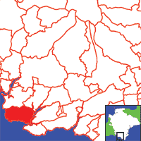
View a map of the boundaries of this town/parish.
You can see maps centred on OS grid reference SX518485 (Lat/Lon: 50.31776, -4.083022), Wembury which are provided by:
- OpenStreetMap
- Google Maps
- StreetMap (Current Ordnance Survey maps)
- Bing (was Multimap)
- Old Maps Online
- National Library of Scotland (Old Ordnance Survey maps)
- Vision of Britain (Click "Historical units & statistics" for administrative areas.)
- English Jurisdictions in 1851 (Unfortunately the LDS have removed the facility to enable us to specify a starting location, you will need to search yourself on their map.)
- Magic (Geographic information) (Click + on map if it doesn't show)
- GeoHack (Links to on-line maps and location specific services.)
- All places within the same township/parish shown on an Openstreetmap map.
- Nearby townships/parishes shown on an Openstreetmap map.
- Nearby places shown on an Openstreetmap map.
The Wembury Local History Societywebsite "provides useful information about Wembury Local History Society, including details of forthcoming meetings and talks, information about the history of Wembury and a host of interesting photographs and publications relevant to the Wembury area".

