Hide
Yarcombe
hide
Hide
hide
- Almanacs◬
- Archives & Libraries◬
- Bibliography◬
- Biography◬
- Business & Commerce Records◬
- Cemeteries
- Census◬
- Chronology◬
- Church History◬
- Church Records
- Churches
- Civil Registration◬
- Correctional Institutions◬
- Court Records◬
- Description & Travel
- Directories◬
- Emigration & Immigration◬
- Encyclopaedias & Dictionaries◬
- Folklore◬
- Gazetteers
- Genealogy◬
- Handwriting◬
- Heraldry◬
- Historical Geography◬
Hide
hide
- History
- Jewish History◬
- Land & Property◬
- Language & Languages◬
- Manors◬
- Maps
- Medical Records◬
- Merchant Marine◬
- Military History◬
- Names, Geographical◬
- Names, Personal
- Newspapers◬
- Occupations◬
- Periodicals◬
- Politics & Government◬
- Poor Houses, Poor Law◬
- Population◬
- Probate Records
- Schools◬
- Social Life & Customs◬
- Societies◬
- Taxation◬
- Voting Registers◬
Hide
"YARCOMBE, or Yartcombe, a village and parish, in Chard Union, on the bold western acclivities of the small river Yarty, near the junction of Devon, Dorset, and Somersetshire, 5 miles W. of Chard, and 8 miles N.E. by N. of Honiton has 826 souls, and 5400 acres of land, rising in lofty hills and comprising many scattered houses. . . The manor was held by Otterton Priory, and after the dissolution a moiety of it was granted to Robert Earl of Leicester, who sold it to Robt. Drake, Esq. of Ash, who conveyed it to Sir Francis Drake, the celebrated circumnavigator, who was possessed of the other moiety by grant from the Crown. The CHURCH (St. John,) is a fine Gothic structure, with an embattled tower and five bells. The interior is neatly fitted up, and has a beautifully carved pulpit." [From White's History, Gazetteer and Directory of Devon (1850)]
In Axminster Hundred and the Archdeaconry of Exeter.
Hide
MIs for this parish are included in the Incledon index - see under Cemeteries on the main Devon page.
Parish Registers going back to 1539 are held in the Devon Record Office.
There are copies of the registers (christenings 1545-1837, marriages 1539-1837, and burials 1539-1837) at the Devon and Cornwall Record Society Library.
The Devon FHS publishes indexes covering (as of June 2004): Marriages 1754-1837, Burials 1813-1837 - for details see their Devon Parish List.
Entered into the IGI (as of Jan 1993): christenings 1545-1837, and marriages 1539-1837.
The Parish Chest of St John the Baptist, Yarcombe. [SOG Library: DE Tracts Box]
The Deanery of Dunkeswell, CD012, Devon Family History Society, Exeter (2007). [Contains indexes: Awliscombe - Baptisms 1813-1839, Marriages 1754-1837, Burials 1813-1837; Churchstanton - Baptisms 1813-1837, Marriages 1754-1837, Burials 1813-1839; Clayhidon - Baptisms 1813-1839, Marriages 1754-1837, Burials 1813-1837; Combe Raleigh - Baptisms 1813-1839, Marriages 1754-1837, Burials 1813-1837; Dunkeswell - Baptisms 1813-1839, Marriages 1754-1837, Burials 1800-1837; Hemyock - Baptisms 1813-1839, Marriages 1635-1837, Burials 1813-1837; Luppitt - Baptisms 1813-1839, Marriages 1754-1838, Burials 1813-1837; Sheldon - Baptisms 1813-1839, Marriages 1755-1836, Burials 1770-1837; Upottery - Baptisms 1813-1839, Marriages 1754-1837, Burials 1813-1837; Yarcombe - Baptisms 1813-1839, Marriages 1754-1837, Burials 1813-1837.]
Section on Yarcombe from Samuel Lewis: A Topographical Dictionary of England (1831), provided by Mel Lockie.
Yarcombe and Marsh Village Design Statement and Parish Plan, from East Devon District Council.
Yarcombe.net - information and news.
The transcription of the section for this parish from the National Gazetteer (1868), provided by Colin Hinson.
- Ask for a calculation of the distance from Yarcombe to another place.
Davidson, J.B. Datton Mill and Donitone. Trans. Devon Assoc. 12 (1880) pp. 464-475. [Index]
Everitt, Ruth. From Monks to the Millennium...A History of Yarcombe, The Author, Heaven's Mouth, Beacon, Yarcombe, Honiton Devon EX14 9LU (1999) 134p. [Index]
Orchard, F.T.A. The Yarcombe story. [1973] 39p: ill. [Westcountry Studies Library - B/YAR 3/0001/ORC]
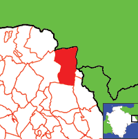
View a map of the boundaries of this town/parish.
You can see maps centred on OS grid reference ST246082 (Lat/Lon: 50.868366, -3.072861), Yarcombe which are provided by:
- OpenStreetMap
- Google Maps
- StreetMap (Current Ordnance Survey maps)
- Bing (was Multimap)
- Old Maps Online
- National Library of Scotland (Old Ordnance Survey maps)
- Vision of Britain (Click "Historical units & statistics" for administrative areas.)
- English Jurisdictions in 1851 (Unfortunately the LDS have removed the facility to enable us to specify a starting location, you will need to search yourself on their map.)
- Magic (Geographic information) (Click + on map if it doesn't show)
- GeoHack (Links to on-line maps and location specific services.)
- All places within the same township/parish shown on an Openstreetmap map.
- Nearby townships/parishes shown on an Openstreetmap map.
- Nearby places shown on an Openstreetmap map.
Yarcombe contributors to a 1678 brief for the rebuilding of St Paul's Cathedral.
Transcript of the will of William Newbery 1596 by Kathleen Noye.

