
Hide
Astley
hide
Hide
hide
Hide
hide
Hide
Hide
ASTLEY, orEast Leigh, a township-chapelry in Leigh parish, Lancashire; near the Bridgewater canal and the Manchester and Liverpool railway, 8½ miles W of Manchester. It has a station on the railway, and a post office under Manchester. Acres, 2,628. Real property, £11,967,-of which £5,000 are in mines. Pop., 2,109. Houses, 437. There are collieries and a large cotton mill. The living is a vicarage in the diocese of Manchester. Value, £250.* Patron, the Vicar of Leigh. The church is modern, and has been thrice enlarged There are a Wesleyan chapel, a free grammar school, a national school, and some small charities.
John Marius Wilson, Imperial Gazetteer of England and Wales (1870-72)
Hide
Local studies information is held at Wigan library.
Details about the census records, and indexes for Astley.
| Astley, Presbyterian |
| Manchester Rd, Astley, Unitarian |
| Astley, St Ambrose Barlow, Roman Catholic |
The Register Office covering the Astley area is Wigan & Leigh.
The National Gazetteer of Great Britain and Ireland - 1868
"ASTLEY, (or East Leigh), a chapelry in the parish of Leigh, hundred of West Derby, in the county palatine of Lancaster, 3 miles to the E. of Leigh. It is a station on the North Western railway; and the Leigh branch of the Bridgwater canal, which joins the Leeds and Liverpool canal at Wigan, passes near the village. The living is a perpetual curacy in the diocese of Manchester, of the value of £250, in the patronage of the Vicar of Leigh. The church is dedicated to St. Stephen, and occupies the site of a more ancient one. There is an endowment founded by Adam Mort in 1630, for the instruction of children in this and other townships. There is also a free school, with an endowment of £26 a year, and several other charities, amounting altogether to £150. Many of the inhabitants are employed in the fustian manufacture. In 1849, a highly interesting and successful experiment was made here of extinguishing a fire in one of the mines, by Mr. Gurney's method of forcing a current of artificial "choke-damp " through the mine.
- Ask for a calculation of the distance from Astley to another place.
In 1835 Astley was a township in the parish of Leigh.
View maps of Astley and places within its boundaries.
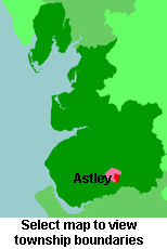
View a map of the boundaries of this town/parish.
You can see maps centred on OS grid reference SJ698988 (Lat/Lon: 53.485064, -2.457295), Astley which are provided by:
- OpenStreetMap
- Google Maps
- StreetMap (Current Ordnance Survey maps)
- Bing (was Multimap)
- Old Maps Online
- National Library of Scotland (Old Ordnance Survey maps)
- Vision of Britain (Click "Historical units & statistics" for administrative areas.)
- English Jurisdictions in 1851 (Unfortunately the LDS have removed the facility to enable us to specify a starting location, you will need to search yourself on their map.)
- Magic (Geographic information) (Click + on map if it doesn't show)
- GeoHack (Links to on-line maps and location specific services.)
- All places within the same township/parish shown on an Openstreetmap map.
- Nearby townships/parishes shown on an Openstreetmap map.
- Nearby places shown on an Openstreetmap map.
For probate purposes prior to 1858, Astley was in the Archdeaconry of Chester, in the Diocese of Chester. The original Lancashire wills for the Archdeaconry of Chester are held at the Lancashire Record Office.
You can also see Family History Societies covering the nearby area, plotted on a map. This facility is being developed, and is awaiting societies to enter information about the places they cover.