Hide
Burnley
hide
Hide
hide
Hide
hide
Hide
Hide
"BURNLEY, a town, a township, four chapelries, a sub-d., and a district in Lancashire. The town stands on the river Burn, immediately above its influx to the West Calder, 22 miles N of Manchester. The Leeds and Liverpool canal is adjacent; and railways go in three directions, toward Skipton, Todmorden, and Blackburn. The town itself is almost wholly modern; has undergone vast increase since the latter part of last century; and owes its character to the rise and enterprize of manufactures. It is built chiefly of freestone; and presents a fair appearance. The town has a head post office, two railway stations, a telegraph office, a banking office, four chief inns, a mechanics' institute, and a public reading room; is a seat of petty sessions and county courts, and a polling-place; and publishes two weekly newspapers. A weekly market is held on Monday; and fairs on 6 March, Easter-Eve, 10 July, and 11 Oct. Woollens were the first great manufacture; but cottons are now the staple. There are three worsted mills, and about thirty cotton mills. There are also calico printing-works, corn mills, iron foundries, brass foundries, machinery-works, rope-walks, tan-works, and breweries. Much trade is carried on likewise from neighbouring collieries and freestone quarries. The town was enfranchised by the reform act of 1867, and sends one member to parliament. Pop. in 1851, 20,828; in 1861, 28,700. Houses, 5,085. The township is of less extent than the town, which extends into the township of Habergham-Eaves. Acres, 1,839. Real property, £71,779; of which £10,136 are in mines. Pop., 19,971. Houses, 3,515."
John Marius Wilson, Imperial Gazetteer of England and Wales (1870-72)
Hide
Burnley Central Library,
Grimshaw Street,
BURNLEY
BB11 2BD
| Ebenezer Baptist, Burnley |
| Bethesda Independent, Burnley |
Details about the census records, and indexes for Burnley.
The Register Office covering the Burnley area is Burnley and Pendle.
"TOWNELEY, a hamlet in the parish of Whalley, county Lancaster, 1 mile S.E. of Burnley. It is a station on the Rose Grove and Todmorden branch of the Lancashire and Yorkshire railway. Towneley Hall, the seat of the Towneleys, is the principal residence."
"ROSE GROVE, in the parish of Whalley, it is a station on the Lancashire and Yorkshire railway, where the Burnley and Todmorden branch turns off, 1½ mile from Burnley."
- Ask for a calculation of the distance from Burnley to another place.
In 1835 Burnley was a chapelry and township in the parish of Whalley.

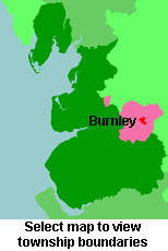
View maps of Burnley and places within its boundaries.
View a map of the boundaries of this town/parish.
You can see maps centred on OS grid reference SD849335 (Lat/Lon: 53.797442, -2.230498), Burnley which are provided by:
- OpenStreetMap
- Google Maps
- StreetMap (Current Ordnance Survey maps)
- Bing (was Multimap)
- Old Maps Online
- National Library of Scotland (Old Ordnance Survey maps)
- Vision of Britain (Click "Historical units & statistics" for administrative areas.)
- English Jurisdictions in 1851 (Unfortunately the LDS have removed the facility to enable us to specify a starting location, you will need to search yourself on their map.)
- Magic (Geographic information) (Click + on map if it doesn't show)
- GeoHack (Links to on-line maps and location specific services.)
- All places within the same township/parish shown on an Openstreetmap map.
- Nearby townships/parishes shown on an Openstreetmap map.
- Nearby places shown on an Openstreetmap map.
The Workhouse site has an interesting description of Burnley workhouse.
For probate purposes prior to 1858, Burnley was in the Archdeaconry of Chester, in the Diocese of Chester. The original Lancashire wills for the Archdeaconry of Chester are held at the Lancashire Record Office.
- Lancashire Family History & Heraldry Society - Pendle & Burnley Branch
- Lancashire Parish Register Society
You can also see Family History Societies covering the nearby area, plotted on a map. This facility is being developed, and is awaiting societies to enter information about the places they cover.
