
Hide
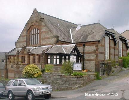
Emmanuel Congregational, Carnforth
hide
Hide
Hide
Hide
It was founded in 1880.
In 1972 many Congregational churches joined with the English Presbyterian church to become the United Reformed Church, but this one of the ones that didn't take that path.
This site provides historical information about churches, other places of worship and cemeteries. It has no connection with the churches themselves. For current information you should contact them directly.
It is located at SD5002070646 (Lat/Lon 54.129222, -2.766327). You can see this on maps provided by:
- OpenStreetMap
- Google Maps
- StreetMap (Current Ordnance Survey maps)
- Bing (was Multimap)
- Old Maps Online
- National Library of Scotland (Old Ordnance Survey maps)
- Vision of Britain (Click "Historical units & statistics" for administrative areas.)
- English Jurisdictions in 1851 (Unfortunately the LDS have removed the facility to enable us to specify a starting location, you will need to search yourself on their map.)
- Magic (Geographic information) (Click + on map if it doesn't show)
- GeoHack (Links to on-line maps and location specific services.)