Hide
St James (originally St Thomas), Gorton, Church of England
hide
Hide
Hide
St James,
Church Lane/Cambert Lane,
Gorton
Hide
The church has/had a graveyard. The Monumental Inscriptions in the graveyard were recorded in the Owen Manuscripts (copies held at Lancashire Record Office).
There are copies of the Monumental Inscriptions for 1704-1964 at Manchester Archives and Local Studies.
1601-1741
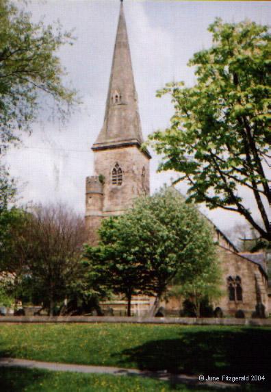
The original place of worship for Gortonians was a wattle and daub, thatched building erected sometime towards the end of the 15th century (no exact date recorded), which was dedicated to St.James. This lasted until 1753, when it was in such a poor state of repair that it was resolved to build a new brick church, which took 2 years to construct and was opened on St.Thomas's day 1755. This one was dedicated to St.Thomas. By 1868, this too was in a poor state and the present church was built with money supplied by the local industrialist and philanthropist, Charles Beyer. This present church of St.James - it reverted to its original patron - was opened in 1871 and is the 2nd church to stand close to the site of the original.
Whilst every effort has been made to record exact details of record office and library holdings you are recommended to check with them before visiting to ensure that they do hold the records and years you wish to examine. Similarly check with transcript publishers to ensure they cover the records and years you require before making a purchase.
Manchester Archives and Local Studies, Manchester Central Library, hold:
- Baptisms 1600-1974
- Marriages 1601-1981
- Burials 1651-1970
Baptisms
1599-1717
1599-1741
Transcript of baptisms 1599-1741 by the Lancashire Parish Register Society - Volume 047
1678-1684
1721-1846
1740-1876
Marriages
1599-1717
1601-1741
1601-1741
Transcript of marriages 1601-1741 by the Lancashire Parish Register Society - Volume 047
1678-1684
1721-1753
1838-1901
Burials
1599-1717
1675-1741
Transcript of burials 1675-1741 by the Lancashire Parish Register Society - Volume 047
1678-1684
1721-1846
1782-1894
- OpenStreetMap
- Google Maps
- StreetMap (Current Ordnance Survey maps)
- Bing (was Multimap)
- Old Maps Online
- National Library of Scotland (Old Ordnance Survey maps)
- Vision of Britain (Click "Historical units & statistics" for administrative areas.)
- English Jurisdictions in 1851 (Unfortunately the LDS have removed the facility to enable us to specify a starting location, you will need to search yourself on their map.)
- Magic (Geographic information) (Click + on map if it doesn't show)
- GeoHack (Links to on-line maps and location specific services.)

