
Hide
Little Hulton
hide
Hide
hide
Hide
hide
Hide
Hide
HULTON (LITTLE), a village and a township chapelry in Deane parish, Lancashire. The village stands 2¼ miles WSW of Halshaw-Moor and Farnworth r. station, and 3½ S of Bolton; is a considerable place, inhabited chiefly by weavers and colliers; and has a post office under Bolton. The chapelry is sometimes called Peel. Acres, 1,470. Real property, £18,005; of which £11,084 are in mines, and £86 in quarries. Pop. in 1851, 3,184; in 1861, 3,390. Houses, 670. Peel Hall belongs to Harrison Blair, Esq.; and Kenyon Peel Hall, to Lord Kenyon. Coal is largely worked. The living is a p. curacy in the diocese of Manchester. Value, £150. Patron, Lord Kenyon. The church is a plain building, with a bell turret. There are a school room used for worship, chapels for Wesleyans and Primitive Methodists, and a national school.
John Marius Wilson, Imperial Gazetteer of England and Wales (1870-72)
Hide
| St Paul Church of England, Peel |
| Manchester Rd East, Walkden, Wesleyan Methodist |
| Providence, Little Hulton, Calvanistic Methodist |
| Wharton Lane Presbyterian, Little Hulton |
Details about the census records, and indexes for Little Hulton.
| Wharton United Reformed, Little Hulton |
| Wharton Lane Presbyterian, Little Hulton |
The Register Office covering the Little Hulton area is Salford.
The National Gazetteer of Great Britain and Ireland - 1868
"LITTLE HULTON, (or Peel), a chapelry in the parish of Deane, hundred of Salford, county Lancaster, 4 miles S. of Bolton. The village, which is considerable, is chiefly inhabited by weavers and colliers. The living is a perpetual curacy in the diocese of Manchester, value £170. The church, which was consecrated in 1760, is dedicated to St. Paul.
- Ask for a calculation of the distance from Little Hulton to another place.
In 1835 Little Hulton was a township in the parish of Deane.
View maps of Little Hulton and places within its boundaries.
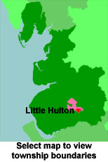
View a map of the boundaries of this town/parish.
You can see maps centred on OS grid reference SD731033 (Lat/Lon: 53.526113, -2.407572), Little Hulton which are provided by:
- OpenStreetMap
- Google Maps
- StreetMap (Current Ordnance Survey maps)
- Bing (was Multimap)
- Old Maps Online
- National Library of Scotland (Old Ordnance Survey maps)
- Vision of Britain (Click "Historical units & statistics" for administrative areas.)
- English Jurisdictions in 1851 (Unfortunately the LDS have removed the facility to enable us to specify a starting location, you will need to search yourself on their map.)
- Magic (Geographic information) (Click + on map if it doesn't show)
- GeoHack (Links to on-line maps and location specific services.)
- All places within the same township/parish shown on an Openstreetmap map.
- Nearby townships/parishes shown on an Openstreetmap map.
- Nearby places shown on an Openstreetmap map.
For probate purposes prior to 1858, Little Hulton was in the Archdeaconry of Chester, in the Diocese of Chester. The original Lancashire wills for the Archdeaconry of Chester are held at the Lancashire Record Office.
You can also see Family History Societies covering the nearby area, plotted on a map. This facility is being developed, and is awaiting societies to enter information about the places they cover.