Hide
Pilkington
hide
Hide
hide
Hide
hide
Hide
Hide
PILKINGTON, a township in Prestwich parish, and a sub-district in Bury district, Lancashire. The town-ship lies adjacent to the river Irwell and the East Lancashire railway, 5¼ miles N N W of Manchester; is cut into the three sections of Outwood, Unsworth, and Whitefieldor Stand; contains the hamlets of Ringley, Cinderhill, Blackford, and Hollins; is supplied with water from the Bury waterworks, and with gas from the Radcliffe and Pilkington gas-works; has a post-office of Whitefield, under Manchester; carries on industry in coal mines, several large cotton factories, bleach-works, and dye-works; and contains the churches of Ringley, Unsworth, and Stand, seven dis-senting chapels, two endowed grammar schools, and two national schools. Acres, 5,378. Real property, £41,765; of which £2,837 are in mines, and £28 in iron-works. Pop. in 1851, 12,863; in 1861, 12,303. Houses, 2,506. The manor belongs to the Earl of Derby. Outwood Park and Outwood Lodge are chief residences. The sub-district is nearly identical with the township, differing only in excluding two small uninhabited portions.
John Marius Wilson, Imperial Gazetteer of England and Wales (1870-72)
Hide
Details about the census records, and indexes for Pilkington.
| All Saints, Stand, Church of England |
| Emmanuel Mission, Ringley, Church of England |
| St Andrew, Whitefield, Church of England |
| St Saviour, Ringley, Church of England |
| Bury New Road Congregational, Besses o' th' Barn |
| Higher Lane, Whitefield, Jewish Cemetery |
| United Synagogue Burial Ground, Whitefield, Jewish Cemetery |
| Hillock Hebrew Congregation Jewish, Whitefield |
| Sha'arei Shalom Reform Synagogue, Whitefield |
| Whitefield Hebrew Congregation Jewish, Whitefield |
| Elms St Methodist, Whitefield |
| Half Acre, Besses o' th' Barn, Wesleyan Methodist |
| Stonepale, Besses o' th' Barn, Wesleyan Methodist |
| Ringley Rd, Stand, Unitarian |
The Register Office covering the Pilkington area is Bury.
The National Gazetteer of Great Britain and Ireland - 1868
"RINGLEY, a chapelry in the parish of Prestwich, hundred of Salford, county Lancaster, 7 miles N.W. of Manchester, on the East Lancashire railway. The living is a perpetual curacy in the diocese of Manchester, value £250, in the patronage of the Rectors of Prestwich, Bury, and Middleton. The church is dedicated to the Holy Trinity. There is a school founded by Nathan Walworth in 1640, with an endowment of about £60 per annum."
"STAND, (or Whitefield), a chapelry in the township of Pilkington, and parish of Prestwich, county Lancaster, 5½ miles N. of Manchester, its post town, and 1½ mile S.E. of Radcliffe railway station. The village is situated on the Bury and Manchester turnpike road. The soil is of a sandy character, with a subsoil of sand and gravel. It contains numerous villa residences. The living is a rectory in the diocese of Manchester, value £270. The church, dedicated to All Saints, has a lofty tower, with a clock and eight bells. There is a stained E. window. The church was erected in 1826, at a cost of £15,000. There is also a New Jerusalem church, with a day and Sunday school adjoining. There are National and Sunday schools. The Independents, Wesleyans, and Unitarians have chapels. The Dales, Park Hill, Stand House, and Stand Hall are the principal residences.
"PILKINGTON, a township in the parish of Prestwich, hundred of Salford, county Lancaster, 5 miles N.W. of Manchester, and 4 S.W. of Bury. It is a populous district, containing the hamlets of Unsworth, Stand, Outwood, and Whitefield, and the poorhouse for the Salford union. A large portion of the inhabitants are employed in the silk and cotton mills. A free grammar school was founded in 1688 by Henry Siddall, which has an income from land of £50. There are two other endowed schools."
"OUTWOOD, a hamlet in the township of Pilkington, parish of Prestwich, county Lancaster, 5 miles N.W. of Manchester. There is a colliery, which employs part of the inhabitants, and others are engaged in the neighbouring cotton-mills."
John Marius Wilson, Imperial Gazetteer of England and Wales - 1870-2
RINGLEY, a chapelry in Prestwich parish, Lancashire; on the river Irwell, and on the Manchester and Bury and Manchester and Bolton railway s, 6¼ miles N W of Manchester. It has a station, of the name of Ringley-Road, on the M. and Bury railway; and its post town is Bolton. Pop., 800. The living is a p. curacy in the diocese of Manchester. Value, £250.* Patron, the Rector of Prestwich. The church was built in 1851.
- Ask for a calculation of the distance from Pilkington to another place.
In 1835 Pilkington was a township in the parish of Prestwich.

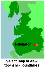
View maps of Pilkington and places within its boundaries.
View a map of the boundaries of this town/parish.
You can see maps centred on OS grid reference SD786055 (Lat/Lon: 53.545355, -2.324799), Pilkington which are provided by:
- OpenStreetMap
- Google Maps
- StreetMap (Current Ordnance Survey maps)
- Bing (was Multimap)
- Old Maps Online
- National Library of Scotland (Old Ordnance Survey maps)
- Vision of Britain (Click "Historical units & statistics" for administrative areas.)
- English Jurisdictions in 1851 (Unfortunately the LDS have removed the facility to enable us to specify a starting location, you will need to search yourself on their map.)
- Magic (Geographic information) (Click + on map if it doesn't show)
- GeoHack (Links to on-line maps and location specific services.)
- All places within the same township/parish shown on an Openstreetmap map.
- Nearby townships/parishes shown on an Openstreetmap map.
- Nearby places shown on an Openstreetmap map.
For probate purposes prior to 1858, Pilkington was in the Archdeaconry of Chester, in the Diocese of Chester. The original Lancashire wills for the Archdeaconry of Chester are held at the Lancashire Record Office.
You can also see Family History Societies covering the nearby area, plotted on a map. This facility is being developed, and is awaiting societies to enter information about the places they cover.
