Hide
Rivington
hide
Hide
hide
Hide
hide
Hide
Hide
RIVINGTON, a village, a township-chapelry, and a sub-district, in Chorley district, Lancashire. The village stands on the side of a hill, 2 miles E N E of Adlington r. station, and 4 S E of Chorley; overlooks the large reservoir of the Liverpool water-works; and has a post-office under Chorley. The chapelry comprises 2,630 acres; and is in Bolton-le-Moors parish. Real property, £2,153. Pop., 369. Houses, 82. The property is divided among a few. R. Hall, Gillbrook Hall, and Beech House are chief residences. R. Pike is a mountain 1,345 feet high, and had formerly a beacon. The living is a p. curacy in the diocese of Manchester. Value, £90* Patrons, the Inhabitants. The church is tolerable; and there are a Presbyterian chapel, and an endowed grammar-school with £310 a year. The sub-district contains also another township of Bolton, and three of Standish. Acres, 7,742. Pop., 3,493. Houses, 676.
John Marius Wilson, Imperial Gazetteer of England and Wales (1870-72)
Hide
Local studies information is held at Chorley library.
| Church of England, Rivington |
| The Green Unitarian, Rivington |
Details about the census records, and indexes for Rivington.
| Church of England, Rivington |
| The Green Unitarian, Rivington |
The Register Office covering the Rivington area is Chorley.
The National Gazetteer of Great Britain and Ireland - 1868
"RIVINGTON, a township and chapelry in the parish of Bolton le Moors, hundred of Salford, county Lancaster, 4 miles S.E. of Chorley, its post town. The village, which is of small extent, is situated under Rivington Pike, which is 1,345 feet in altitude, and had once a beacon. The inhabitants are chiefly engaged in agriculture, and a few in the lead mines. The mineral called barytes was first found here, and coal and gritstone are also worked, the latter being in great demand for paving. The chapelry comprises the townships of Rivington and Anglezark, and is about 6 miles long by 3 broad. The land consists chiefly of moss comprising the range of hills called Rivington Q Anglezark moors. The Leeds and Liverpool canal, and the Bolton and Preston railway pass within 2 miles of the village. Swinton Moor, a small estate of little value, was some years back leased to the guardians of the poor of Manchester, for £250, for the training of about 1,000 pauper children of that parish. There are several chalybeate springs in the township, and in Dean Wood is a cascade of 32 feet fall. On the summit of a hill, about 1,500 feet above the sea: level, is a square tower 20 feet high, from which in favourable weather a prospect is obtained embracing Furness Fell, Snowdon, and the Isle of Man. The living is a perpetual curacy in the diocese of Manchester, value £90, in the patronage of inhabitants. The church was erected about 1530, by Richard Pilkington. The screen and font are supposed to have belonged to some earlier edifice. The parochial charities consist of Bishop Pilkington's free grammar school, founded in 1566, the endowment of which has increased to £310 per annum. The Unitarians have a place of worship."
- Ask for a calculation of the distance from Rivington to another place.
In 1835 Rivington was a township in the parish of Bolton.

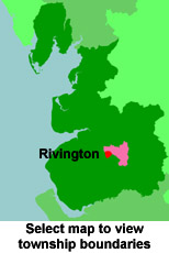
View maps of Rivington and places within its boundaries.
View a map of the boundaries of this town/parish.
You can see maps centred on OS grid reference SD641141 (Lat/Lon: 53.622126, -2.543796), Rivington which are provided by:
- OpenStreetMap
- Google Maps
- StreetMap (Current Ordnance Survey maps)
- Bing (was Multimap)
- Old Maps Online
- National Library of Scotland (Old Ordnance Survey maps)
- Vision of Britain (Click "Historical units & statistics" for administrative areas.)
- English Jurisdictions in 1851 (Unfortunately the LDS have removed the facility to enable us to specify a starting location, you will need to search yourself on their map.)
- Magic (Geographic information) (Click + on map if it doesn't show)
- GeoHack (Links to on-line maps and location specific services.)
- All places within the same township/parish shown on an Openstreetmap map.
- Nearby townships/parishes shown on an Openstreetmap map.
- Nearby places shown on an Openstreetmap map.
For probate purposes prior to 1858, Rivington was in the Archdeaconry of Chester, in the Diocese of Chester. The original Lancashire wills for the Archdeaconry of Chester are held at the Lancashire Record Office.
You can also see Family History Societies covering the nearby area, plotted on a map. This facility is being developed, and is awaiting societies to enter information about the places they cover.
