
Hide
Satterthwaite
hide
Hide
hide
Hide
hide
Hide
Hide
Satterthwaite is a township of considerable extent, having a length of six miles and a breadth of upwards of four miles. A chain of hills covers the whole township, frequently exposing to the view nothing but the denuded rocks. In some places the fells are covered with a thick mantle of heath, while in a few favoured situations the scenery is of a sylvan character. The township possesses a village of the same name, about four miles south from Hawkshead, and also the hamlets of Cunsey, Dale Park, Force Forge, and Low Graythwaite.
This township is very thinly peopled; and on the road leading from Hawkshead to Graythwaite, which winds over hill and dale, the traveller may walk nearly four miles without passing a human habitation. A large portion of this hilly district is shrouded in coppice, which supplies the materials for the bobbin mills, an occupation which gives employment to many of the inhabitants. At Force Forge are two bobbin manufactories.
from Mannex's directory of Furness & Cartmel, 1882
Hide
Local studies information is held at Cumbria Record Office & Local Studies Library, Barrow.
Details about the census records, and indexes for Satterthwaite.
The Register Office covering the Satterthwaite area is Ulverston.
The National Gazetteer of Great Britain and Ireland - 1868
"SATTERTHWAITE, a township and chapelry in the parish of Hawkshead, hundred of Lonsdale North of the Sands, county Lancaster, 4 miles S.W. of Hawkshead. Milnthorpe is its post town. The village, which is of small extent, is situated on a branch of the river Leaven, and is chiefly agricultural. A portion of the inhabitants are engaged in the bobbin mills at Cunsey. The township includes the hamlets of Dale-Park, Force Forge, Grizedale, and Lower Graythwaite. There is a large extent of coppice wood, formerly used for the smelting of iron-ore. The living is a perpetual curacy in the diocese of Carlisle, value £120. The church has a square tower containing one bell, and was enlarged and rebuilt in 1835. There is a National school for both sexes at Grizedale. Satterthwaite Hall and High Graythwaite Hall are the principal residences."
"SATTERTHWAITE, a chapelry in the parish of Ulverston, hundred of Lonsdale North of the Sands, county Lancaster, 7 miles N.W. of Ulverston. There are quarries of roofing slate."
- Ask for a calculation of the distance from Satterthwaite to another place.
In 1835 Satterthwaite was a township in the parish of Hawkshead.
View maps of Satterthwaite and places within its boundaries.
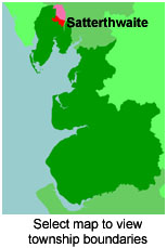
View a map of the boundaries of this town/parish.
You can see maps centred on OS grid reference SD345932 (Lat/Lon: 54.329783, -3.008103), Satterthwaite which are provided by:
- OpenStreetMap
- Google Maps
- StreetMap (Current Ordnance Survey maps)
- Bing (was Multimap)
- Old Maps Online
- National Library of Scotland (Old Ordnance Survey maps)
- Vision of Britain (Click "Historical units & statistics" for administrative areas.)
- English Jurisdictions in 1851 (Unfortunately the LDS have removed the facility to enable us to specify a starting location, you will need to search yourself on their map.)
- Magic (Geographic information) (Click + on map if it doesn't show)
- GeoHack (Links to on-line maps and location specific services.)
- All places within the same township/parish shown on an Openstreetmap map.
- Nearby townships/parishes shown on an Openstreetmap map.
- Nearby places shown on an Openstreetmap map.
For probate purposes prior to 1858, Satterthwaite was in the Archdeaconry of Richmond, in the Diocese of Chester. The original Lancashire wills for the Archdeaconry of Richmond are held at the Lancashire Record Office.
You can also see Family History Societies covering the nearby area, plotted on a map. This facility is being developed, and is awaiting societies to enter information about the places they cover.