Hide
Alford
hide
Hide
hide
Hide
hide
Hide
Hide
hide
Hide
"ALFORD, a parish and market-town in the Weld division of the hundred of Calceworth, parts of Lindsey, in the county of Lincoln, 30 miles to the E. of Lincoln, and 130 miles by rail from London. It is a station on the East Lincolnshire section of the Great Northern railway. Its name indicates its position on an old ford over a stream that runs through the town. The living is a vicarage in the diocese of Lincoln, value with the perpetual curacy of Rigsby, £180, in the patronage of the bishop. The church is of stone, with a thatched chancel, and is dedicated to St. Wilfrid. It has several ancient monuments, among which is a fine one to Sir Robert Christopher, Knt., and his lady. The Reformed and Primitive Wesleyan Methodists, and the Baptists have chapels here. A court of requests was established here in the reign of George III., which is held once a month. Petty sessions are held, and polling for the north division of the county takes place here. Spanning's free grammar school was founded in 1565. Its revenue, at first small, has been raised by several endowments to £350. In 1576, a charter was granted by Queen Elizabeth; by which it was made a royal foundation, and the governors a corporation with a common seal. It has in connection with it two fellowships at Magdalen College, Oxford, and one at Jesus College, Cambridge. There is a national school for 130 children, boys and girls, partly supported by endowment. Its income is now £60. In 1668, Sir Robert Christopher built and endowed some almshouses for six poor persons, which were further endowed in 1716 by Lord Harborough. There are various other charities. In 1854 a handsome building was erected for the Mechanics' Institute, which includes a library and lecture hall. There are some tumuli in the parish, and a mineral spring. The market is held on Thursday, and fairs on Whit-Tuesday, and the 8th November. Alford gives the title of viscount to Earl Brownlow, of Belton."
[Transcribed from The National Gazetteer of Great Britain and Ireland 1868]
by Colin Hinson ©2020
Hide
The Alford Library is a Community Library, an incorporated charity primarily funded by the Lincolnshire County Council. It is currently open most weeks for 4 days each week. It has a Local History Archive.
- Alford Public Library
- 6 South Market Place
- Alford, Lincolnshire
- LN13 9AF
- Tele: 01522 782010
J. THOMAS has a photograph of the Alford Focal Point and Library on Geo-graph, taken in May, 2020.
- The parish is well covered in Reginald C. DUDDING's "History of the parish and manors of Alford with Rigsby and Ailby," published by W. K. Morton, 1930, 223 pages.
- The Cemetery, laid out in 1881, covered two acres and is on the south side of the town and contains a mortuary chapel. It was under the control of the Town Council.
- Richard CROFT has a photograph of the Alford Cemetery Chapel on Geo-graph, taken in September, 2010.
- J. HANNAN-BRIGGS has a phtograph of the Alford Crematorium entrance on Geo-graph, taken in August, 2012. This is on the West side of Alford town.
- The parish was in the Alford sub-district of the Spilsby Registration District.
- Check our Census Resource page for county-wide resources.
- The table below gives census piece numbers, where known:
Census
YearPiece No. 1841 H.O. 107 / 626 1851 H.O. 107 / 2110 1861 R.G. 9 / 2377 1871 R.G. 10 / 3395 & 3396 1881 R.G. 11 / 3258 1891 R.G. 12 / 2605
| Alford, Baptist |
| Chauntry Road, Alford, Independent |
| Chauntry Road/Hamilton Road, Alford, Congregationalist |
| Farlesthorpe Road, Alford, Cemetery |
| Miles Cross Hill, Alford, Crematorium |
| South Street, Alford, Cemetery |
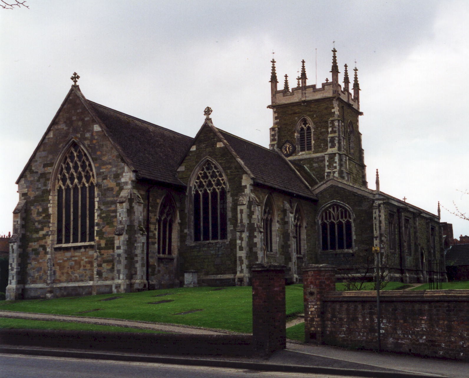
- The Anglican parish church is dedicated to Saint Wilfrid (sometimes given as St. Wilfred) and is built of green sandstone.
- The church was endowed in 1209.
- The church was rebuilt around 1250 to replace a smaller structure.
- Queen Elizabeth's grammar School started in a room above the church porch.
- The church was restored and enlarged in 1867-8.
- The church seats 750 persons.
- There is a photograph of St. Wilfrid's church on the Wendy PARKINSON Church Photos web site, taken by Paul Fenwick.
- Here is a photograph St. Wilfrid Church supplied by Ron COLE (who retains the copyright):
- The Anglican parish church register dates from 1538.
- The Lincolnshire Archives holds: Baptisms 1561-1987; Marriages 1538-1998; Burials 1538-1944; Bishops Transcripts 1561-1836 and 1882-1891.
- The Family History Library in Salt Lake City has copies of the parish register on film 1541968 covering baptisms 1845-1944.
- We have the beginnings of a Parish Register Extract in a pop-up text file for you to review. Your additions are welcomed.
- The Lincolnshire FHS has published several marriage indexes and a burial index for the Calcewaith and Candleshoe Deanery to make your search easier.
- The Primitive Methodists erected a chapel in 1836, but they moved to a new chapel on South Street in 1856.
- There were chapels here prior to 1871 for Wesleyan Methodists and Reformed Methodists, as well as Independents and Baptists. The Wesleyans built their's in 1864-5 on Chapel street to seat up to 700 members and guests. The Congragational Chapel was founded in 1795. A United Methodist chapel was built in 1850 in South End. For information and assistance in researching these chapels, see our non-conformist religions page.
- Richard CROFT has a photograph of the Alford Methodist Chapel on Geo-graph, taken in April, 2007.
- Check our Church Records page for county-wide resources.
- The parish was in the Alford sub-district of the Spilsby Registration District.
- Check our Civil Registration page for sources and background on Civil Registration which began in July, 1837.
- Bob Harvey has a photograph of the Town Stocks for miscreants on Geo-graph, taken in October, 2020. I believe he has just released his teenagers from them.
Alford is both a parish and a small but ancient market town. A small brook runs through the parish, which sits 141 miles north of London, and only 6 miles from the North Sea, 8 miles north-east of Spilsby and 13 miles south-east of Louth. Bilsby parish is just to the east, and Well parish to the south. The parish covers about 1,100 acres.
If you are planning a visit:
- Well parish is also called "Holy Well" because the well is said to have medicinal properties.
- Passenger rail service ended in 1970.
- By automobile, the town is just east of the A16 trunkroad that runs between Spilsby and Louth. From that road, take the A1104 east about two miles to Alford.
- Visit the Alford Town Council website to see what is happening in town. The town has an official guide available at the Library and the Tourist Office, and cost is around 50p.
- See our touring page for more sources.
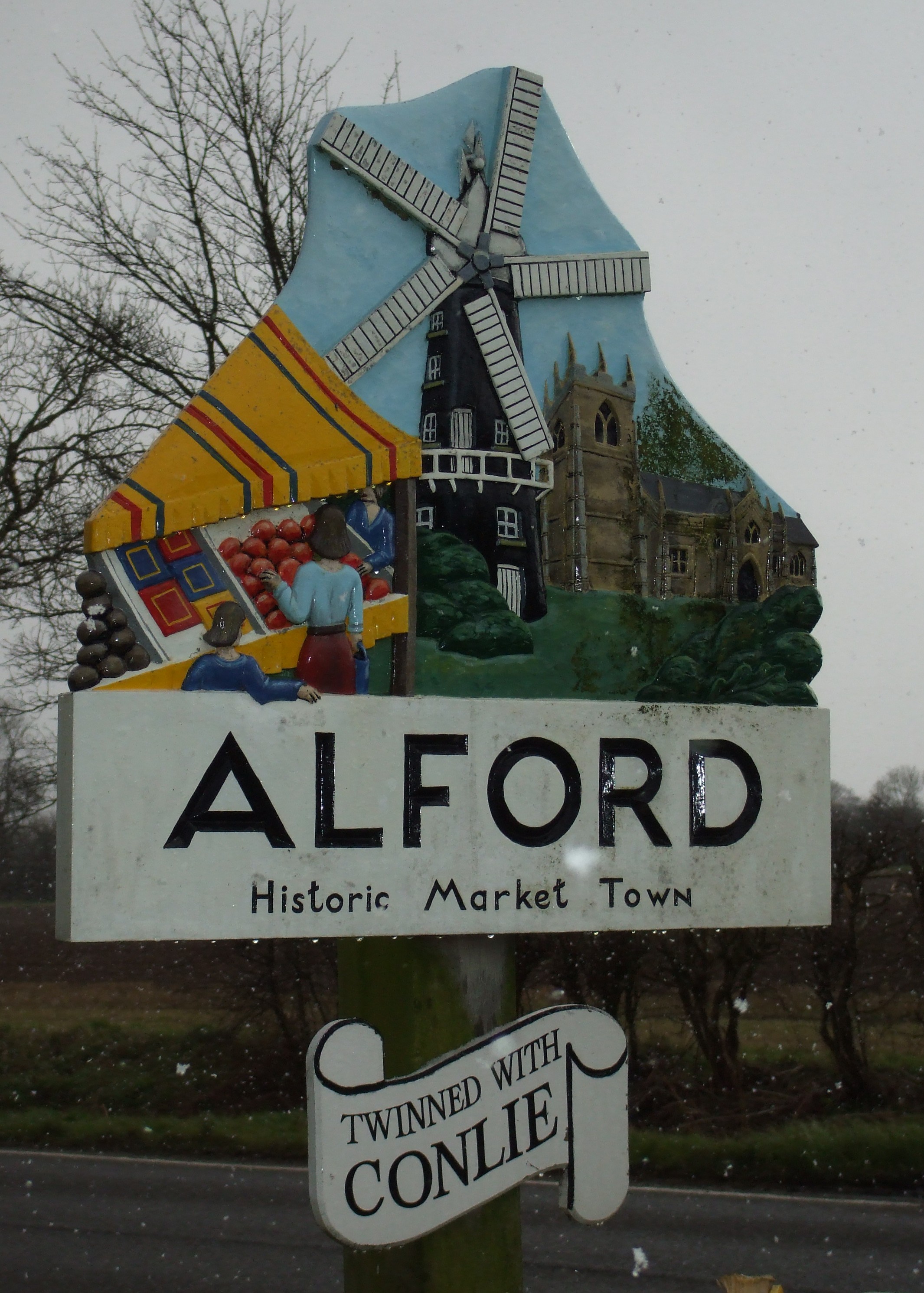
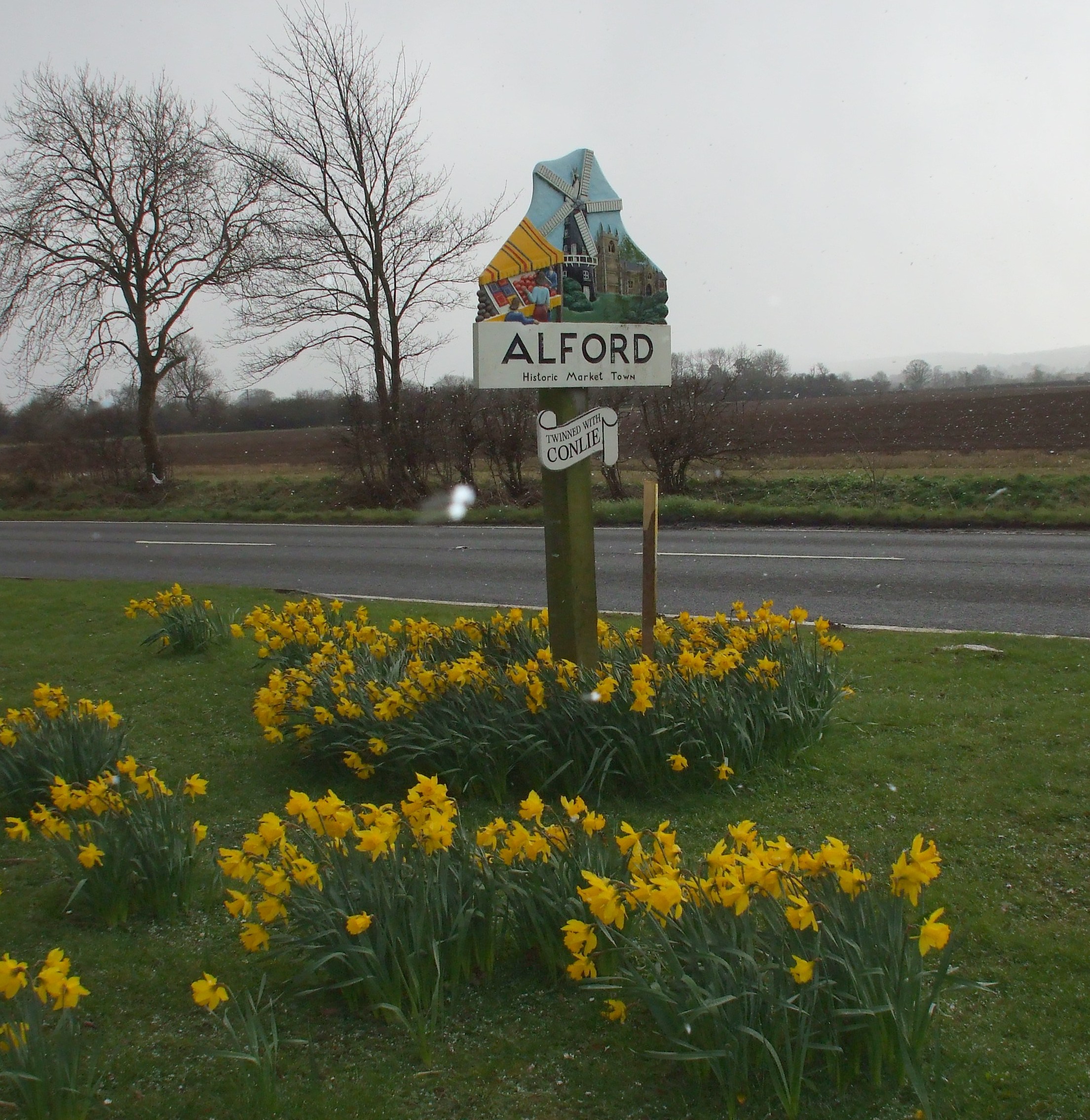
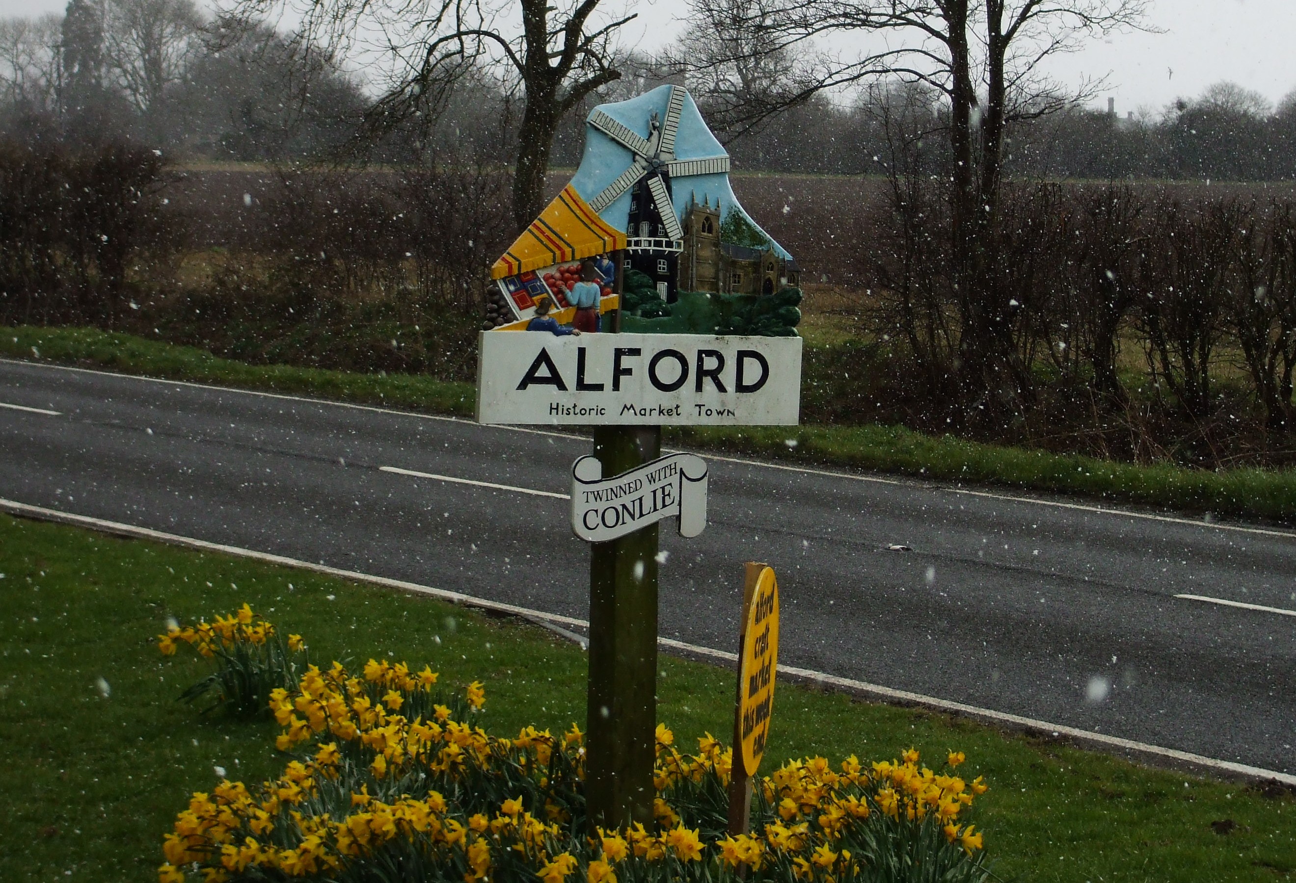
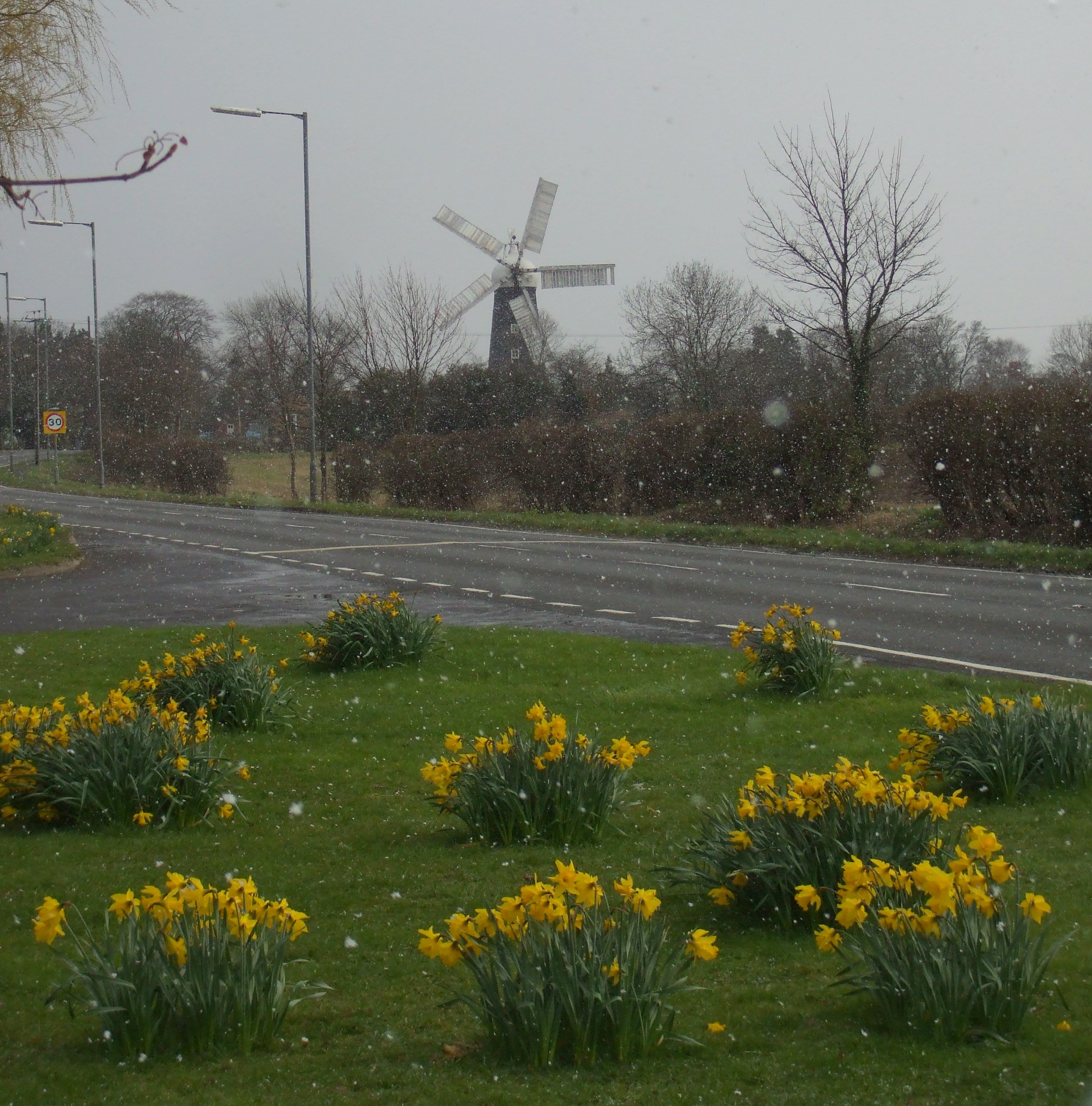
- Here are some photographs of the village sign and some sights along the road into Alford, taken in 2008 by Patricia McCrory (who retains the copyright). Notice the snow!
The National Gazetteer of Great Britain and Ireland - 1868
- Ask for a calculation of the distance from Alford to another place.
- Robert HARVEY has a photograph of the fountain in the marketplace on Geo-graph, taken in October, 2020. This is a Grade II monument with English Heritage.
- Robert HARVEY has also photographed the informational sign for the fountain, taken in October, 2020.
- Richard CROFT has a photograph of Hanby Hall on Geo0graph, taken in March, 2008.
- Ivan Dominikovich tells us:
Alford was a very historical town dating back to about 500 A.D. and first settled by the Angles and Saxons. Later Danish settlers established hamlets side by side and these communities and local place names nearly all ended in 'By' and 'Thorpe'. It lies between the Lincolnshire Wolds and the coast and is mainly used for cropping. Fields are of sugar beet, cabbages, cauliflower, broad beans, peas, potatoes, barley and wheat. The land is very flat with many drains and canals with high floodbanks along their sides. John WESLEY preached some of his first sermons in Alford. The little chapel is still there - used as a garage.
- Ivan Dominikovich also tells us:
In the year 1630 Alford was plague stricken, almost a quarter of a century earlier than the great plague of London in 1665. The town was probably saved from extinction by the generosity of the people of the surrounding districts when a cross was placed on the top of a hill (Mikes Cross Hill). In a receptacle that contained vinegar [the only known disinfectant at that time] the Alford people placed their money, the other people would bring food stuffs, poultry, eggs etc., and place it out at fixed prices and retire. The Alford people then climbed the hill, removed the food they wanted and left money in its place. This way they never came into contact but were able to know the situation and in doing so surely saved Alford and many of its families from disaster. At the top of Miles Cross Hill the food was left by a large stone. At some point this PLAGUE STONE as it is locally known was removed and placed in the garden of Tothby Manor where it still lies today.
- Market Day was held every Tuesday.
- The Alford Savings' bank was established in 1817.
- A gas works was erected here in 1842.
- A Police Station was built here in 1844.
- Around 1850, the East Lincolnshire branch of the Great Northern railway established a station here, about a half mile west of the town.
- The Corn Exchange was erected here in the Market Place in 1856.
- There is a booklet entitled: "Alford Guide and History," by Geoff HADFIELD and Jane HILL.
- J. THOMAS has a photograph of the Windmill Hotel on Geo-graph, taken in May, 2020.
- J. THOMAS also has a photograp of the George Inn on Geo-graph, taken in May, 2020. Notice the church in the background?
- The Half Moon Hotel claims to have a history that goes back 400 years. Alas, it closed in late 2015. Jo TURNER has a photograph of the Half Moon on Geo-graph, taken in September, 2019.
- J. THOMAS has a photograph of The White Hart in South Street on Geo-graph, taken in May, 2020.
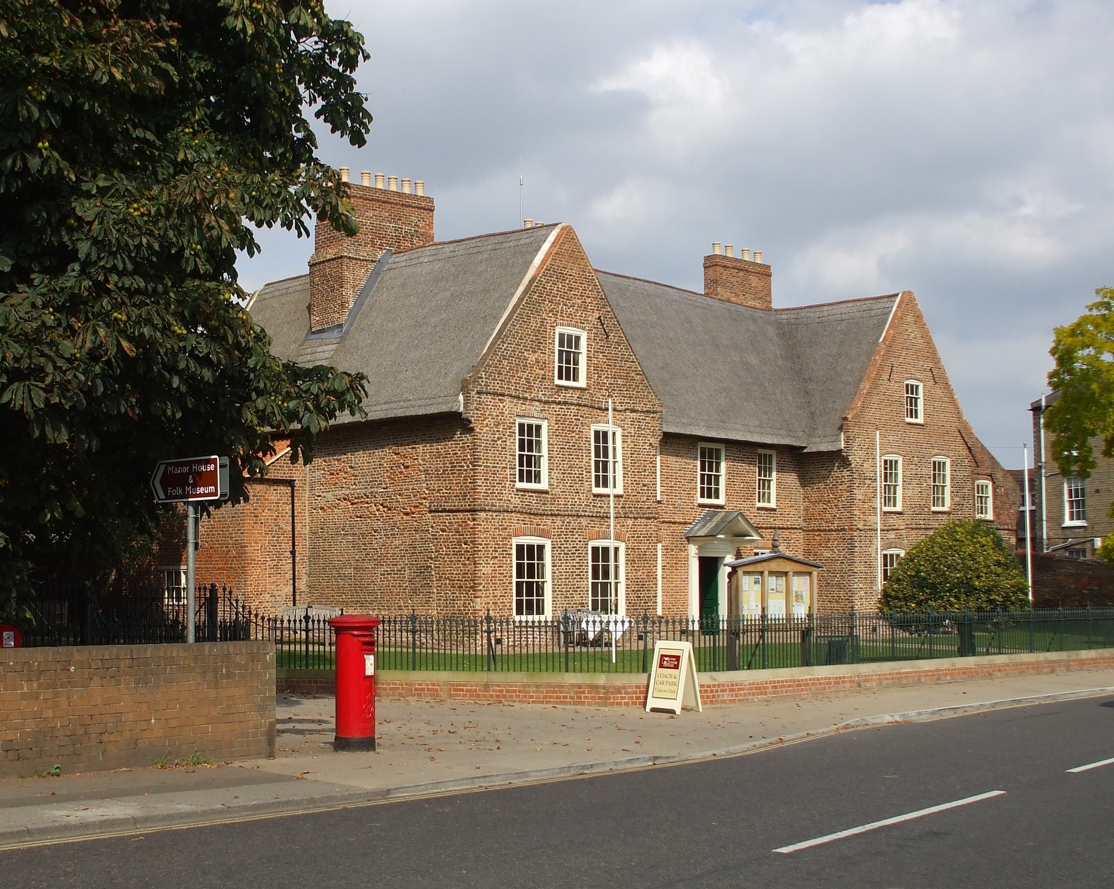
- Alford Manor House is a Grade II listed Building, and it could be one of England's largest thatched Manor Houses. Recent research by a York University archaeological team has dated the House to 1611. The building was erected from the start as a timber and masonry structure, known now as a mud and stud house.
- In 1896 and 1900, Alford Manor House was the residence of Major John J. HIGGINS.
- Alford Manor House was given to the town by Dorothy HIGGINS, whose Grandfather had once lived there. In 1967 Alford Civic Trust was formed with the aim of preserving the House, and it is now owned by Alford and District Civic Trust Ltd.
- J. THOMAS has a photograph of Alford Manor House on Geo-graph, taken in May, 2020.
- Here is a photograph of the Manor House, showing its thatched roof, taken in 2008 by Patricia McCRORY (who retains the copyright):
- See our Maps page for additional resources.
You can see maps centred on OS grid reference TF455760 (Lat/Lon: 53.261052, 0.179875), Alford which are provided by:
- OpenStreetMap
- Google Maps
- StreetMap (Current Ordnance Survey maps)
- Bing (was Multimap)
- Old Maps Online
- National Library of Scotland (Old Ordnance Survey maps)
- Vision of Britain (Click "Historical units & statistics" for administrative areas.)
- English Jurisdictions in 1851 (Unfortunately the LDS have removed the facility to enable us to specify a starting location, you will need to search yourself on their map.)
- Magic (Geographic information) (Click + on map if it doesn't show)
- GeoHack (Links to on-line maps and location specific services.)
- All places within the same township/parish shown on an Openstreetmap map.
- Nearby townships/parishes shown on an Openstreetmap map.
- Nearby places shown on an Openstreetmap map.
- The Alford and District War Memorial Cottage Hospital was built on Station road. Founded in January, 1920, it was built in memory of the men of the district who fell in World War One. It opened in August, 1921, with 8 beds. No records of admissions are known.
- Miss R. METHERELL was the matron in 1930.
- Chris ? thinks he has a photograph of the War Memorial Hospital on Geo-graph, taken in February, 2014. We'd both appreciate confirmation.
- A Volunteer Corps, consisting of 100 men, was formed in 1860. The officers were Captain J. HIGGINS, Lieutenant George CARTWRIGHT and Ensign Thomas A. HANDSLEY. By 1869 this was the 11th Lincolnshire Rifle Corps.
- It is believed that Thomas A. HANDSLEY was born circa 1831 in Binbrook, Lincs. and married Lucy from London.
- In 1882, H Company of the 1st Lincolnshire Rifle Volunteers, now numbering about 70 men, had the following officers: Captain John HIGGINS; Lieutenant George CARTWRIGHT; surgeon Richard LANPHIER. Thomas A. HANDSLEY, from the entry above, was by now a civiliain surgeon living on Park Lane.
- It is believed that Richard LANPHIER was born in Ireland.
- In 1896, H company of the 1st Lincolnshire regiment was headquartered at the Drill Hall in the Corn Exchange. Major Frederick RIGGALL was commanding.
- In 1900, Alford was home to F Company of the 3rd Volunteer Battalion, Lincolnshire Regiment, housed in the Drill Hall in South End. The Captain was Thomas Eeward SANDALL, Lieutenants were Charles H. HUMPHREYS and Joseph F. PORTER, the chaplain was Rev. B. G. JARRETT and the Drill Instructor was Col-Sergt. Henry YALLOP.
- It is believed that Thomas SANDALL, with a middle name of Edward, was born in Northamptonshire around 1870. He was in Stamford, LIN, in 1891. Henry YALLOP was born in Norfolk.
- In 1912, Alford was home to F Company of the 5th Battalion, Lincolnshire Regiment, housed in the Drill Hall in South End. The Captain was James Henry HADFIELD, and the Drill Instructor was Sergt. Wm. COLDWELL. The Territorial Drill Hall was erected in 1910.
- The Alford War Memorial was dedicated in August 1919 in pouring rain by Lt Col. SANDELL, a local man who had been the Colonel of 1/5th Lincolnshire Regiment throughout the Great War. He was a doctor by profession. The memorial is immediately outside the main door of St Wilfrid's Parish Church. My thanks to volunteers who have added more than just the names to this list.
- Richard CROFT has a photograph of the Alford War Memorial Cross on Geo-graph, taken in March, 2008.
- Robert HARVEY has a photograph of the War Memorial Cross on Geo-graph, taken in October, 2020. While not the subject of his photo, the Cross on the left is well lit and nicely framed.
- John READMAN has a photograph of the Alford Great War Roll of Honour in St. WIlfrid's Church on the Geo-graph website, taken in November, 2005.
- John READMAN has a photograph of the Roll of Honour for Alford, with Rigsby & Aliby in St. WIlfrid's Church on the Geo-graph website, taken in November, 2005.
- In 1930, Major Walter Hugh RAWNSLEY was the lord of the manor.
For a photograph of the Alford War Memorial and the list of names on the rolls, see the Roll of Honour site.
- The name Alford is from an ancient ford over a stream.
- Locals pronounce the name as "Olfuhd". [Simon Meeds, 2001]
- Thomas PAINE, the American revolutionary and essayist, was appointed as an Excise Officer here in Alford in August, 1764. He left Alford in 1767.
- Robert HARVEY has a photograph of the Thomas Paine Plaque on Geo-graph, taken in October, 2020.
- Click to see the text file: Bailey's British Merchant's and Trader's Useful Companion for 1784 list of names. [Mark in Barcelona]
- This place was an ancient parish in Lincoln county and it became a modern Civil Parish when those were established.
- The parish was in the ancient Calceworth Wapentake in the East Lindsey district in the parts of Lindsey.
- The town of Alford is governed by an Urban District Council first established in April, 1896.
- You can contact the Alford Town Council regarding civic or political matters, but they are NOT staffed to assist with family history searches.
- The Town Council holds its meetings in the Library Conference Room as of 2020.
- For today's district governance, see the East Lindsey District Council.
- Bastardy cases would be heard in the Alford petty sessional hearings on alternate Tuesdays at the Police Station.
- In 1668, Sir Robert CHRISTOPHER left £550 to build an almshouse at Alford for six poor people. The sum was augmented in 1716 by Lord Harborough. The almshouse was rebuilt in 1870.
- After the 1834 Poor Law Amendment Act reforms, the parish became part of the Spilsby Poor Law Union.
Year Inhabitants 1801 1,040 1821 1,508 1831 1,784 1871 2,881 1881 2,894 1891 2,843 1901 2,478 1911 2,394 1921 2,194 1931 2,227 1951 2,218 1961 2,139
- Francis SPANNING founded the Grammar School here in 1565. In the 1800s, the school was "free for the classics to all the boys of Alford" and some neighboring parishes. This was later known as "Queen Elizabeth's Grammar School" and later was a secondary school.
- A National School was first built here in 1820, expanded in 1860 and again in 1866. It was on West Street. It is believed that this is the "Daddy Ruston School" identified by John Readman, which was converted in 1958 to the Ritz cinema and later became a carpet shop. However, it may also be the "John Spendluffe School".
- A Girls' National School was built in 1851, and enlarged in 1866.
- An Infants' School was built in West Street to hold up to 180 children.
- An Education Committee for the Public Elementary Schools was formed in 1903.
- For more on researching school records, see our Schools Research page.
