
Hide
Baumber
hide
Hide
hide
Hide
hide
Hide
Hide
hide
Hide
Hide
- The parish was in the Wragby sub-district of the Horncastle Registration District.
- Check our Census Resource page for county-wide resources.
- The table below gives census piece numbers, where known:
| Census Year | Piece No. |
|---|---|
| 1841 | H.O. 107 / 627 |
| 1851 | H.O. 107 / 2107 |
| 1861 | R.G. 9 / 2365 |
| 1871 | R.G. 10 / 3379 |
| 1891 | R.G. 12 / 2597 |
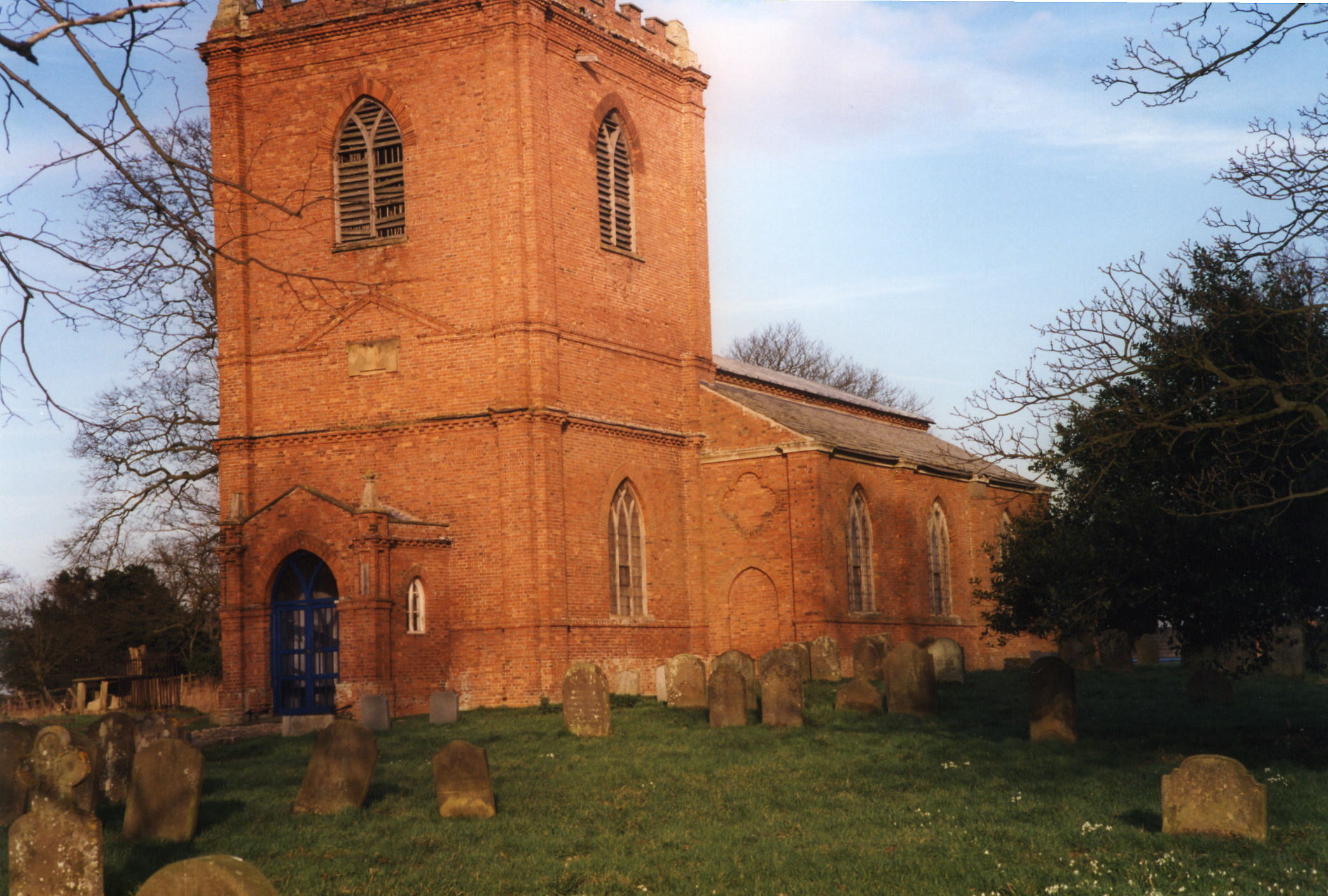
- The Anglican parish church was dedicated to Saint Swithin.
- The church tower appears to be of early Norman origin.
- The church was faced with bricks in 1770.
- The church seats 300.
- David HITCHBORNE has a photograph of St. Swithin's Church on Geo-graph, taken in April, 2004.
- Richard CROFT also has a photograph of St. Swithin's Church on Geo-graph, taken in January, 2006.
- Here is a photograph St. Swithin's Church supplied by Ron COLE (who retains the copyright):
- The Anglican parish register dates from 1691.
- The LFHS has published several marriage indexes for the Horncastle Deanery to make your search easier.
- The Wesleyan Methodists had a small chapel here, built in 1844. For information and assistance in researching these chapels, see our non-conformist religions page.
- Check our Church Records page for county-wide resources.
- The parish was in the Wragby sub-district of the Horncastle Registration District.
- Check our Civil Registration page for sources and background on Civil Registration which began in July, 1837.
Baumber is a village and parish which sits on a ridge above the valley of the Bain River on the old Wragby road about 3.5 miles northwest of Horncastle. The parish covers about 3,000 acres and includes the hamlet of Little Sturton.
If you are planning a visit:
- By automobile, take the A158 trunk road northwest out of Horncastle for about 3.5 miles.
- Visit our touring page for more sources.
- Ask for a calculation of the distance from Baumber to another place.
- Stourton Hall was built in 1810. It was later rebuilt in Ancaster stone. It is the seat of the LIVESEY family.
- Stourton Hall was the property of Joseph M. LIVESEY in 1900, but was unoccupied at the time.
- See our Maps page for additional resources.
You can see maps centred on OS grid reference TF222745 (Lat/Lon: 53.253449, -0.1698), Baumber which are provided by:
- OpenStreetMap
- Google Maps
- StreetMap (Current Ordnance Survey maps)
- Bing (was Multimap)
- Old Maps Online
- National Library of Scotland (Old Ordnance Survey maps)
- Vision of Britain (Click "Historical units & statistics" for administrative areas.)
- English Jurisdictions in 1851 (Unfortunately the LDS have removed the facility to enable us to specify a starting location, you will need to search yourself on their map.)
- Magic (Geographic information) (Click + on map if it doesn't show)
- GeoHack (Links to on-line maps and location specific services.)
- All places within the same township/parish shown on an Openstreetmap map.
- Nearby townships/parishes shown on an Openstreetmap map.
- Nearby places shown on an Openstreetmap map.
- A Royal Observer Corps station can be found near the road junction just south of the village.
- Ian PATERSON has a photograph of the ROC station at A158 on Geo-graph, taken in May, 2007.
- This place was an ancient parish in the county of Lincoln and became a modern Civil Parish when those were established.
- The parish was in the Northern division of the ancient Gartree Wapentake in the East Lindsey district in the parts of Lindsey.
- You may contact the local Baumber Parish Council regarding civic or political issues. Be aware that they will not assist with family history research.
- For today's district governance, see the East Lindsey District Council.
- Bastardy cases would be heard in the Horncastle petty session hearings.
- As a result of the 1834 Poor Law Amendment Act, the parish became part of the Horncastle Poor Law Union.
- A Public Elementary School was built here in 1876 and enlarged in 1893 for up to 92 children.
- At last report, in 2010, the school was closing.
- For more on researching school records, see our Schools Research page.