
Hide
Bigby
hide
Hide
hide
Hide
hide
Hide
Hide
hide
Hide
"KETTLEBY and KETTLEBY THORPE, hamlets in the parishes of Bigby and Wrawby, wapentake of Yarborough, county Lincoln, 3 miles N.E. of Glandford-Brigg."
[Transcribed from The National Gazetteer of Great Britain and Ireland 1868]
by Colin Hinson ©2020
Hide
The nearby Caistor Library is an excellent resource with a Local History section and a Family History section.
Peter Wood has a photograph of the churchyard cemetery on Geo-graph, taken in February, 2019.
| All Saints, Bigby, Church of England |
- The parish was in the Caistor sub-district of the Caistor Registration District.
- A portion of the parish was in the Brigg sub-district of the Glanford Brigg Registration District.
- Check our Census Resource page for county-wide resources.
- The table below gives census piece numbers, where known:
| Census Year | Piece No. |
|---|---|
| 1841 | H.O. 107 / 627 |
| 1851 | H.O. 107 / 2114 |
| 1861 | R.G. 9 / 2392 |
| 1871 | R.G. 10 / 3420 & 3429 |
| 1891 | R.G. 12 / 2621 |
| All Saints, Bigby, Church of England |
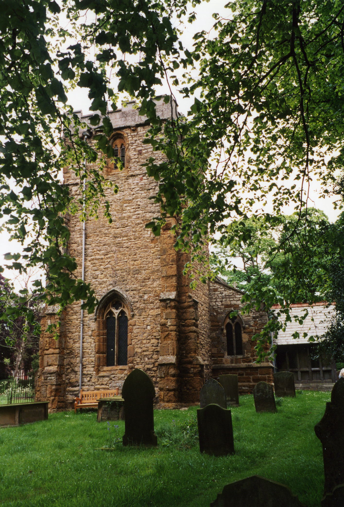
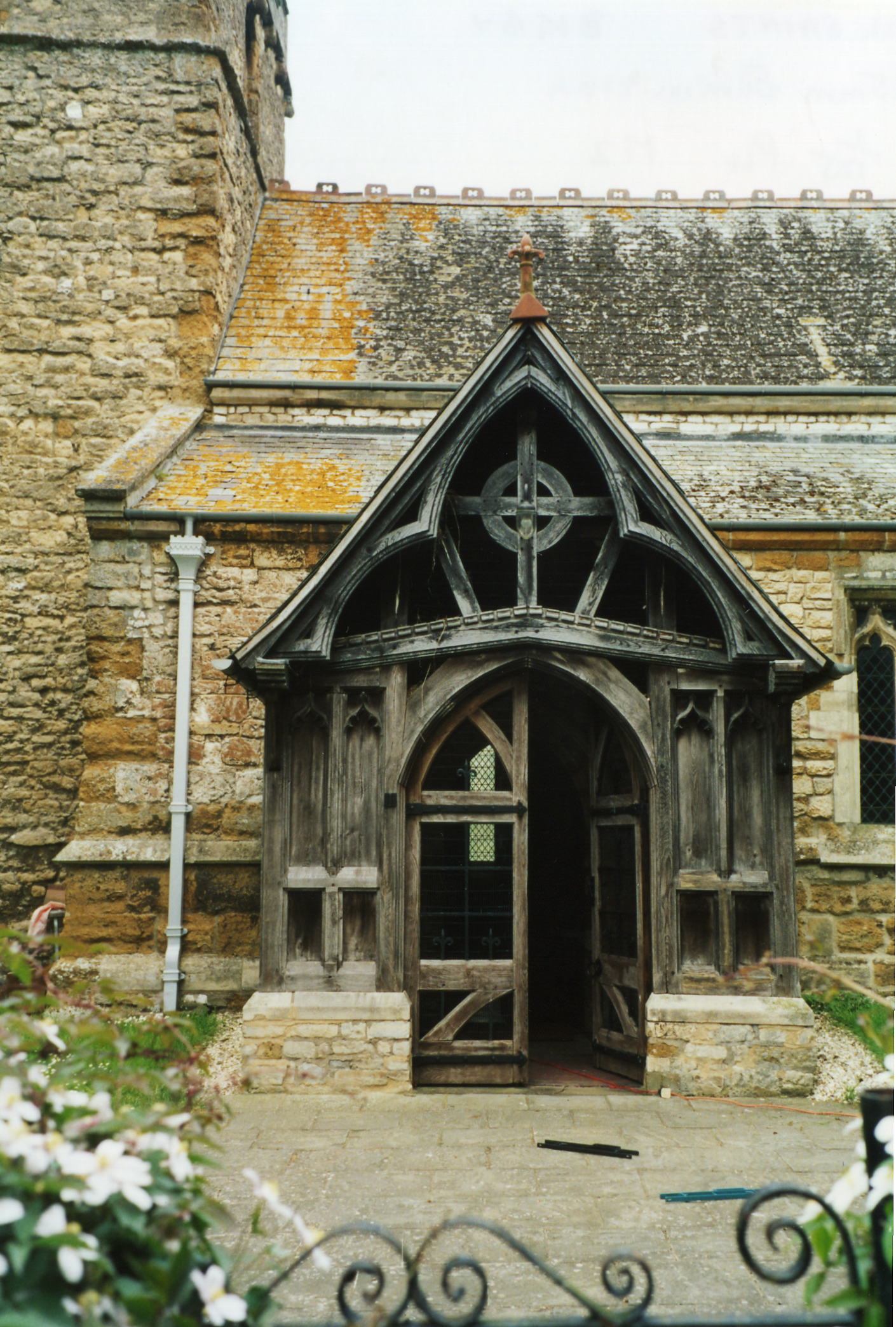
- The local Anglican Church is dedicated to All Saints and dates from the 12th Century.
- The church has undergone restorations in 1780 and 1878.
- The church is a Grade I listed structure.
- The church seats 120.
- A photograph of All Saints church is at the Wendy PARKINSON English Church Photographs site.
- Richard CROFT has a photograph of All Saints Church in the snow on Geo-graph, taken in January, 2010.
- Here are two photographs of All Saints. One is of the church tower and the other is of the church entrance. Both were taken by Ron COLE (who retains the copyright):
- The Anglican parish register dates from 1696.
- All Saints contains monuments and effiges of the TYRWHITT and SKIPWORTH families. One TYRWHITT tomb dates to 1581.
- We have the beginnings of a Parish Register Extract in a text file for your use. Your additions and corrections are welcome.
- The Lincolnshire FHS has published several marriage indexes and a burial index for the Yarborough Deanery to make your search easier.
- Check our Church Records page for county-wide resources.
- The parish was in the Caistor sub-district of the Caistor Registration District.
- Check our Civil Registration page for sources and background on Civil Registration beginning in July 1837.
This village and parish lies south of Barnetby le Wold and north-west of Caistor. Somerby parish lies to the south-east. The parish covers about 3,450 acres and includes the hamlet of Kettleby.
The hamlet of Kettleby lies about 1.5 miles west of the Bigby village. This hamlet is where Kettle, a captain of the Dane Knute, is said to have resided. A portion of Brigg township incorporates the western edge of the parish. If you are planning a visit:
- By automobile, the village is on the A1084 trunk road between Caistor and Brigg.
- Jonathan THACKER has a photograph of Bigby Village Hall on Geo-graph, taken in October, 2010. You should drop in and ask for a schedule of forth-coming events.
- Bigby Top is a hill just east of the village. Iain MACAULAY has a photograph of the Bigby Top Trig. Point on Geo-graph, taken in May, 2006.
- Check the resources on our Transport page for bus and car hire services.
- See our touring page for visitor services.
The National Gazetteer of Great Britain and Ireland - 1868
"KETTLEBY and KETTLEBY THORPE, hamlets in the parishes of Bigby and Wrawby, wapentake of Yarborough, county Lincoln, 3 miles N.E. of Glandford-Brigg."
- Ask for a calculation of the distance from Bigby to another place.
- In 1881, the principal landowner was V. D. H. CAREY-ELWES, lord of the manor. Other landowners were the MAW, METCALF and other families.
- The TYRWHITT (pronounced Tirrit) family is very old and once had a mansion in the hamlet of Kettleby in this parish. They appear in the lists of Sheriffs of Linconshire as far back as at least 1482.
- Kettleby House bears the date of 1769. The former Manor House used to occupy the same spot.
- The national map grid coorinates for Bigby are TA0507.
- See our Maps page for additional resources.
You can see maps centred on OS grid reference TA059073 (Lat/Lon: 53.551658, -0.403012), Bigby which are provided by:
- OpenStreetMap
- Google Maps
- StreetMap (Current Ordnance Survey maps)
- Bing (was Multimap)
- Old Maps Online
- National Library of Scotland (Old Ordnance Survey maps)
- Vision of Britain (Click "Historical units & statistics" for administrative areas.)
- English Jurisdictions in 1851 (Unfortunately the LDS have removed the facility to enable us to specify a starting location, you will need to search yourself on their map.)
- Magic (Geographic information) (Click + on map if it doesn't show)
- GeoHack (Links to on-line maps and location specific services.)
- All places within the same township/parish shown on an Openstreetmap map.
- Nearby townships/parishes shown on an Openstreetmap map.
- Nearby places shown on an Openstreetmap map.
Bigby is one of four Thankful Villages in Lincolnshire, because it lost no men in the First World War.
Pingley Farm, or Camp 81, was the site of a Second World War Prisoner-of-war camp. Purpose-built to house 750 low-risk Italian prisoners, by May 1946 Pingley camp held 984. The camp has been demolished as of January 2009, and the site redeveloped as housing.
For a photograph of the Bigby War Memorial and the two names on the plaque, see the Roll of Honour site.
Bigby is recorded in the 1086 Domesday Book as "Bechebi", with the Lord of the manor as William son of Nigel.
- This place was an ancient parish in Lincolnshire and became a modern Civil Parish when those were established.
- The parish was in the east division of the ancient Yarborough Wapentake in the West Lindsey district in the parts of Lindsey.
- Kelly's 1900 Directory of Lincolnshire places the parish, perhaps erroneously, in North Lindsey district of the county.
- You can contact the Bigby Parish Council concerning civic or political matters, but they are NOT staffed to help you with family history searches.
- Today's district governance is provided by the West Lindsey District Council.
- Bastardy cases would be heard in the Brigg petty session hearings.
- The Common Land was enclosed here in 1756.
- As a result of the 1834 Poor Law Amendment Act, the parish became part of the Caistor Poor Law Union.
- A portion of the parish, in the Glanford Brigg township, became part of the Glanford Brigg Poor Law Union
- A National School, shared by the parishes of Bigby and Somerby, was built in 1871 to accommodate 50 children. In 1881, the average attendance was about 30.
- For more on researching school records, see our Schools Research page.