Hide
Billingborough
hide
Hide
hide
Hide
hide
Hide
Hide
hide
Hide
[Transcribed from The National Gazetteer of Great Britain and Ireland 1868]
by Colin Hinson ©2020
Hide
The Library at Bourne will prove useful in your research.
- The Billingborough Cemetery is just west of the village on the Birthorpe Road.
- The Billingborough Cemetery is not mentioned in Directories prior to 1930.
- Julian P. GUFFOGG has a photograph of St. Andrew's chuchyard on Geo-graph, taken in February, 2016.
- The parish was in the Aslackby sub-district of the Bourne Registration District.
- Check our Census Resource page for county-wide resources.
- The table below gives census piece numbers, where known:
| Census Year | Piece No. |
|---|---|
| 1841 | H.O. 107 / 615 |
| 1851 | H.O. 107 / 2095 |
| 1861 | R.G. 9 / 2316 |
| 1871 | R.G. 10 / 3312 |
| 1891 | R.G. 12 / 2556 |
- The Anglican parish church is dedicated to Saint Andrew.
- The church is believed to have some Saxon portions, but most of the building dates from 1312.
- The chancel was rebuilt in 1891.
- The church has a spire 150 feet tall.
- The church is Grade I listed with English Heritage.
- The church seats 375.
- There is a photograph of St. Andrew's Church on the Wendy PARKINSON web site under her "Still more Lincolnshire churches".
- Richard CROFT has a photograph of St. Andrew's Church on Geo-graph, taken in 2007.
- Peter LANGSDALE has a photograph of St. Andrew's interior on Geo-graph, taken in February, 2004.
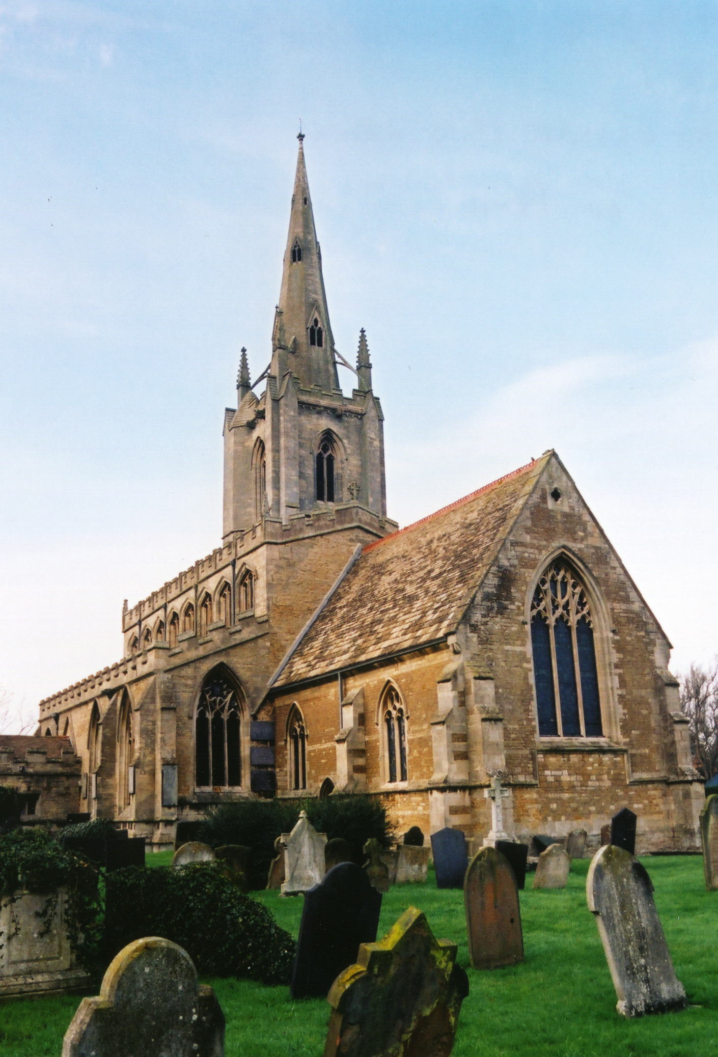
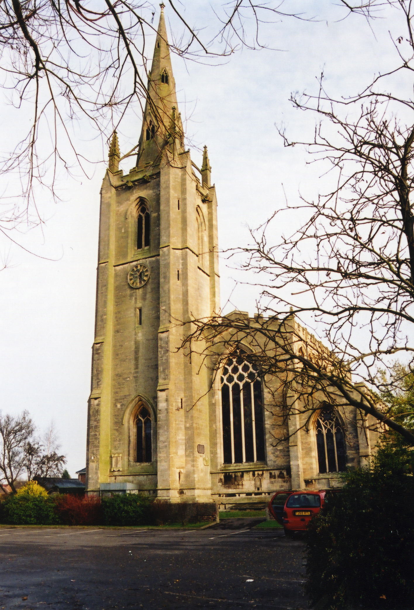
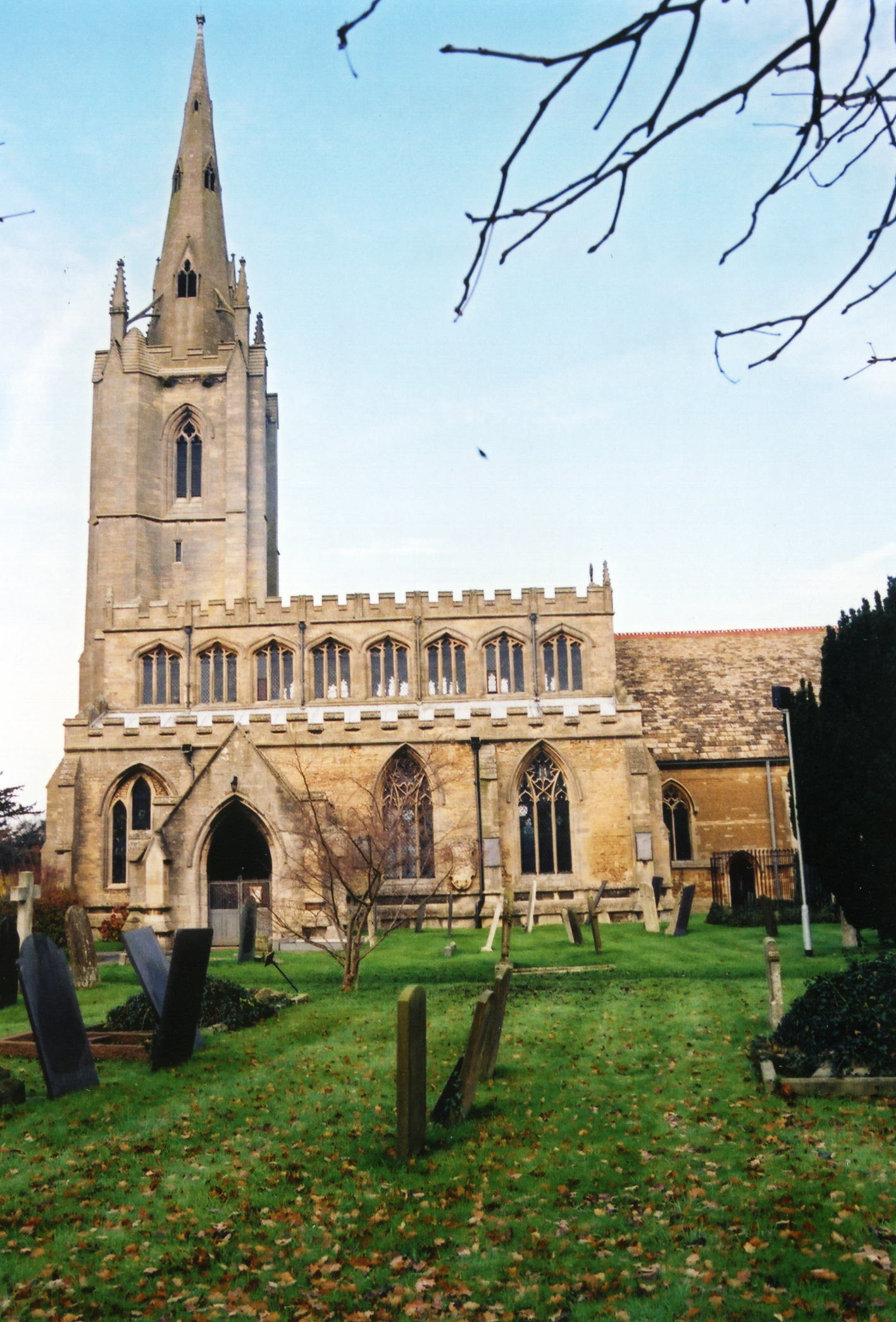
- Here are three photos of St. Andrew's church, taken by Ron COLE (who retains the copyright):


- The Anglican parish registers exist from 1561.
- We have a handful of entries in our parish register extract. Your additions to this are welcome.
- If you are a PICKWORTH or GOULD researcher, you'll enjoy our quadruplets report.
- The Lincolnshire FHS has published several marriage indexes and a burial index for the Aveland and Ness Deanery to make your search easier.
- The Calvanistic Baptist Chapel was built in 1786.
- The Wesleyan Methodist Chapel was built in 1829 and rebuilt in 1906.
- In addition, there was another Baptist chapel in the parish. The Primitive Methodists built their's in 1868. Another Primitive Methodist chapel followed in 1902.
- For more on researching these chapel records, see our non-conformist religions page.
- Check our Church Records page for county-wide resources.
- The parish was in the Aslackby sub-district of the Bourne Registration District.
- Check our Civil Registration page for sources and background on Civil Registration which began in July, 1837.
Billingborough is both a large village and a parish 104 miles north of London and 9 miles NNE of Bourne. The B1177 road passes through the centre of the parish. Horbling parish lies to the north, just across the Ouse Mare Lode stream. The South Forty Foot Drain completes the eastern border. The old Car Dyke passes just east of the village. The parish encompasses about 2,200 acres.
For the visitor with a little time to spare, there's nothing like a visit to Hansens Handmade Chocolates on the High Street.
If you are planning a visit:
- By automobile, take the A52 trunk road between Grantham and Boston and turn south onto the B1177 arterial. Pass through Horbling and the next village is Billingborough.
- See our touring page for visitor services.
The National Gazetteer of Great Britain and Ireland - 1868
- Ask for a calculation of the distance from Billingborough to another place.
- Jonathan THACKER has a photograph of Spring Well, a Chalybeate spring in the heart of the village, on Geo-graph, taken in July, 2019.
- The Billingborough and Horbling Gas Works were erected here in 1864.
- A Public Hall was erected here in 1865, built of red brick with stone dressings. The Hall could hold 400.
- The village hosted a County Police Station in 1900. Robert CARTER was the sergeant.
- The Fortescue Arms is an imposing whitewashed public house in the village High Street, built over 300 years ago. Rex NEEDLE has a photograph of the Fortescue Arms on Geo-graph, taken in September, 2000.
- J. THOMAS has a photograph of the 17th century George and Dragon Inn in High Street on Geo-graph, taken in April, 2012.
- These are the names associated with the George and Dragon in various directories:
| "Year" | Person |
|---|---|
| 1842 | Sar. JOHNSON, Vict. |
| 1868 | Mrs. Sarah JOHNSON |
| 1872 | Edward JOHNSON, vict. |
| 1882 | Edward JOHNSON, vict. |
| 1900 | Robert WADSLEY |
| 1913 | Edward SMITH |
| 1919 | Newcomb PECK |
| 1930 | Geo. W. BOOTH |
Edward JOHNSON, above, was born in Billingborough, LIN, circa 1836. His mother, Sarah, was born in France.
- Buckminster Hall was the residence of Lieut.-Col Albert De BURTON in 1900.
- The village also had "Old Hall", which was a large mansion in the Tudor style. In the 18th and 19th Centuries it was the home of the TOLLER family. Early in the 1900s, this was divided into three residences.
- Old Hall is Grade II* rated with English Heritage. It is now a home for the elderly.
- The national grid reference is TF 1134.
- You'll want an Ordnance Survey Explorer map, which has 2.5 inches to the mile scale.
- See our Maps page for additional resources.
You can see maps centred on OS grid reference TF117343 (Lat/Lon: 52.894553, -0.341051), Billingborough which are provided by:
- OpenStreetMap
- Google Maps
- StreetMap (Current Ordnance Survey maps)
- Bing (was Multimap)
- Old Maps Online
- National Library of Scotland (Old Ordnance Survey maps)
- Vision of Britain (Click "Historical units & statistics" for administrative areas.)
- English Jurisdictions in 1851 (Unfortunately the LDS have removed the facility to enable us to specify a starting location, you will need to search yourself on their map.)
- Magic (Geographic information) (Click + on map if it doesn't show)
- GeoHack (Links to on-line maps and location specific services.)
- All places within the same township/parish shown on an Openstreetmap map.
- Nearby townships/parishes shown on an Openstreetmap map.
- Nearby places shown on an Openstreetmap map.
- In 1912 Lieut.-Col. Albert De BARTON resided in the parish in Buckminster Hall. The last name is rendered as "de BURTON" in the 1881 census. He was born in London, but was a Captain in the Royal South Lincolnshire Militia in 1881 with three adult children born in Lincolnshire. In 1901, he is Lieutenant-Colonel, living in Billingborough, still with wife Fanny V., but the children are not with them - only three servants
- In the churchyard there is one gravestone for a WWI casualty and two for WWII. See the Traces of War website.
- David HITCHBORNE has a photograph of one of the WWII Memorials in the churchyard on Geo-graph, taken in August, 2013.
For a photograph of the Billingborough War Memorial and the names on the plaques in the church, see the Roll of Honour site.
- Michael Peck advises: "The WW2 memorial at St Andrews Church, Billingborough has been recorded. It shows no numbers, ranks or arms of service. Names recorded are:"
WW2:
- Cyril BRYANT
- Ralph Hilton CREDLAND
- Roy Hardy FREEMAN
- Robert Walter IRONMONGER
- Stephen LAMB
- Frank Henry MEADS
- Tom SPENSER
There are also 3 private memorials in the church:
- To Sgt Ralph H CREDLAND Royal Air Force VR died 28 Jan 1942.
- To Leslie Grosvenor HODGKINSON Royal Field Artillery, eldest son of Charles Grosvenor HODGKINSON and Mary. Born St Andrews Day 1893 and killed in action near Ypres 1917 (no actual date mentioned), aged 23.
- To 2nd Lieut Charles Reginald WINCKLEY (Sherwood Foresters). Killed in France 20th July 1916, aged 22. Second son of Revd Charles R Thorold WINCKLEY of Billingborough.
Steve Morse adds:
- HODGKINSON Leslie G - Killed 28/07/1917 (three days prior to 3rd Ypres. He was a gunner in 'B' Battery, 58th Brigade RFA service no 20981.
- WINCKLEY Charles R - 15th Bn Sherwood Foresters, The address for his parents is given as Leamington, Warwickshire.
Julian P. GUFFOGG has a photograph of the Stained glass window memorial on Geo-graph, taken in February, 2016.
There are three Commonwealth War Graves in the Billingborough churchyard:
- R. CHRISTIAN, priv., Durham Light Inf., died 22 Nov. 1918, son of Elizabeth CHRISTIAN, Kirkby Underwood.
- Cyril Arthur BRYANT, srgt., 9 Sqdn. RAF, 24, died 30 Oct. 1939.
- Roy Hardy FREEMAN, ldg. airman, RN (HMS Nightjar), died 23 Oct. 1943, son of William Hardy and Charlotte Lilian FREEMAN, Billingborough.
- In the 1086 Domesday Book, the village name is rendered as Billingeburg, from the Old English Bill+inga+burh meaning "stronghold of the followers of Bill".
[A. D. Mills, "A Dictionary of English Place-Names," Oxford University Press, 1991]
- This place was an ancient parish in the county of Lincoln and became a modern Civil Parish when those were established.
- The parish was in the ancient Aveland Wapentake in the South Kesteven district in the parts of Kesteven.
- You may contact the Billingborough Parish Council regarding civic or political issues, but they are NOT staffed to assist you with family history searches.
- For today's district governance, contact the South Kesteven District Council.
- Bastardy cases would be heard in the Bourne petty session hearings.
- The Common Land was enclosed here in 1770.
- The Charities for the poor amounted to £41 per year in 1900. There are stone tablets in the church which record several gifts for the Charities.
- After the 1834 Poor Law Amendment Act reforms, the parish became part of the Bourne Poor Law Union.
The parish grew quickly in the 1800s. With the coming of the railroads around 1845, the population soared.
Year Inhabitants 1801 537 1831 831 1841 999 1851 1,048 1871 1,227 1891 1,123 1911 964
- A Council School was built here in 1876 to hold up to 400 children. In 1918, only 143 children attended.
- For more on researching school records, see our Schools Research page.
