Hide
Binbrook
hide
Hide
hide
Hide
hide
Hide
Hide
hide
Hide
Hide
In 1882, the parish opened its own library. In 1913, Miss Mabel H. GILL was the librarian.
The Library at Louth will prove useful in your research.
Peter WOOD has a nice photograph of the Burial Ground at the parish church on Geo-graph, taken in April, 2018.
- The parish was in the Binbrook sub-district of the Louth Registration District.
- Check our Census Resource page for county-wide resources.
- The table below gives census piece numbers, where known:
| Census Year | Piece No. |
|---|---|
| 1841 | H.O. 107 / 627 |
| 1851 | H.O. 107 / 2112 |
| 1861 | R.G. 9 / 2384 |
| 1871 | R.G. 10 / 3405 |
| 1891 | R.G. 12 / 2609 |
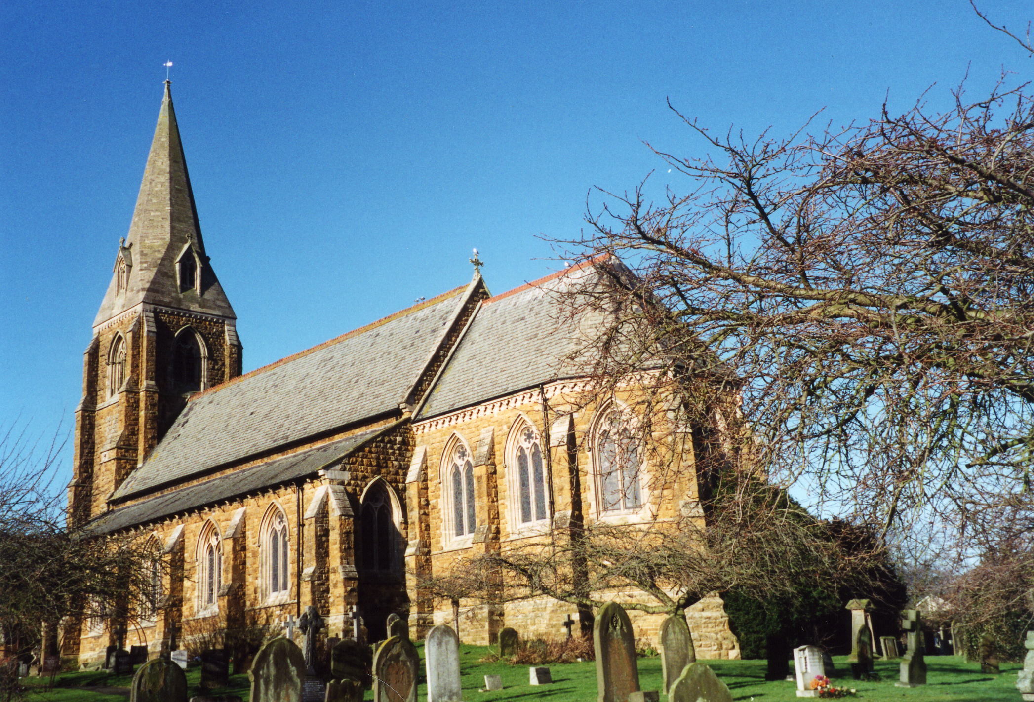
- Originally, there were two Anglican ecclesiastical parishes here: Saint Mary and Saint Gabriel. They were merged to create one church and civil parish. St. Gabriel Church was in poor shape and fell down in 1822. St. Mary's Church, a small building, was pulled down in 1867.
- The Anglican parish church was replaced with a new building, dedicated to Sts. Mary and Gabriel.
- The building was consecrated on 3 August, 1869.
- The church can seat about 555 people.
- Richard CROFT has a photograph of St. Mary & St. Gabriel's Church on Geo-graph, taken in August, 2005.
- Here is a photo of the church, taken by Ron COLE (who retains the copyright):

- The parish registers date from 1600.
- We have the beginning of a Parish Register Extract as a text file for your review. Your additions and corrections are welcome.
- The LFHS has published several marriage and burial indexes for the Haverstoe Deanery to make your search easier.
- Check our Church Records page for county-wide resources.
- The village had a Wesleyan Methodist chapel built here in 1815.
- The village had a Primitive Methodist chapel built here in 1836.
- The Primitive Methodists replaced their chapel with a small chapel here, built in 1879. The United Methodists built theirs in 1855 and the Wesleyan Methodists built a new one in 1877. There is still a Methodist chapel on High Street, but the website author does not know the denomination.
- For information and assistance in researching these chapels, see our non-conformist religions page.
- The parish was in the Binbrook sub-district of the Louth Registration District.
- Check our Civil Registration page for sources and background on Civil Registration which began in July, 1837.
Binbrook is a parish and a village northwest of Louth and about 12 miles south of Grimsby. The parish is in the Wold Hills. Kirmond le Mire parish lies to the west. The parish covers about 5,400 acres, so it is larger than average.
A small, rapid brook runs through the village. If you are planning a visit:
- Stop by the Village Hall and get a schedule of forthcoming events. Jonathan THACKER has a photograph of the Village Hall on Geo-graph, taken in November, 2010.
- By automobile, take the B1203 south out of Grimsby and head for Tealby.
- Watch for the Village Sign as photographed by John BEAL on Geo-graph, taken in September, 2008.
- Visit our touring page for more sources.
- Ask for a calculation of the distance from Binbrook to another place.
- In 1840, a Temperance Hall was built in the village. It was still active in 1911.
- In 1852, a Police Station was built in the village. It included a lock-up and a house for the sergeant.
- Prior to 1911, a weekly market was held in the village.
- Up near Orford hamlet, an annual Open Farm event hosts a gathering of farm tractors. Chris ? has several photographs of Tractors arriving for the event on Geo-graph, taken in June, 2013.
- The Marquess of Granby Inn served travellers since 1695. In 1842, John TOPLIS was the victualler. In 1913, Mrs. Elizabeth P. MEANWELL was the proprietress. During World War II, the Inn was popular with RAF personnel and was run by Ms. Rene TREVOR. The Inn was restored and converted to offices in 1999.
- Stewart MARSH has a photograph of the former Marquess of Granby on Geo-graph, taken in July, 2019.
- John BEAL has a photograph of the Marquess of Granby on on Geo-graph, taken in September, 2008.
- Jonathan THACKER has a photograph of Binbrook Manor on Geo-graph, taken in November, 2010.
- See our Maps page for additional resources.
You can see maps centred on OS grid reference TF209940 (Lat/Lon: 53.428937, -0.181837), Binbrook which are provided by:
- OpenStreetMap
- Google Maps
- StreetMap (Current Ordnance Survey maps)
- Bing (was Multimap)
- Old Maps Online
- National Library of Scotland (Old Ordnance Survey maps)
- Vision of Britain (Click "Historical units & statistics" for administrative areas.)
- English Jurisdictions in 1851 (Unfortunately the LDS have removed the facility to enable us to specify a starting location, you will need to search yourself on their map.)
- Magic (Geographic information) (Click + on map if it doesn't show)
- GeoHack (Links to on-line maps and location specific services.)
- All places within the same township/parish shown on an Openstreetmap map.
- Nearby townships/parishes shown on an Openstreetmap map.
- Nearby places shown on an Openstreetmap map.
- Binbrook was an excellent location for an airfield. In July 1940, 12 Squadron RAF and 142 Squadron RAF was stationed here. In May 1943, 460 Squadron RAAF had the field. In September 1945, 12 Squadron RAF were back. In April 1946, 9 Squadron RAF with their Canberra bombers took over.
- In 1960, the field was closed, but in June 1962, Fighter Command reactivated the field.
- Richard CROFT has a photograph of the Officers' Mess on Geo-graph, taken in March, 2009.
- Michael PECK tells us: "There are over 50 soldier/airman headstones in Binbrook churchyard, and these were all recorded and photographed for The British War Memorial Project." As a teaser, he presents one name:
416113 Sgt F. E. BISHOP Royal Australian Air Force, died 19th Sept 1942 at age 29.
- Adrian S. PYE has a phtograph of the RAAF Squqdron 460 Memorial on Geo-graph, taken in August, 2019.
- Be sure to read RAF Binbrook in the Second World War.
For a photograph of the Binbrook War Memorial and the list of names on it, see the Roll of Honour site.
- In the 1086 Domesday Book, the village name is rendered as Binnibroc, from the Old English Binni+broc meaning "place enclosed by the brook".
[A. D. MILLS, "A Dictionary of English Place-Names," Oxford University Press, 1991].
- The name is often spelled "Binbroke".
- The hamlet of Orford, about a mile north of Binbrook village, was annexed to the parish of Stainton le Vale in Victoria's reign.
- The parish was in the ancient Walshcroft Wapentake in the East Lindsey district in the parts of Lindsey.
- You may contact the Binbrook Parish Council regarding civic or political issues, but they are NOT staffed to help you with family history searches.
- For today's district governance, see the East Lindsey District Council.
- Bastardy cases would be heard on the 1st Tuesday each month at the Market Rasen petty session hearings.
- As a result of the 1834 Poor Law Amendment Act reforms, the parish became part of the Louth Poorlaw Union.
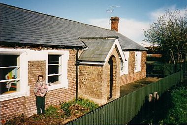
- A Public Elementary School was built in 1842 and later enlarged.
- Here is a list of names from the Admission Records for Binbrook School, 1909 to 1911: BOCOCK, BONTOFT, BRYAN, BURNETT, CHAPMAN, CLARK, COUSINS, DAVY, DERRY, DOBBS, EVISON, FIELDSEND, GOODWIG, HIDES, HILDRED, HOLMES, HURST, JACKLIN, JARVIS, JOHNSON, LOCKING, METCALFE, REED, RHODES, ROCKCIFFE, SANDERSON, SCRIMSHAW, SNELL, STRINGER, TINKER, TOPLESS, TRAVES, and WILSON.
- For more on researching school records, see our Schools Research page.
- Here is a photo of Binbrook School, taken by Debbie SHEARWOOD (who retains the copyright):

