Hide
Boothby Graffoe
hide
Hide
hide
Hide
hide
Hide
Hide
hide
Hide
[Transcribed from The National Gazetteer of Great Britain and Ireland 1868]
by Colin Hinson ©2020
Hide
- The parish was in the South West sub-district of the Lincoln Registration District.
- There is an index and transcription of the 1861 census now available on the Wendy PARKINSON web site.
- Check our Census Resource page for county-wide resources.
- The table below shows census piece numbers, where known:
| Census Year | Piece Numbers |
|---|---|
| 1841 | H.O. 107 / 615 |
| 1851 | H.O. 107 / 2104 |
| 1861 | R.G. 9 / 2354 |
| 1871 | R.G. 10 / 3364 |
| 1891 | R.G. 12 / 2587 |
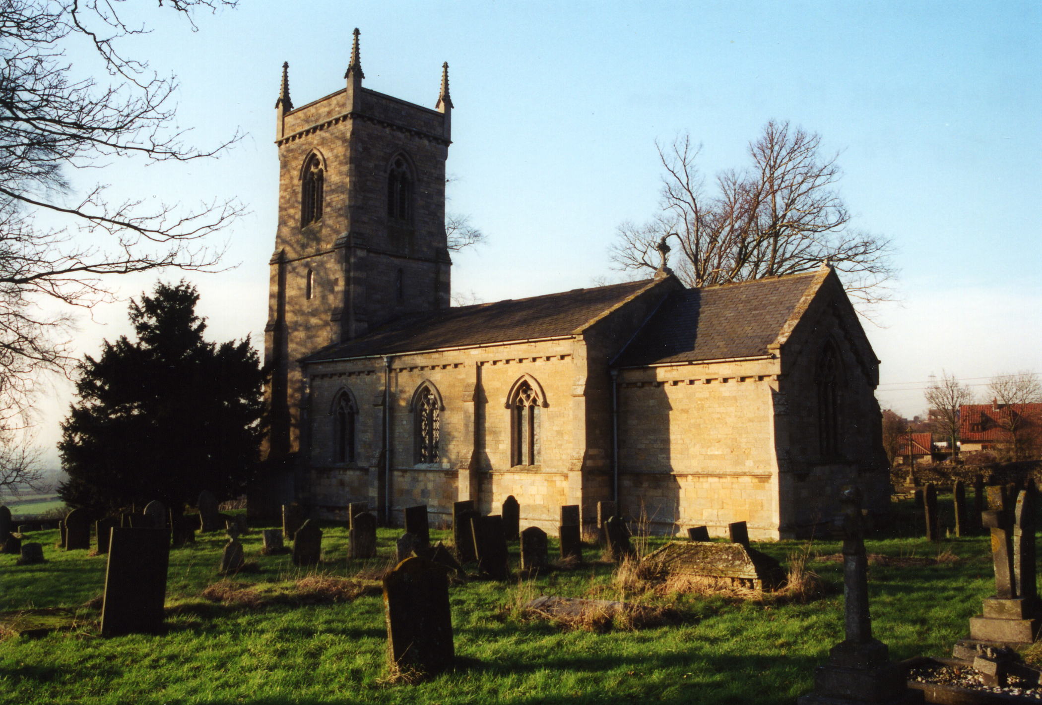
- The Anglican parish church is dedicated to Saint Andrew.
- The first known church here was blown down by a hurricane in the year of the Great London Fire.
- The second was torn down in 1842 and the third church erected that same year. The existing church is built of stone.
- The church seats about 130.
- Richard CROFT has a photograph of St. Andrew's Church on Geo-graph, taken in January, 2006.
- Here is a photo of St. Andrew's church, taken by Ron COLE (who retains the copyright):

- The Anglican parish register dates from 1720.
- The Lincolnshire Archives have the parish register from 1720.
- The Lincolnshire FHS has published several marriage indexes and a burial index for the Graffoe Deanery to make your search easier.
- Check our Church Records page for county-wide resources.
- The parish was in the South West sub-district of the Lincoln Registration District.
- Check our Civil Registration page for sources and background on Civil Registration which began in July, 1837.
This village and parish lie 8 miles south of Lincoln and between Coleby and Navenby. Aubourn parish is to the northwest and Metheringham parish to the east. The parish covers just over 2,000 acres.
The village sits high on the Cliff range, near the old Ermine Street (the Roman road from London to the Humber River). If you are planning a visit:
- Take the A15 trunk road south out of Lincoln and turn off at the B1202 road. Take that west to Boothby Graffoe village, just across the A607 trunk road.
- Matthew SMITH provides a photograph of the Main Street on Geo-graph, taken in October, 2005.
- See our touring page for more sources.
The National Gazetteer of Great Britain and Ireland - 1868
"BOOTHBY, (or Boothby-graffo), a parish in the higher division of the wapentake of Boothby-Graffo, parts of Kesteven, in the county of Lincoln, 8 miles to the S. of Lincoln, its post town. A castle, called Somerton Castle, was founded here in 1305, by Anthony Bee, Bishop of Durham. It was defended by a double moat, and occupied a space about 250 feet in length and 200 feet in breadth. Circular towers stood at the four angles of the fortress. After the battle of Poictiers, John, King of France, was confined in this castle, in the custody of Sir Saier de Rochford, who was allowed 2s. a day for his services. The living is a rectory* in the diocese of Lincoln, of the value of £638, in the patronage of J. Fullerton, Esq. The church is dedicated to St. Andrew. The ruins of the castle are about 2 miles from the village.
- Ask for a calculation of the distance from Boothby Graffoe to another place.
- Anthony BEKE, Bishop of Durham, obtained a license from Edward I to crenellate his mansion at "Saubretonne" or "Somerton" in this parish. Portions of this structure remain. It is locally known as Somerton Castle.
- Boothby Hall was the seat of Charles Edward MARFLEET. It was erected in 1867, built of stone.
- The national grid reference is SK 9859.
- You'll want an Ordnance Survey "Explorer #272" map, which has 2.5 inches to the mile scale.
- You can get a map of the Village Conservation Area in Portable Document File format (requires Adobe Reader) from the North Kesteven District Council.
- See our Maps page for additional resources.
You can see maps centred on OS grid reference SK986593 (Lat/Lon: 53.121767, -0.528082), Boothby Graffoe which are provided by:
- OpenStreetMap
- Google Maps
- StreetMap (Current Ordnance Survey maps)
- Bing (was Multimap)
- Old Maps Online
- National Library of Scotland (Old Ordnance Survey maps)
- Vision of Britain (Click "Historical units & statistics" for administrative areas.)
- English Jurisdictions in 1851 (Unfortunately the LDS have removed the facility to enable us to specify a starting location, you will need to search yourself on their map.)
- Magic (Geographic information) (Click + on map if it doesn't show)
- GeoHack (Links to on-line maps and location specific services.)
- All places within the same township/parish shown on an Openstreetmap map.
- Nearby townships/parishes shown on an Openstreetmap map.
- Nearby places shown on an Openstreetmap map.
For a photograph of the Boothby Graffoe War Memorial and the names inscribed on it, see the Roll of Honour site.
- This place was an ancient parish in county Lincoln and became a modern Civil Parish when those were established.
- The parish was in the ancient Graffoe Wapentake in the North Kesteven division of the county, in the parts of Kesteven.
- For today's district governance, see the North Kesteven District Council.
- Bastardy cases would be heard in the Lincoln South petty session hearings.
- The Common Lands were enclosed here in 1774.
- As a result of the 1834 Poor Law Amendment Act, the parish became part of the Lincoln Poor Law Union.
- A National School was built here in 1851 to hold up to 50 children. Average attendance was about half that number.
- For more on researching school records, see our Schools Research page.
