Hide
Burgh le Marsh
hide
Hide
hide
Hide
hide
Hide
Hide
hide
Hide
[Transcribed from The National Gazetteer of Great Britain and Ireland 1868]
by Colin Hinson ©2020
Hide
- Michael GARLICK has a photograph of the parish churchyard on Geo-graph, taken in September, 2016.
- The parish was in the Burgh sub-district of the Spilsby Registration District.
- Check our Census Resource page for county-wide resources.
- The table below gives census piece numbers, where known:
Census
YearPiece No. 1841 H.O. 107 / 629 1861 R.G. 9 / 2376 1871 R.G. 10 / 3393B 1891 R.G. 12 / 2604
- Formerly, there were two churches here. No trace remains of Saint Mary's Church.
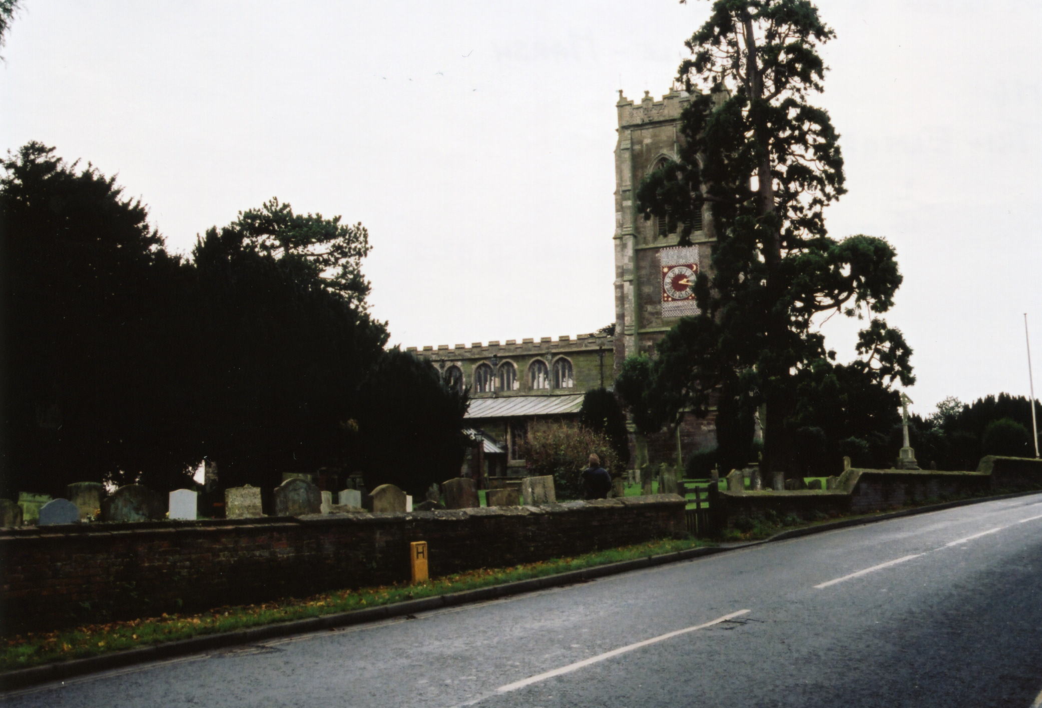
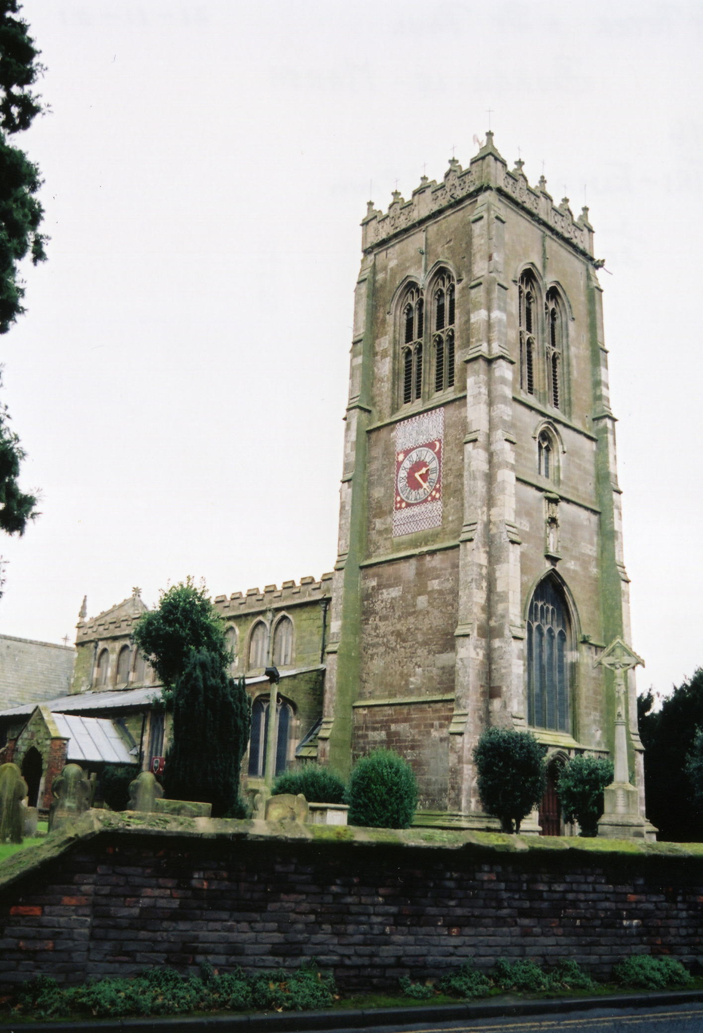
- The Anglican parish church is on Glebe Rise and is dedicated to St. Peter & St. Paul.
- A Mission Chapel was erected in the marsh, two miles from the town, in 1867.
- A photograph of the Anglican parish church is at the Wendy PARKINSON English Church Photographs site.
- Here are two photographs of St. Peter & St. Paul Church supplied by Ron COLE (who retains the copyright):


- Parish registers date from 1538, the first year they were used, but are more readable after 1562.
- We have a partial Parish Register Extract text file for your use. Your additions and corrections are most welcome.
- The LFHS has published several marriage indexes and a burial index for the Calcewaith and Candleshoe Deanery to make your search easier.
- Check our Church Records page for county-wide resources.
- The Baptists (since 1783) and the Wesleyan Methodists (since 1816) have chapels in Burgh le Marsh. The Methodist chapel is on Jacksons Lane.
- For information and assistance in researching these chapels, see our non-conformist religions page.
- The parish was in the Burgh sub-district of the Spilsby Registration District.
- Check our Civil Registration page for sources and background on Civil Registration which began in July, 1837.
Burgh le Marsh is both a village and a parish that lies near the Orby Marsh about 8 miles east of Spilsby and 5 miles west of Skegness on the A158 trunk road. Croft parish lies to the south, Orby to the north, and Winthorpe parish to the east. The parish contains 4,231 acres of land.
The village itself sits on a small rise above the marshland. Once a Roman settlement, Burge le Marsh has been a thriving Market Town since the 16th century. Time has caught up and the town now has it's own web site. If you are planning a visit:
- Within the UK, the town offers a free booklet of information via the web site.
- One of the present sites for kids' tours is the local Windmill, built in 1813, open for tours from 2pm to 5pm on Sundays.
- Nearby, Sycamore Lakes offers fishing.
- Do you need a new flag, or want to design one for your new country? Then visit Newton Newton, the flagmakers.
- Visit our touring page for more sources.
The National Gazetteer of Great Britain and Ireland - 1868
- Ask for a calculation of the distance from Burgh le Marsh to another place.
- The Old Roman Road runs through the town from Skegness to Worthingham. (It is now the A158 for most of its route).
- Burgh le Marsh became a market town in 1401 with the granting of a town charter.
- A county police station was built here in 1845. Amos CRAWSHAW was the police sergeant in 1881. In 1911, Frederick BURSNALL was the constable in charge.
- In 1851, fossil bones were found in the parish.
- A gas works was first erected here in 1858.
- See our "Maps page for additional resources.
You can see maps centred on OS grid reference TF501649 (Lat/Lon: 53.160101, 0.243759), Burgh le Marsh which are provided by:
- OpenStreetMap
- Google Maps
- StreetMap (Current Ordnance Survey maps)
- Bing (was Multimap)
- Old Maps Online
- National Library of Scotland (Old Ordnance Survey maps)
- Vision of Britain (Click "Historical units & statistics" for administrative areas.)
- English Jurisdictions in 1851 (Unfortunately the LDS have removed the facility to enable us to specify a starting location, you will need to search yourself on their map.)
- Magic (Geographic information) (Click + on map if it doesn't show)
- GeoHack (Links to on-line maps and location specific services.)
- All places within the same township/parish shown on an Openstreetmap map.
- Nearby townships/parishes shown on an Openstreetmap map.
- Nearby places shown on an Openstreetmap map.
For a photograph of the Burgh le Marsh War Memorial and the list of names on it, see the Roll of Honour site.
- The name Burgh le Marsh is from the Old English burh+le+marsh, or "fortification in the marshland". It appeared in the 1086 Domesday Book as Burg.
[A. D. Mills, "A Dictionary of English Place-Names," Oxford University Press, 1991]
- Locals pronounce the name as "Burra-lee Marsh".
- It is also common to hear the name as "Burley Marsh," which is close to the Old English pronunciation.
- The parish was in the Marsh division of the ancient Candleshoe Wapentake in the East Lindsey district in the parts of Lindsey.
- You can contact the local Town Council regarding civic or political issues, but they are NOT staffed to assist you with family history questions.
- For today's district governance, see the East Lindsey District Council.
- Bastardy cases would be heard in the Spilsby petty session hearings held every other Monday.
- In 1503, John HOLDEN left 54 acres of land in his will, in this and neighboring parishes, to support the charitable needs of the parish.
- The poor parishioners have two cottages and five acres of land left by Mary VEALE in 1680.
- After the Poor Law Amendment Act reforms of 1834, the parish became part of the Spilsby Poor Law Union.
- Palmer's Grammar School was founded in Burgh le Marsh in 1726, by Jane Palmer, of Newark, but they didn't have their own school house until 1840.
- The Wesleyan Methodists contributed 500 Pounds to build a Day School in 1856. In 1871 it had 70 students.
- A National School was added about 1864. And in 1868 a Middle Class School was erected at the west end of town.
- St. Paul's Missionary College was opened in 1878 to train students for foreign missionary work. The chapel was completed in 1907.
- For more on researching school records, see our Schools Research page.
