
Hide
Burwell
hide
Hide
hide
Hide
hide
Hide
Hide
hide
Hide
[Transcribed from The National Gazetteer of Great Britain and Ireland 1868]
by Colin Hinson ©2020
Hide
The Louth Library is an excellent resource with a Local History section and a Family History section.
- The church photographs below show portion of the churchyard burials.
- Peter WOOD has a photgraph of the Burial Ground on Geo-graph, taken in February, 2019.
- The parish was in the Louth sub-district of the Louth Registration District.
- Check our Census Resource page for county-wide resources.
- The table below gives census piece numbers, where known:
| Census Year | Piece No. |
|---|---|
| 1841 | H.O. 107 / 629 |
| 1851 | H.O. 107 / 2111 |
| 1861 | R.G. 9 / 2382 |
| 1871 | R.G. 10 / 3404 |
| 1881 | R.G. 11 / 3263 |
| 1891 | R.G. 12 / 2608 |
| 1901 | R.G. 13 / 3084 |
- In the Norman era, there was a priory of Benedictine monks here, founded by John de HAY. It was affiliated with the abbey at Bordeaux. Burwell Priory was dissolved in 1427 and sold to the college of Tattershall.
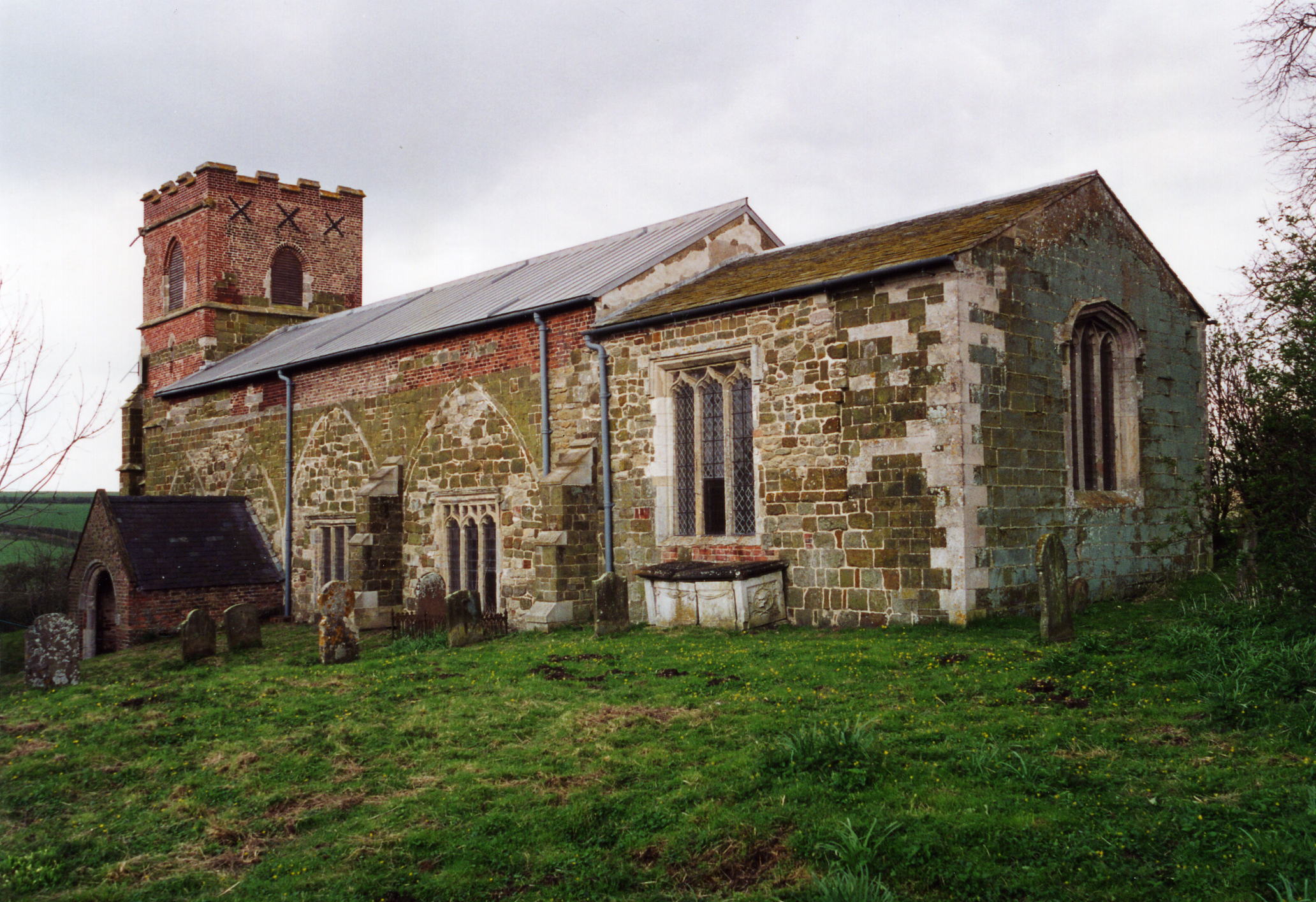
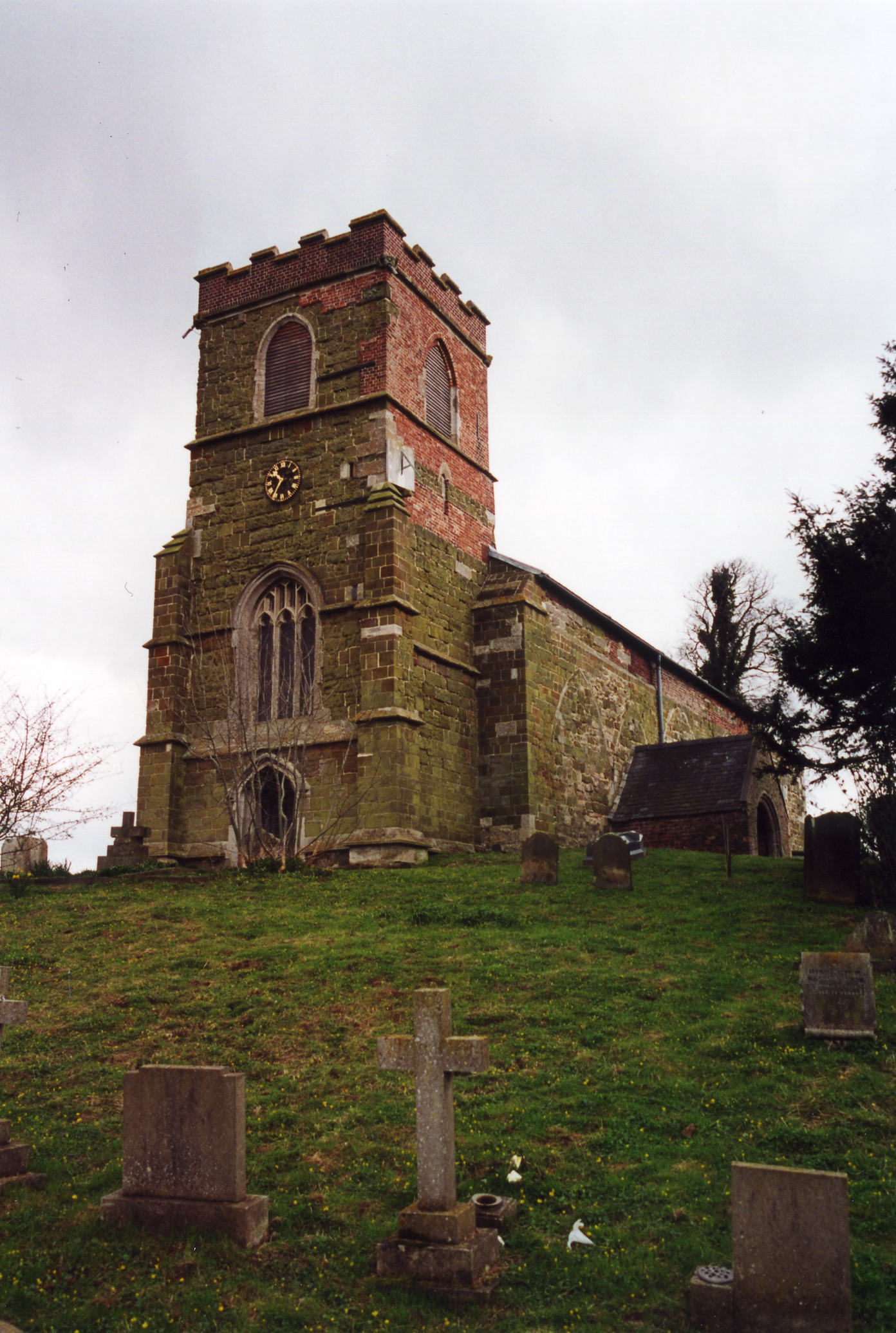
- The Anglican parish church is dedicated to Saint Michael.
- The church is an ancient building of apparent Norman origin. The church was restored in 1911.
- The church seats 160.
- The vicarage was annexed to Muckton rectory in 1841. The curacy of Walmsgate was united with Burwell. Walmsgate no longer has a parish church of its own.
- The Diocese of Lincoln declared this church redundant in May, 1981, and the church closed in 1982 and was turned over to the Redundant Churches Fund.
- There is a photograph of the Anglican parish church on the Wendy PARKINSON Church Photos web site, taken by Paul Fenwick.
- David HITCHBORNE has a photograph of St. Michael from the side on Geo-graph, taken in April, 2004.
- Andrew TELFER has a photograph of the church tower on Geo-graph, taken in September, 2005.
- Here are two photos of the church, taken by Ron COLE (who retains the copyright):
- Anglican parish registers exist from 1586. As of late 2004, the registers have not been deposited in the Lincs. Archives, nor have they been filmed by the LDS Family History Library. And copies of the Bishop's Transcripts have not been deposited either.
- The Lincolnshire FHS has published several Marriage indexes and a Burial index for the Louthesk Deanery to make your search easier.
- Kelly's 1900 Directory of Lincolnshire places the parish in the rural deanery of Calcewaith No. 1.
- Check our Church Records page for county-wide resources.
- The parish was in the Louth sub-district of the Louth Registration District.
- Check our Civil Registration page for sources and background on Civil Registration which began in July, 1837.
Burwell is a village and a parish in the Wold Hills of Lincolnshire, situated on the Spilsby road 5 miles south-east of Louth, and 3 miles west of Authorpe. The parish covers just over 2,000 acres.
If you are planning a visit, see:
- By automobile, take the A16 main road between Louth and Spilsby. The road passes thru the centre of Burwell village.
- Alex McGREGOR has a photograph of the Village Sign on Geo-graph, taken in May, 2011.
- See our touring page for visitor services.
The National Gazetteer of Great Britain and Ireland - 1868
- Ask for a calculation of the distance from Burwell to another place.
- Burwell was granted the right to hold an annual market in the late 13th century.
- The Burwell Butter Cross has been converted into the Burwell Parish Hall. Richard CROFT has a photograph of the Butter Cross at Geo-graph, taken in May, 2007.
- Richard CROFT has a photograph of the Stag's Head P. H. on Geo-graph, taken in May, 2007.
- These are the names associated with the Stag's Head Inn in various directories:
| Year | Person |
|---|---|
| 1842 | Thos. ROBERTSON, vict. |
| 1868 | Mrs. Mary ROBINSON |
| 1872 | Thomas William ODLING, victualler |
| 1882 | Mrs. Eliza ODLING, vict. |
| 1900 | Frederick William BRIGGS, wheelwright |
| 1913 | Tom SYKES |
| 1919 | Tom SYKES |
| 1930 | Mrs. SYKES |
Thomas W. ODLING, above, was born in Burwell, LIN, circa 1824. Eliza ODLING, above, was born in Burwell, LIN, circa 1826. Tom SYKES was born in Louth Park cica 1862.
- The Manor House stood in Burwell Park. The park covered some 200 acres. IT was built in 1760 for Matthew LISTER. It was demolished in 1958, and only the stables remain.
- Mandeville Hall, (off Reach Road) officially opened in 2011, has three halls. The venue is available for hire for weddings, private parties as well as community events. The halls can be hired individually or collectively, each with access to kitchen facilities.
- On the High street, Gardiner Memorial Hall was built in 1915 and serves as the village hall. It comprises a large hall with stage and is available for hire. There are facilities for tea/coffee making, a dedicated car park for users and full disabled access.
- See our Maps page for additional resources.
You can see maps centred on OS grid reference TF355796 (Lat/Lon: 53.296037, 0.031595), Burwell which are provided by:
- OpenStreetMap
- Google Maps
- StreetMap (Current Ordnance Survey maps)
- Bing (was Multimap)
- Old Maps Online
- National Library of Scotland (Old Ordnance Survey maps)
- Vision of Britain (Click "Historical units & statistics" for administrative areas.)
- English Jurisdictions in 1851 (Unfortunately the LDS have removed the facility to enable us to specify a starting location, you will need to search yourself on their map.)
- Magic (Geographic information) (Click + on map if it doesn't show)
- GeoHack (Links to on-line maps and location specific services.)
- All places within the same township/parish shown on an Openstreetmap map.
- Nearby townships/parishes shown on an Openstreetmap map.
- Nearby places shown on an Openstreetmap map.
For a photograph of the Burwell War Memorial plaque in the church and the names on it, see the Roll of Honour site.
- The name Burwell is from the Old English burh+wella meaning "spring by the fort". In the 1086 Domesday book, the village name is given as Burwelle.
A. D. Mills, "A Dictionary of English Place-Names," Oxford University Press, 1991.
- This place was an ancient parish in county Lincoln and became a modern Civil Parish when those were established.
- Early in its history the parish was delineated as being in the Hill Hundred.
- The parish was later in the Wold division of the ancient Louth Eske Wapentake in the East Lindsey district in the parts of Lindsey.
- You may contact the local Burwell Parish Council regarding civic or political issues. They are NOT staffed to assist you with family history questions. The Parish Council meets at the Jubilee Meeting Room at 99 The Causeway where full public meeting are held twice monthly. The parsh also holds an annual Community Meeting to discuss matters affecting all residents, usually in October.
- For today's district governance, see the East Lindsey District Council.
- Bastardy cases would be heard in the Louth petty session hearings every other Wednesday.
- After the Poor Law Amendment Act reforms of 1834, this parish became part of the Louth Poor Law Union.
- A Public Elementary School was built in 1825 to serve Burwell and the nearby parishes of Walmsgate and Muckton. It was enlarged in 1896.
- For more on researching school records, see our Schools Research page.