Hide
Cadney
hide
Hide
hide
Hide
hide
Hide
Hide
"HOUSHAM, a township in the parish of Cadney, S. division of the hundred of Yarborough, parts of Lindsey, county Lincoln, 4 miles N.W. of Caistor."
[Transcribed from The National Gazetteer of Great Britain and Ireland 1868]
by Colin Hinson ©2020
Hide
The Brigg Library is an excellent resource with a Local History section.
- The parish has an "overflow" cemetery across the street from the churchyard.
- There is a registry of burial, indexed by surname, for the period of 1813 - 1904.
- The parish was in the Brigg sub-district of the Glanford Brigg Registration District.
- Check our Census Resource page for county-wide resources
- The table below gives census piece numbers, where known:
| Census Year | Piece No. |
|---|---|
| 1841 | H.O. 107 / 630 |
| 1851 | H.O. 107 / 2116 |
| 1861 | R.G. 9 / 2398 |
| 1871 | R.G. 10 / 3428 |
| 1891 | R.G. 12 / 2625 |
| Church Lane, Cadney, Independent |
- Sometime prior to the year 1173, a small island in the Ancholme, called Ruckholme, was given to St. Gilbert and the canons of Sempringham. There they founded Newstede Priory, dedicated to the Holy Trinity. It is found on more modern maps with the name Newstead Farm.
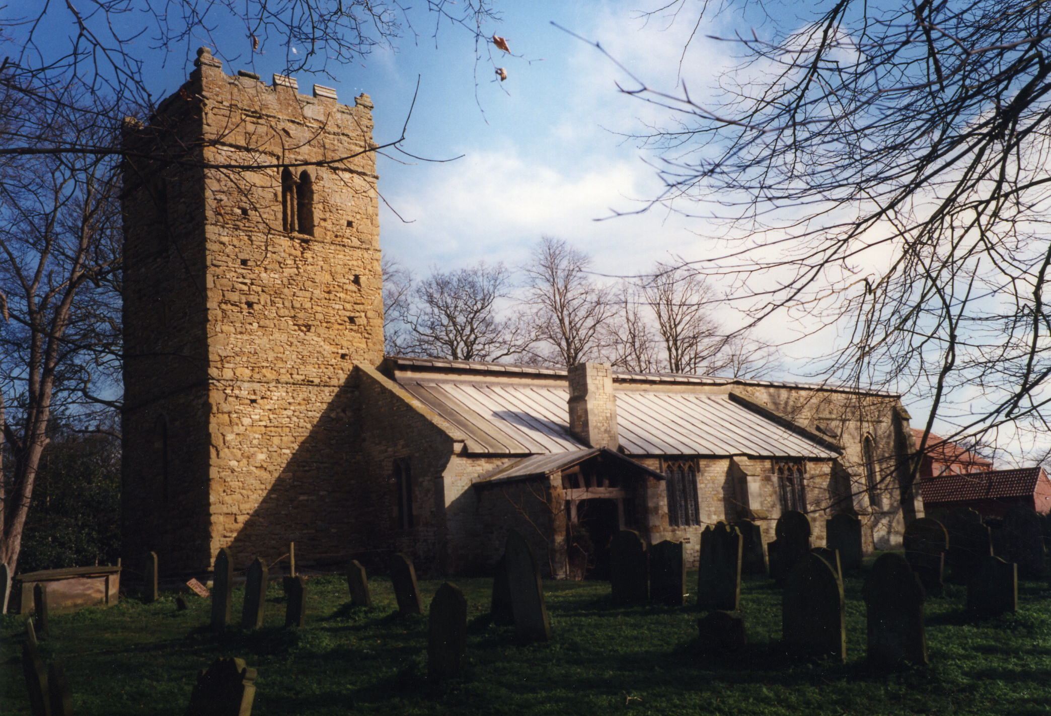
- The Anglican parish church was dedicated to All Saints.
- The church is of Norman 12th century origin.
- The church was restored in 1913.
- The church is a Grade I listed building with English Heritage.
- David HITCHBORNE has a photograph of the "church interior" on Geo-graph, taken in 2004.
- Here is a photo of the church, taken by Ron COLE (who retains the copyright):

- The Anglican parish register dates from 1564.
- We have some interesting extracts from the parish register.
- The LFHS has published several marriage indexes for the Yarborough Deanery to make your search easier.
- The Independents had a chapel in Cadney village. The Wesleyan and the Primitive Methodists both had chapels in Housham. For information and assistance in researching these chapels, see our non-conformist religions page.
- Chris has a photograph of the Primitive Methodist chapel on Geo-graph, taken in November, 2012.
- Check our Church Records page for county-wide resources.
- The parish was in the Brigg sub-district of the Glanford Brigg Registration District.
- Check our Civil Registration page for sources and background on Civil Registration which started in July, 1837.
Cadney (with Housham) is both a village and a parish in the north of Lincolnshire, just east of the River Ancholme. The parish lies about 160 miles north of London and two miles south of Brigg. The parish is part of the low cars (see our Geographic Names page) or marshes and covers about 5,000 acres.
The village of Cadney is about three miles east of the old Roman road, Ermine Street, now the A15 trunk road, near Hibaldstow. Howsham (also spelt "Housham") is a hamlet and a township in the parish, about a mile east of Cadney. If you are planning a visit:
- Take the A1084 trunk road east out of Brigg and turn south on the B1434. At Howsham (Housham), continue west to Cadney.
- Richard CROFT has a photograph of the "Village Hall" on Geo-graph, taken in June, 2013. Stop in and ask for a schedule of forth-coming events.
- Visit our touring page for more sources.
The National Gazetteer of Great Britain and Ireland - 1868
"HOUSHAM, a township in the parish of Cadney, S. division of the hundred of Yarborough, parts of Lindsey, county Lincoln, 4 miles N.W. of Caistor."
- Ask for a calculation of the distance from Cadney to another place.
- See our Maps page for additional resources.
You can see maps centred on OS grid reference TA026043 (Lat/Lon: 53.525005, -0.454464), Cadney which are provided by:
- OpenStreetMap
- Google Maps
- StreetMap (Current Ordnance Survey maps)
- Bing (was Multimap)
- Old Maps Online
- National Library of Scotland (Old Ordnance Survey maps)
- Vision of Britain (Click "Historical units & statistics" for administrative areas.)
- English Jurisdictions in 1851 (Unfortunately the LDS have removed the facility to enable us to specify a starting location, you will need to search yourself on their map.)
- Magic (Geographic information) (Click + on map if it doesn't show)
- GeoHack (Links to on-line maps and location specific services.)
- All places within the same township/parish shown on an Openstreetmap map.
- Nearby townships/parishes shown on an Openstreetmap map.
- Nearby places shown on an Openstreetmap map.
There is a single Commonwealth War Grave in Cadney churchyard for:
- George William DAY, priv., 9th Btn. Lincolnshire Rgt., age 21, died 17 March 1917. Son of William A. and A. G. DAY, of Hudson Heights, Quebec, Canada.
- The parish was in the ancient Yarborough Wapentake in the Glanford Brigg division of the county, in the parts of Lindsey.
- Kelly's 1913 Directory of Lincolnshire places this parish, perhaps erroneously, in the North Lindsey division of the county.
- For today's district governance, see the North Lincolnshire Council website.
- Bastardy cases would be heard in the Brigg petty session hearings every other Tuesday.
- William TAYLOR left 10 shillings a year for the poor out of a farm at Grassby.
- After the Poor Law Amendment Act reforms of 1834, the parish became part of the Glanford Brigg Poor Law Union in 1837.
- A British School was erected in 1847 and could hold up to 80 children.
- For more on researching school records, see our Schools Research page.
