Hide
Cammeringham
hide
Hide
hide
Hide
hide
Hide
Hide
hide
Hide
"CAMMERINGHAM, a parish in the western division of the wapentake of Aslacoe, parts of Lindsey, in the county of Lincoln, 7 miles to the N. of Lincoln, its post town. It was the site of an alien priory, founded in the reign of Henry II. Limestone is quarried in the parish. The living is a vicarage, in the diocese of Lincoln, value £160, in the patronage of Lord Monson. The church is dedicated to St. Michael, and is of modern date."
[Transcribed from The National Gazetteer of Great Britain and Ireland 1868]
by Colin Hinson ©2020
Hide
- The parish was in the North-East sub-district of the Lincoln Registration District.
- Check our Census Resource page for county-wide resources.
- The table below gives census piece numbers, where known:
Census
YearPiece No. 1841 H.O. 107 / 630 1861 R.G. 9 / 2363 1871 R.G. 10 / 3375 1891 R.G. 12 / 2596
- There was once a Praemonstratensian Priory in the parish, founded in 1155 in the reign of Henry II.
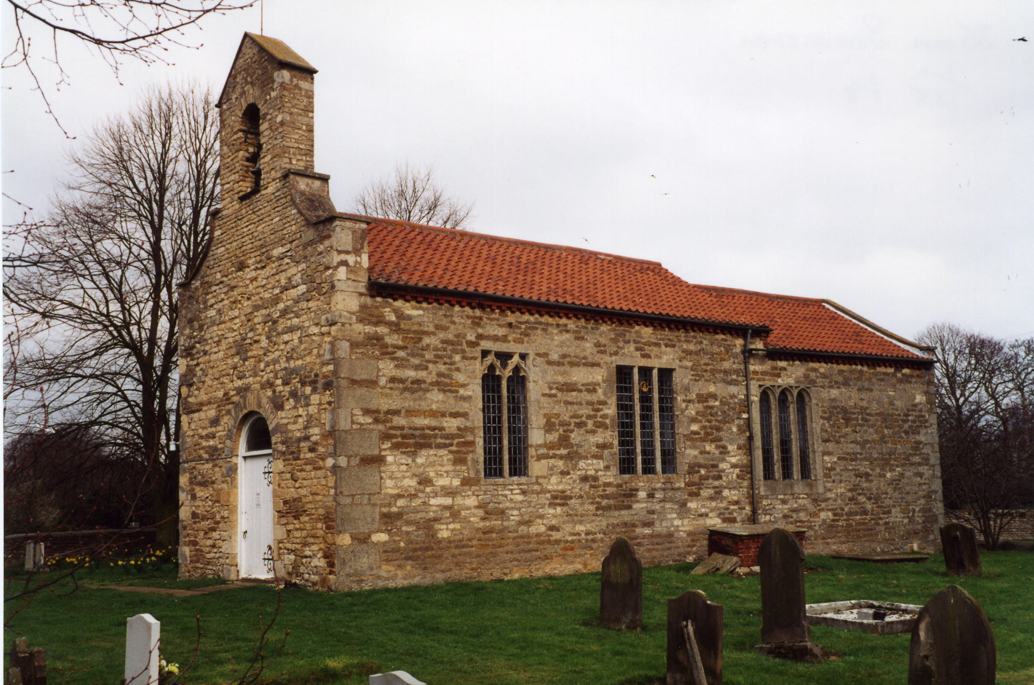
- The Anglican parish church is dedicated to Saint Michael.
- The church is considerably reduced in size from its former glory.
- The church is a grade II* structure with English Heritage.
- The church seats only 90.
- Richard CROFT has a photograph of St. Michael's Church on Geo-graph, taken in October 2005.
- Here is a photo of the church, taken by Ron COLE (who retains the copyright):

- The Anglican parish register dates from 1775.
- The LFHS has published several marriage indexes and a burial index for the Lawres Deanery to make your search easier.
- Check our Church Records page for county-wide resources.
- The parish was in the North-East sub-district of the Lincoln Registration District.
- Check our Civil Registration page for sources and background on Civil Registration which began in July, 1837.
Cammeringham is both a village and a parish 7 miles north of the city of Lincoln. Brattleby parish lies to the south and Ingham parish to the north. The parish covers just over 1,800 acres.
Cammeringham village is small. If you are planning a visit:
- Take the B1398 north out of Lincoln. The village is about six miles outside of Lincoln.
- See our touring page for more sources.
The National Gazetteer of Great Britain and Ireland - 1868
"CAMMERINGHAM, a parish in the western division of the wapentake of Aslacoe, parts of Lindsey, in the county of Lincoln, 7 miles to the N. of Lincoln, its post town. It was the site of an alien priory, founded in the reign of Henry II. Limestone is quarried in the parish. The living is a vicarage, in the diocese of Lincoln, value £160, in the patronage of Lord Monson. The church is dedicated to St. Michael, and is of modern date."
- Ask for a calculation of the distance from Cammeringham to another place.
- John de BOTHBY, Lord Chancellor of Ireland, who died in 1380, is recorded as owning a manor here.
- See our Maps page for additional resources.
You can see maps centred on OS grid reference SK948822 (Lat/Lon: 53.328361, -0.577555), Cammeringham which are provided by:
- OpenStreetMap
- Google Maps
- StreetMap (Current Ordnance Survey maps)
- Bing (was Multimap)
- Old Maps Online
- National Library of Scotland (Old Ordnance Survey maps)
- Vision of Britain (Click "Historical units & statistics" for administrative areas.)
- English Jurisdictions in 1851 (Unfortunately the LDS have removed the facility to enable us to specify a starting location, you will need to search yourself on their map.)
- Magic (Geographic information) (Click + on map if it doesn't show)
- GeoHack (Links to on-line maps and location specific services.)
- All places within the same township/parish shown on an Openstreetmap map.
- Nearby townships/parishes shown on an Openstreetmap map.
- Nearby places shown on an Openstreetmap map.
- The RAF considered building an airfield here in the 1930s, but it was passed over for more favorable grounds. WIth the growth of Bomber Command the idea for an airfield was resurrected in 1940. The gradients in the area made a bomber airfield unsuitable. In May of 1942, the Wellingtons of No. 199 Squadron arrived. The field was sandwiched between the A15 and the B1398 and close to Ingham village. In January, 1945, the airfield was placed in reserve, although the Polish Air Force still operated here until the next year.
- The field was known as RAF Ingham, but the name was eventually changed to RAF Cammeringham in 1944 after spare parts wee mistakenly shipped to Ingham, Norfolk and Ingham, Suffolk.
- This place wan an ancient parish in Lincoln county and became a modern Civil Parish when those were established.
- The parish was in the West division of the ancient Aslacoe Wapentake in the West Lindsey district in the parts of Lindsey.
- You may contact the Cammeringham Parish Council regarding civic or political issues, but they are NOT funded to assist you with family history research.
- Today's district governance is provided by the West Lindsey District Council.
- Bastardy cases would be heard in the Lincoln (Bail and Close) petty session hearings on the 1st and 3rd Friday of every month.
- As a result of the Poor Law Amendment Act reforms of 1834, the parish became part of the Lincoln Poor Law Union.
- A school room was erected here before 1872 and was enlarged in 1882.
- Early in the 20th century, the children of this parish started attending a school in Ingham.
- For more on researching school records, see our Schools Research page.
